Elevation of Ganote
Longitude: 75.3091483
Latitude: 33.2767329
Elevation: 2167m / 7110feet
Barometric Pressure: 78KPa
Elevation Map:
Satellite Map:
Related Photos:
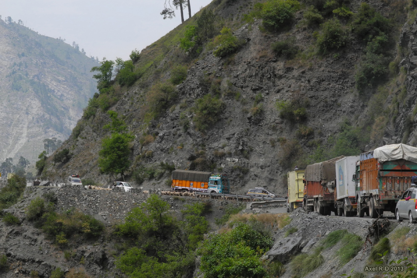
Jammu-Srinagar Highway

#ChenabValley #Gool #ShoaibTantray

CHENAB VALLEY, RAMBAN_ Shoaib Tantray

2013-08-03_16h54m33s

Baglihar dam on river Chenab

...along the banks of the river Chenab, Ramban(Jammu & kashmir)... Phone click! ???? #chenab #ramban #ChenabValley #river #stone #stones #nature #water

#me #portrait

CHENAB VALLEY, RAMBAN_ Shoaib Tantray

CHENAB VALLEY, RAMBAN_ Shoaib Tantray

CHENAB VALLEY, RAMBAN_ Shoaib Tantray

CHENAB VALLEY, RAMBAN_ Shoaib Tantray

CHENAB VALLEY, RAMBAN_ Shoaib Tantray
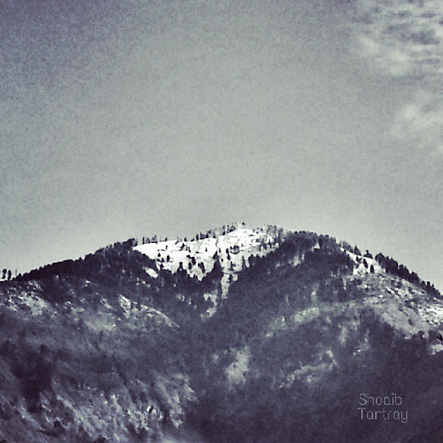
#ChenabValley #Ramban #Snow #mountain #ShoaibTantray

What's its English name? #ShoaibTantray #vegetable

#ChenabValley #RiverChenab #Ramban ©Shoaib Tantray

#myself

2013-08-03_16h08m54s
Topographic Map of Ganote
Find elevation by address:

Places near Ganote:
Ramban
Patnitop
J&k Bank
Jawahar Tunnel
Doda
Kokernag
Doda
Udhampur Bus Stand Road
Leray
Udhampur
Vaishno Devi
Katra
Bhaderwah Fire Station
Anantnag Ktm
Domel
Bhaderwah - Chamba Road
Shopian
Forest Block Padpawan
Jammu
Jammu Tawi
Recent Searches:
- Elevation of Corso Fratelli Cairoli, 35, Macerata MC, Italy
- Elevation of Tallevast Rd, Sarasota, FL, USA
- Elevation of 4th St E, Sonoma, CA, USA
- Elevation of Black Hollow Rd, Pennsdale, PA, USA
- Elevation of Oakland Ave, Williamsport, PA, USA
- Elevation of Pedrógão Grande, Portugal
- Elevation of Klee Dr, Martinsburg, WV, USA
- Elevation of Via Roma, Pieranica CR, Italy
- Elevation of Tavkvetili Mountain, Georgia
- Elevation of Hartfords Bluff Cir, Mt Pleasant, SC, USA