Elevation of Pentridge Ln, Chestertown, MD, USA

Location: United States > Maryland > Kent County > 4, Chestertown > Chestertown >

Longitude: -76.138667

Latitude: 39.174843

Elevation: 9m / 30feet

Barometric Pressure: 101KPa

Elevation Map:

elevation map of Pentridge Ln, Chestertown, MD, USA

Satellite Map:

Satellite map of Pentridge Ln, Chestertown, MD, USA

Related Photos:

dragonfly chestertownquad kentcounty maryland nature wildlife insect
Blue Dasher (Pachydiplax longipennis)
bloomfieldfarm chesapeakebayprogram dc districtofcolumbia easternshore easternshorelandconservancy maryland nonprofits queenannescounty recreation transportation washington aerial conservation conservationeasement environment publicaccess unitedstates camera:model=canoneos5dmarkiv exif:lens=ef70200mmf28lusm camera:make=canon geocity geostate exif:focallength=160mm exif:aperture=ƒ56 exif:isospeed=200 geo:country=unitedstates exif:model=canoneos5dmarkiv exif:make=canon
Bloomfield Farm in Queen Anne's County, Md.
bird seagull maryland explore chestertown larusdelawarensis chesterriver kentcounty canonef100400mmf4556lisusm mywinners
Rude Arrival
bird tyrannusdominicensis
Gray Kingbird in Maryland
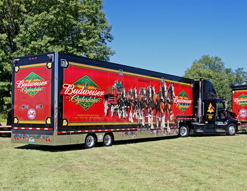
birthday usa festival america kent parade hunter bud budweiser smalltown 18wheeler ctown clydesdales 300th chesterriver kentcounty smalltownamerica budweiserclydesdales budweiserbeer chestertownmd chestertownmaryland truckpictures nflravens kentco wilmerpark kentcountymaryland shoreshotphotography chestertowns300thbirthday chestertowns300thbirthdayparade thefamousbudweiserclydesdales
BUDWEISER CLYDESDALES 18 WHEELER
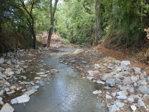
usfws fishandwildlifeservice usfishandwildlifeservice northeastregion restoration hurricanesandy hurricanesandyresilience hurricanesandyresilienceproject centrevilledam centrevilledamremoval corsicariver marylanddamremoval hurricanesandyfws hurricanesandyproject89 aquaticconnectivity
Centreville Dam rock ramp, downstream view
bloomfieldfarm chesapeakebayprogram dc districtofcolumbia easternshore easternshorelandconservancy maryland nonprofits queenannescounty recreation transportation washington aerial conservation conservationeasement environment publicaccess unitedstates exif:aperture=ƒ80 exif:model=canoneos5dmarkiv camera:make=canon geocity geostate exif:focallength=70mm exif:lens=ef2470mmf28lusm geo:country=unitedstates exif:isospeed=200 camera:model=canoneos5dmarkiv exif:make=canon
Bloomfield Farm in Queen Anne's County, Md.
bloomfieldfarm chesapeakebayprogram dc districtofcolumbia easternshore easternshorelandconservancy maryland nonprofits queenannescounty recreation transportation washington aerial conservation conservationeasement environment publicaccess unitedstates exif:isospeed=400 exif:aperture=ƒ80 exif:model=canoneos5dmarkiv exif:focallength=54mm geocity geostate exif:lens=ef2470mmf28lusm geo:country=unitedstates camera:model=canoneos5dmarkiv camera:make=canon exif:make=canon
Bloomfield Farm in Queen Anne's County, Md.
bloomfieldfarm chesapeakebayprogram dc districtofcolumbia easternshore easternshorelandconservancy maryland nonprofits queenannescounty recreation transportation washington aerial conservation conservationeasement environment publicaccess unitedstates exif:isospeed=400 exif:aperture=ƒ80 exif:model=canoneos5dmarkiv camera:make=canon geocity geostate exif:focallength=70mm exif:lens=ef2470mmf28lusm geo:country=unitedstates camera:model=canoneos5dmarkiv exif:make=canon
Bloomfield Farm in Queen Anne's County, Md.
geotagged kent colonial maryland easternshore 18thcentury episcopal easton flemishbond eighteenth delmarva churchofengland
Vestry House, 1766
bloomfieldfarm chesapeakebayprogram dc districtofcolumbia easternshore easternshorelandconservancy maryland nonprofits queenannescounty recreation transportation washington aerial conservation conservationeasement environment publicaccess unitedstates exif:isospeed=400 exif:aperture=ƒ80 exif:model=canoneos5dmarkiv camera:make=canon geocity geostate exif:lens=ef2470mmf28lusm geo:country=unitedstates exif:focallength=55mm camera:model=canoneos5dmarkiv exif:make=canon
Bloomfield Farm in Queen Anne's County, Md.
bloomfieldfarm chesapeakebayprogram dc districtofcolumbia easternshore easternshorelandconservancy maryland nonprofits queenannescounty recreation transportation washington aerial conservation conservationeasement environment publicaccess unitedstates camera:model=canoneos5dmarkiv exif:lens=ef70200mmf28lusm camera:make=canon geocity geostate exif:aperture=ƒ56 exif:isospeed=200 geo:country=unitedstates exif:model=canoneos5dmarkiv exif:focallength=200mm exif:make=canon
Bloomfield Farm in Queen Anne's County, Md.
usa church geotagged kent colonial maryland easternshore 18thcentury episcopal easton eighteenth delmarva churchofengland 1713
St. Paul's Episcopal Church, Kent County, Maryland
moth caterpillar
Wavy-lined Heterocampa Moth caterpillar (Heterocampa biundata)
uploaded:by=flickrmobile flickriosapp:filter=nofilter
A Story Untold
park windows summer chimney white tree men brick public architecture afternoon shadows landscaping balcony south maryland easternshore historic lazy shutters government courthouse lounging benches federal 18thcentury centreville bucolic 2012 lateday nrhp mystuart
Courthouse Square, 1796.
15fav md pomona
Cliff City Landing
chesapeakefarms chestertown maryland remington trees water westforklangfordcreek agriculture bird creek dupont landscape morning nest osprey refuge seahawk wildlife wings rockhall unitedstates us
Osprey at Chesapeake Farms
winter snow ice maryland easternshore rockhall chesapeakebay nikkor18200mmvr nikond300 easternnecknationalwildliferefuge nikonflickraward nikonflickrawardgold nikonflickrawardplatinum
Frozen Chesapeake
bird birds animal animals md maryland aves 7d 100400mm animalia hola passeriformes hornedlark shorelark passerine eremophilaalpestris eremophila chordata alaudidae img9881 taxonomy:binomial=eremophilaalpestris andelotfarmbioblitz
Horned Lark
chesterriver corsicariver easternshore md maryland waterbodies environment unitedstates exif:focallength=24mm camera:model=canoneos5dmarkii camera:make=canon geocity geostate exif:model=canoneos5dmarkii exif:aperture=ƒ50 exif:lens=ef24105mmf4lisusm geo:country=unitedstates exif:isospeed=800 exif:make=canon
Corsica River in Queen Anne's County, Md.
chesapeakebayprogram maryland queenannescounty climatechange environment livingshoreline restoration sealevelrise unitedstates camera:model=canoneos5dmarkiv exif:lens=ef70200mmf28lusm camera:make=canon geocity geostate exif:aperture=ƒ56 exif:isospeed=200 geo:country=unitedstates exif:model=canoneos5dmarkiv exif:focallength=200mm exif:make=canon
20170720-IMG_2337
chesapeakebayprogram maryland queenannescounty climatechange environment livingshoreline restoration sealevelrise unitedstates camera:model=canoneos5dmarkiv exif:lens=ef70200mmf28lusm camera:make=canon geocity geostate exif:aperture=ƒ56 exif:isospeed=200 geo:country=unitedstates exif:model=canoneos5dmarkiv exif:focallength=200mm exif:make=canon
20170720-IMG_2283
chesapeakebayprogram maryland queenannescounty climatechange environment livingshoreline restoration sealevelrise unitedstates camera:model=canoneos5dmarkiv exif:lens=ef70200mmf28lusm camera:make=canon geocity geostate exif:focallength=70mm exif:aperture=ƒ56 exif:isospeed=200 geo:country=unitedstates exif:model=canoneos5dmarkiv exif:make=canon
20170720-IMG_2266
chesapeakebayprogram maryland queenannescounty climatechange environment livingshoreline restoration sealevelrise unitedstates camera:model=canoneos5dmarkiv exif:lens=ef70200mmf28lusm camera:make=canon geocity exif:focallength=75mm exif:aperture=ƒ56 exif:isospeed=200 geo:country=unitedstates geostate exif:model=canoneos5dmarkiv exif:make=canon
20170720-IMG_2322
chesapeakebayprogram maryland queenannescounty climatechange environment livingshoreline restoration sealevelrise unitedstates camera:model=canoneos5dmarkiv exif:lens=ef70200mmf28lusm camera:make=canon geocity geostate exif:aperture=ƒ56 exif:isospeed=200 geo:country=unitedstates exif:model=canoneos5dmarkiv exif:focallength=200mm exif:make=canon
20170720-IMG_2257