Elevation of Airy Hill Rd, Chestertown, MD, USA

Location: United States > Maryland > Kent County > 4, Chestertown > Chestertown >

Longitude: -76.098433

Latitude: 39.191312

Elevation: 11m / 36feet

Barometric Pressure: 101KPa

Elevation Map:

elevation map of Airy Hill Rd, Chestertown, MD, USA

Satellite Map:

Satellite map of Airy Hill Rd, Chestertown, MD, USA

Related Photos:

bloomfieldfarm chesapeakebayprogram dc districtofcolumbia easternshore easternshorelandconservancy maryland nonprofits queenannescounty recreation transportation washington aerial conservation conservationeasement environment publicaccess unitedstates camera:model=canoneos5dmarkiv exif:lens=ef70200mmf28lusm camera:make=canon geocity geostate exif:focallength=160mm exif:aperture=ƒ56 exif:isospeed=200 geo:country=unitedstates exif:model=canoneos5dmarkiv exif:make=canon
Bloomfield Farm in Queen Anne's County, Md.
bloomfieldfarm chesapeakebayprogram dc districtofcolumbia easternshore easternshorelandconservancy maryland nonprofits queenannescounty recreation transportation washington aerial conservation conservationeasement environment publicaccess unitedstates exif:aperture=ƒ80 exif:model=canoneos5dmarkiv camera:make=canon geocity geostate exif:focallength=70mm exif:lens=ef2470mmf28lusm geo:country=unitedstates exif:isospeed=200 camera:model=canoneos5dmarkiv exif:make=canon
Bloomfield Farm in Queen Anne's County, Md.
bloomfieldfarm chesapeakebayprogram dc districtofcolumbia easternshore easternshorelandconservancy maryland nonprofits queenannescounty recreation transportation washington aerial conservation conservationeasement environment publicaccess unitedstates exif:isospeed=400 exif:aperture=ƒ80 exif:model=canoneos5dmarkiv exif:focallength=54mm geocity geostate exif:lens=ef2470mmf28lusm geo:country=unitedstates camera:model=canoneos5dmarkiv camera:make=canon exif:make=canon
Bloomfield Farm in Queen Anne's County, Md.
bloomfieldfarm chesapeakebayprogram dc districtofcolumbia easternshore easternshorelandconservancy maryland nonprofits queenannescounty recreation transportation washington aerial conservation conservationeasement environment publicaccess unitedstates exif:isospeed=400 exif:aperture=ƒ80 exif:model=canoneos5dmarkiv camera:make=canon geocity geostate exif:focallength=70mm exif:lens=ef2470mmf28lusm geo:country=unitedstates camera:model=canoneos5dmarkiv exif:make=canon
Bloomfield Farm in Queen Anne's County, Md.
bloomfieldfarm chesapeakebayprogram dc districtofcolumbia easternshore easternshorelandconservancy maryland nonprofits queenannescounty recreation transportation washington aerial conservation conservationeasement environment publicaccess unitedstates camera:model=canoneos5dmarkiv exif:lens=ef70200mmf28lusm camera:make=canon geocity geostate exif:aperture=ƒ56 exif:isospeed=200 geo:country=unitedstates exif:model=canoneos5dmarkiv exif:focallength=200mm exif:make=canon
Bloomfield Farm in Queen Anne's County, Md.
geotagged kent colonial maryland easternshore 18thcentury episcopal easton flemishbond eighteenth delmarva churchofengland
Vestry House, 1766
bloomfieldfarm chesapeakebayprogram dc districtofcolumbia easternshore easternshorelandconservancy maryland nonprofits queenannescounty recreation transportation washington aerial conservation conservationeasement environment publicaccess unitedstates exif:isospeed=400 exif:aperture=ƒ80 exif:model=canoneos5dmarkiv camera:make=canon geocity geostate exif:lens=ef2470mmf28lusm geo:country=unitedstates exif:focallength=55mm camera:model=canoneos5dmarkiv exif:make=canon
Bloomfield Farm in Queen Anne's County, Md.
usa church geotagged kent colonial maryland easternshore 18thcentury episcopal easton eighteenth delmarva churchofengland 1713
St. Paul's Episcopal Church, Kent County, Maryland
bird seagull maryland explore chestertown larusdelawarensis chesterriver kentcounty canonef100400mmf4556lisusm mywinners
Rude Arrival
andelotfarmbioblitz sx30 flash raynox dcr250 cute eyes bug bugs spider spiders animal animals animalia arthropod arthropods arthropoda chelicerate chelicerates chelicerata arachnid arachnids arachnida araneae araneomorphae entelegynes jumpingspider jumpingspiders salticidae salticid img9804 arachtober arachtober2016
Cute.
dragonfly chestertownquad kentcounty maryland nature wildlife insect
Blue Dasher (Pachydiplax longipennis)
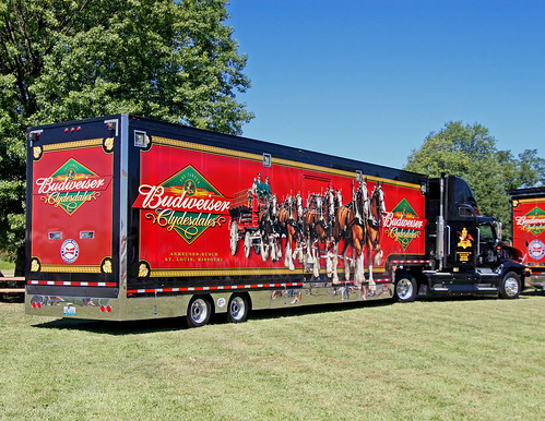
birthday usa festival america kent parade hunter bud budweiser smalltown 18wheeler ctown clydesdales 300th chesterriver kentcounty smalltownamerica budweiserclydesdales budweiserbeer chestertownmd chestertownmaryland truckpictures nflravens kentco wilmerpark kentcountymaryland shoreshotphotography chestertowns300thbirthday chestertowns300thbirthdayparade thefamousbudweiserclydesdales
BUDWEISER CLYDESDALES 18 WHEELER
bloomfieldfarm chesapeakebayprogram dc districtofcolumbia easternshore easternshorelandconservancy maryland nonprofits queenannescounty recreation transportation washington aerial conservation conservationeasement environment publicaccess unitedstates exif:isospeed=400 exif:aperture=ƒ80 exif:model=canoneos5dmarkiv camera:make=canon geocity geostate exif:focallength=70mm exif:lens=ef2470mmf28lusm geo:country=unitedstates camera:model=canoneos5dmarkiv exif:make=canon
Bloomfield Farm in Queen Anne's County, Md.
uploaded:by=flickrmobile flickriosapp:filter=nofilter
A Story Untold
bird birds animal animals md maryland aves 7d 100400mm animalia hola passeriformes hornedlark shorelark passerine eremophilaalpestris eremophila chordata alaudidae img9881 taxonomy:binomial=eremophilaalpestris andelotfarmbioblitz
Horned Lark
bird birds animal animals md maryland aves sparrow 7d sparrows 100400mm animalia emberizidae passeriformes grasshoppersparrow ammodramussavannarum passerine grsp chordata passerines ammodramus img9719 img9733 img9721 img9729 taxonomy:binomial=ammodramussavannarum andelotfarmbioblitz
Lifebird #548 / #359
chesapeakebayprogram maryland queenannescounty climatechange environment livingshoreline restoration sealevelrise unitedstates camera:model=canoneos5dmarkiv exif:lens=ef70200mmf28lusm camera:make=canon geocity geostate exif:aperture=ƒ56 exif:isospeed=200 geo:country=unitedstates exif:model=canoneos5dmarkiv exif:focallength=200mm exif:make=canon
20170720-IMG_2337
chesapeakebayprogram maryland queenannescounty climatechange environment livingshoreline restoration sealevelrise unitedstates camera:model=canoneos5dmarkiv exif:lens=ef70200mmf28lusm camera:make=canon geocity geostate exif:focallength=70mm exif:aperture=ƒ56 exif:isospeed=200 geo:country=unitedstates exif:model=canoneos5dmarkiv exif:make=canon
20170720-IMG_2266
chesapeakebayprogram maryland queenannescounty climatechange environment livingshoreline restoration sealevelrise unitedstates camera:model=canoneos5dmarkiv exif:lens=ef70200mmf28lusm camera:make=canon geocity geostate exif:aperture=ƒ56 exif:isospeed=200 geo:country=unitedstates exif:model=canoneos5dmarkiv exif:focallength=200mm exif:make=canon
20170720-IMG_2283
chesapeakebayprogram maryland queenannescounty climatechange environment livingshoreline restoration sealevelrise unitedstates camera:model=canoneos5dmarkiv exif:lens=ef70200mmf28lusm camera:make=canon geocity exif:focallength=75mm exif:aperture=ƒ56 exif:isospeed=200 geo:country=unitedstates geostate exif:model=canoneos5dmarkiv exif:make=canon
20170720-IMG_2322
chesapeakebayprogram maryland queenannescounty climatechange environment livingshoreline restoration sealevelrise unitedstates camera:model=canoneos5dmarkiv exif:lens=ef70200mmf28lusm camera:make=canon geocity geostate exif:focallength=70mm exif:aperture=ƒ56 exif:isospeed=200 geo:country=unitedstates exif:model=canoneos5dmarkiv exif:make=canon
20170720-IMG_2306
chesapeakebayprogram maryland queenannescounty climatechange environment livingshoreline restoration sealevelrise unitedstates camera:model=canoneos5dmarkiv exif:lens=ef70200mmf28lusm camera:make=canon geocity geostate exif:aperture=ƒ56 exif:isospeed=200 geo:country=unitedstates exif:model=canoneos5dmarkiv exif:focallength=200mm exif:make=canon
20170720-IMG_2315
chesapeakebayprogram maryland queenannescounty climatechange environment livingshoreline restoration sealevelrise unitedstates camera:model=canoneos5dmarkiv exif:lens=ef70200mmf28lusm camera:make=canon geocity geostate exif:aperture=ƒ56 exif:isospeed=200 geo:country=unitedstates exif:model=canoneos5dmarkiv exif:focallength=200mm exif:make=canon
20170720-IMG_2257
chesapeakebayprogram maryland queenannescounty climatechange environment livingshoreline restoration sealevelrise unitedstates camera:model=canoneos5dmarkiv exif:lens=ef70200mmf28lusm camera:make=canon geocity geostate exif:aperture=ƒ56 exif:isospeed=200 geo:country=unitedstates exif:focallength=108mm exif:model=canoneos5dmarkiv exif:make=canon
20170720-IMG_2318
chesapeakebayprogram maryland queenannescounty climatechange environment livingshoreline restoration sealevelrise unitedstates exif:focallength=150mm camera:model=canoneos5dmarkiv exif:lens=ef70200mmf28lusm camera:make=canon geocity geostate exif:aperture=ƒ56 exif:isospeed=200 geo:country=unitedstates exif:model=canoneos5dmarkiv exif:make=canon
20170720-IMG_2239
chesapeakebayprogram maryland queenannescounty climatechange environment livingshoreline restoration sealevelrise unitedstates camera:model=canoneos5dmarkiv exif:lens=ef70200mmf28lusm camera:make=canon geocity geostate exif:aperture=ƒ56 exif:isospeed=200 geo:country=unitedstates exif:model=canoneos5dmarkiv exif:focallength=200mm exif:make=canon
20170720-IMG_2310