Elevation of Cliffs City Rd, Chestertown, MD, USA

Location: United States > Maryland > Kent County > 4, Chestertown > Chestertown >

Longitude: -76.146528

Latitude: 39.108202

Elevation: 6m / 20feet

Barometric Pressure: 101KPa

Elevation Map:

elevation map of Cliffs City Rd, Chestertown, MD, USA

Satellite Map:

Satellite map of Cliffs City Rd, Chestertown, MD, USA

Related Photos:

longexposure blue light red summer sky usa moon reflection cars beautiful car night clouds pen dark stars photography us amazing nice md pretty view bright outdoor maryland olympus trail queenstown lighttrails unitedstate epl1 mirrorlesscamera
Light Trail Under the Moon
bird seagull maryland explore chestertown larusdelawarensis chesterriver kentcounty canonef100400mmf4556lisusm mywinners
Rude Arrival
bird tyrannusdominicensis
Gray Kingbird in Maryland
neck landscape md wildlife maryland aerial national eastern usfws refuge nationalwildliferefuge easternnecknationalwildliferefuge
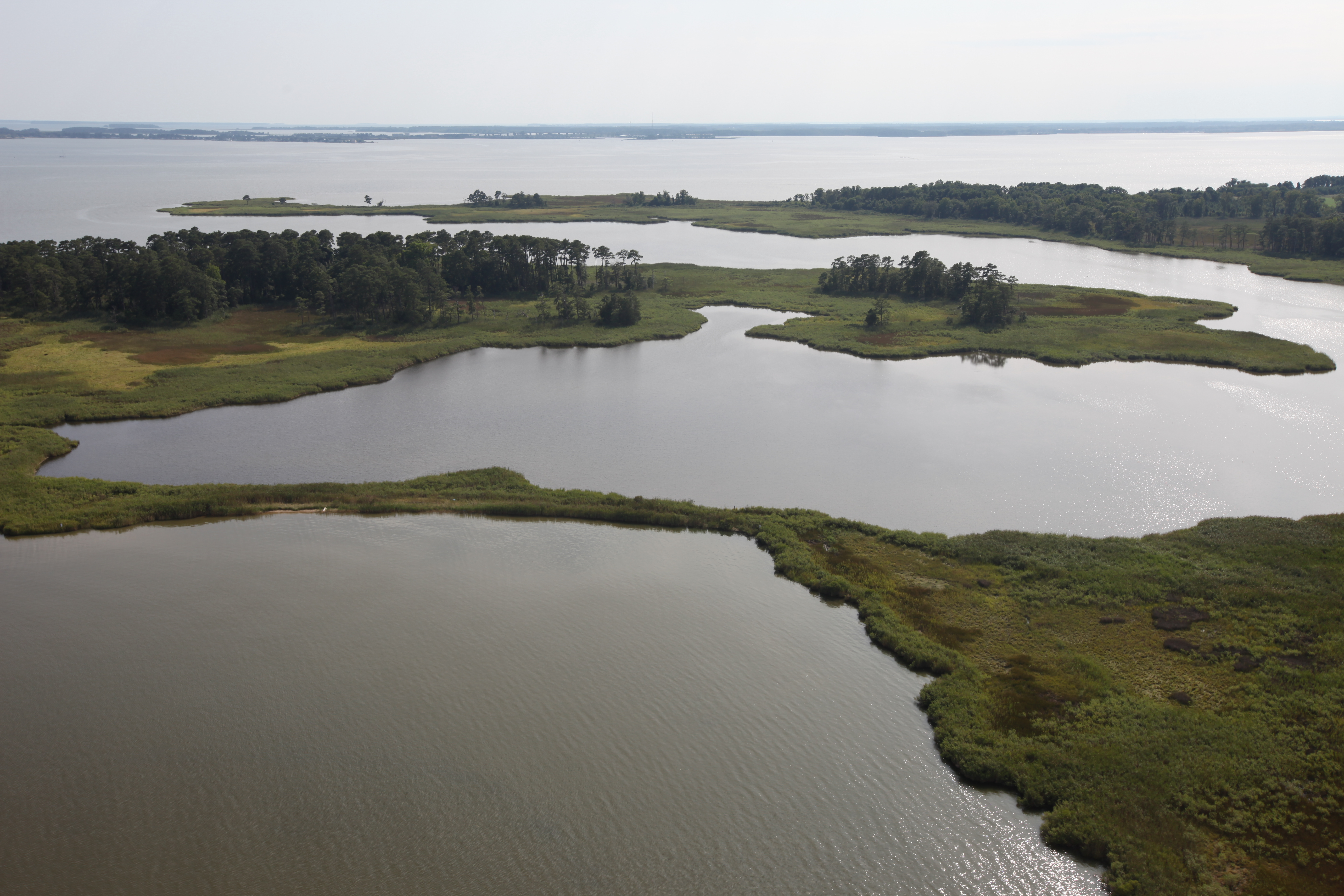
Aerial view of Hale Cove
dragonfly chestertownquad kentcounty maryland nature wildlife insect
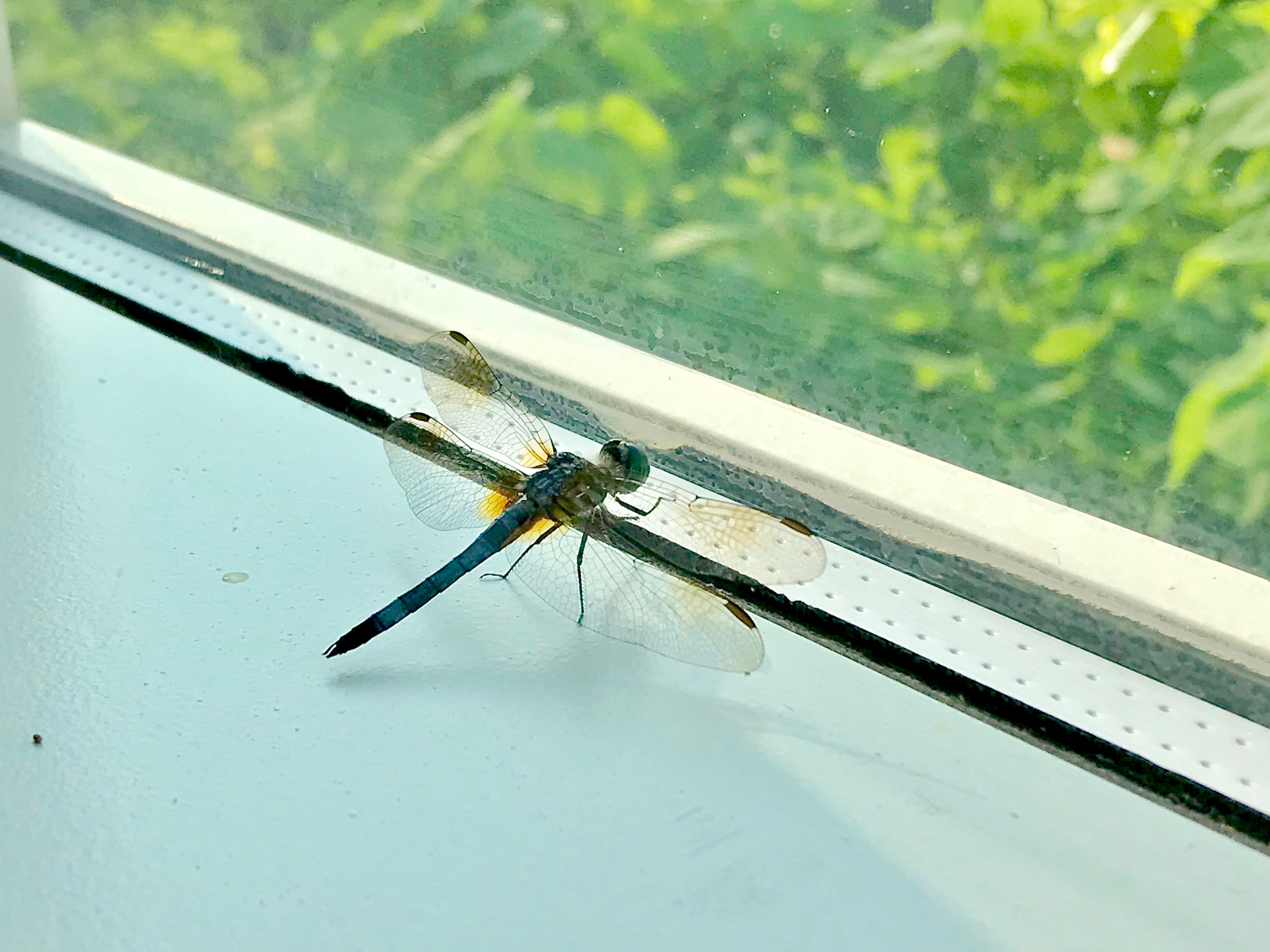
Blue Dasher (Pachydiplax longipennis)
birthday usa festival america kent parade hunter bud budweiser smalltown 18wheeler ctown clydesdales 300th chesterriver kentcounty smalltownamerica budweiserclydesdales budweiserbeer chestertownmd chestertownmaryland truckpictures nflravens kentco wilmerpark kentcountymaryland shoreshotphotography chestertowns300thbirthday chestertowns300thbirthdayparade thefamousbudweiserclydesdales
BUDWEISER CLYDESDALES 18 WHEELER
usfws fishandwildlifeservice usfishandwildlifeservice northeastregion restoration hurricanesandy hurricanesandyresilience hurricanesandyresilienceproject centrevilledam centrevilledamremoval corsicariver marylanddamremoval hurricanesandyfws hurricanesandyproject89 aquaticconnectivity
Centreville Dam rock ramp, downstream view
fire maryland marsh controlledburn chesapeakebay delmarva invasivespecies prescribedfire usfishandwildlifeservice northeastregion firemanagement brackishmarsh easternnecknationalwildliferefuge chesapeakemarshlandsnationalwildliferefugecomplex
View from inside Marshmaster
bloomfieldfarm chesapeakebayprogram dc districtofcolumbia easternshore easternshorelandconservancy maryland nonprofits queenannescounty recreation transportation washington aerial conservation conservationeasement environment publicaccess unitedstates camera:model=canoneos5dmarkiv exif:lens=ef70200mmf28lusm camera:make=canon geocity geostate exif:focallength=160mm exif:aperture=ƒ56 exif:isospeed=200 geo:country=unitedstates exif:model=canoneos5dmarkiv exif:make=canon
Bloomfield Farm in Queen Anne's County, Md.
bloomfieldfarm chesapeakebayprogram dc districtofcolumbia easternshore easternshorelandconservancy maryland nonprofits queenannescounty recreation transportation washington aerial conservation conservationeasement environment publicaccess unitedstates exif:aperture=ƒ80 exif:model=canoneos5dmarkiv camera:make=canon geocity geostate exif:focallength=70mm exif:lens=ef2470mmf28lusm geo:country=unitedstates exif:isospeed=200 camera:model=canoneos5dmarkiv exif:make=canon
Bloomfield Farm in Queen Anne's County, Md.
bloomfieldfarm chesapeakebayprogram dc districtofcolumbia easternshore easternshorelandconservancy maryland nonprofits queenannescounty recreation transportation washington aerial conservation conservationeasement environment publicaccess unitedstates exif:isospeed=400 exif:aperture=ƒ80 exif:model=canoneos5dmarkiv exif:focallength=54mm geocity geostate exif:lens=ef2470mmf28lusm geo:country=unitedstates camera:model=canoneos5dmarkiv camera:make=canon exif:make=canon
Bloomfield Farm in Queen Anne's County, Md.
bloomfieldfarm chesapeakebayprogram dc districtofcolumbia easternshore easternshorelandconservancy maryland nonprofits queenannescounty recreation transportation washington aerial conservation conservationeasement environment publicaccess unitedstates exif:isospeed=400 exif:aperture=ƒ80 exif:model=canoneos5dmarkiv camera:make=canon geocity geostate exif:focallength=70mm exif:lens=ef2470mmf28lusm geo:country=unitedstates camera:model=canoneos5dmarkiv exif:make=canon
Bloomfield Farm in Queen Anne's County, Md.
geotagged kent colonial maryland easternshore 18thcentury episcopal easton flemishbond eighteenth delmarva churchofengland
Vestry House, 1766
bloomfieldfarm chesapeakebayprogram dc districtofcolumbia easternshore easternshorelandconservancy maryland nonprofits queenannescounty recreation transportation washington aerial conservation conservationeasement environment publicaccess unitedstates exif:isospeed=400 exif:aperture=ƒ80 exif:model=canoneos5dmarkiv camera:make=canon geocity geostate exif:lens=ef2470mmf28lusm geo:country=unitedstates exif:focallength=55mm camera:model=canoneos5dmarkiv exif:make=canon
Bloomfield Farm in Queen Anne's County, Md.
bloomfieldfarm chesapeakebayprogram dc districtofcolumbia easternshore easternshorelandconservancy maryland nonprofits queenannescounty recreation transportation washington aerial conservation conservationeasement environment publicaccess unitedstates camera:model=canoneos5dmarkiv exif:lens=ef70200mmf28lusm camera:make=canon geocity geostate exif:aperture=ƒ56 exif:isospeed=200 geo:country=unitedstates exif:model=canoneos5dmarkiv exif:focallength=200mm exif:make=canon
Bloomfield Farm in Queen Anne's County, Md.
usa church geotagged kent colonial maryland easternshore 18thcentury episcopal easton eighteenth delmarva churchofengland 1713
St. Paul's Episcopal Church, Kent County, Maryland
blue usa green nature field clouds landscape us wheat maryland bluesky greenfield blueskyandclouds greenwheat centervillemd
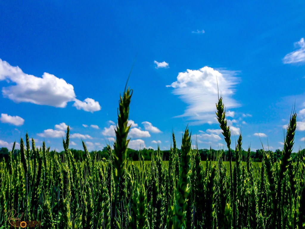
The Green Wheat Field
blue usa green nature field clouds landscape us wheat maryland bluesky greenfield blueskyandclouds greenwheat centervillemd
Green Wheat Stand Up
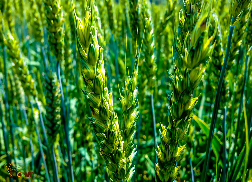
usa green nature field landscape us wheat maryland greenfield greenwheat centervillemd
The Green Wheat
uploaded:by=flickrmobile flickriosapp:filter=nofilter
A Story Untold
chesapeakefarms chestertown maryland remington trees water westforklangfordcreek agriculture bird creek dupont landscape morning nest osprey refuge seahawk wildlife wings rockhall unitedstates us
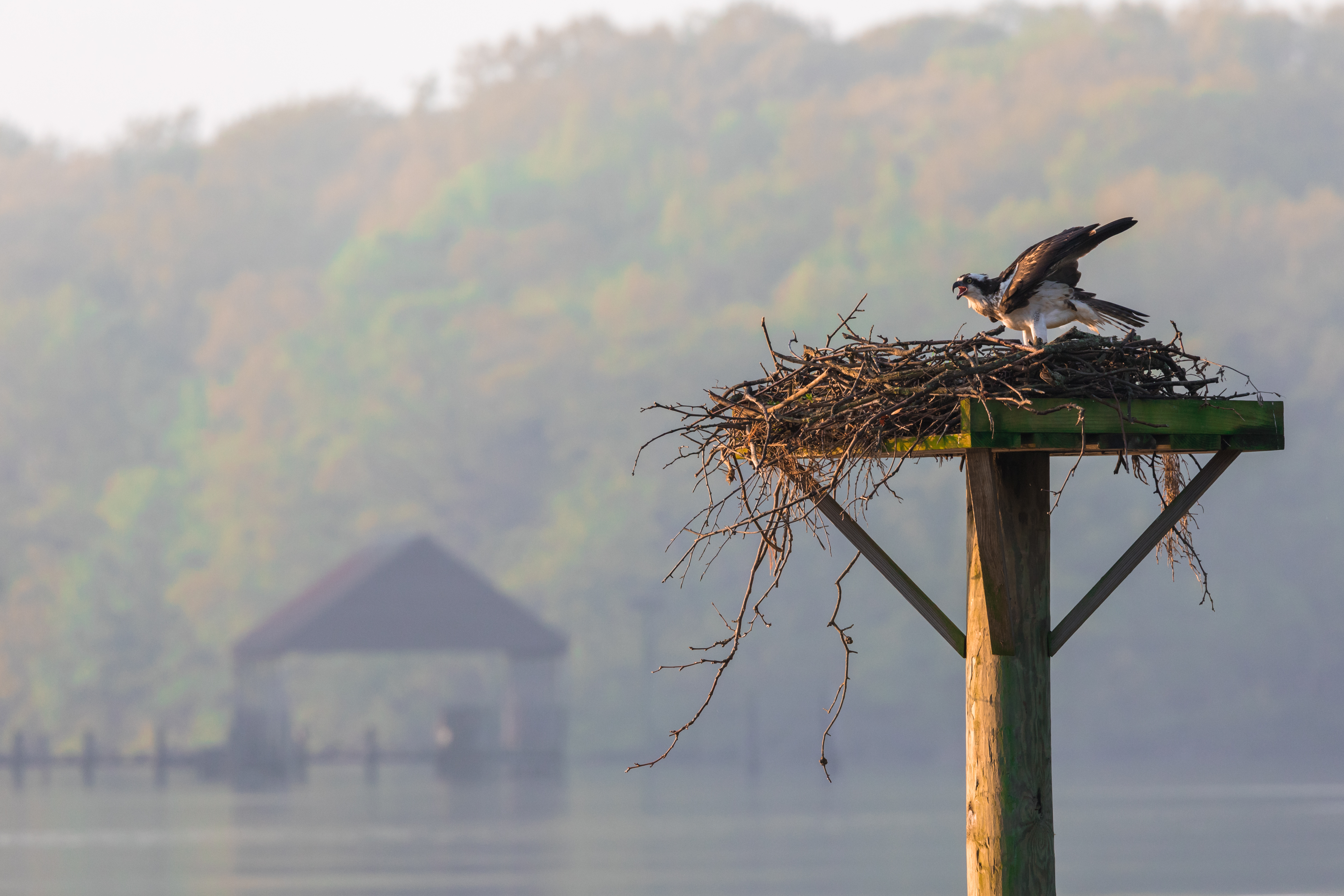
Osprey at Chesapeake Farms
winter snow ice maryland easternshore rockhall chesapeakebay nikkor18200mmvr nikond300 easternnecknationalwildliferefuge nikonflickraward nikonflickrawardgold nikonflickrawardplatinum
Frozen Chesapeake
neck landscape md wildlife maryland national eastern usfws refuge nationalwildliferefuge easternnecknationalwildliferefuge
Eastern Neck National Wildlife Refuge
chesterriver corsicariver easternshore md maryland waterbodies environment unitedstates exif:focallength=24mm camera:model=canoneos5dmarkii camera:make=canon geocity geostate exif:model=canoneos5dmarkii exif:aperture=ƒ50 exif:lens=ef24105mmf4lisusm geo:country=unitedstates exif:isospeed=800 exif:make=canon
Corsica River in Queen Anne's County, Md.
fire maryland marsh controlledburn chesapeakebay delmarva invasivespecies prescribedfire usfishandwildlifeservice northeastregion firemanagement brackishmarsh easternnecknationalwildliferefuge chesapeakemarshlandsnationalwildliferefugecomplex
Eastern Neck National Wildlife Refuge controlled burn
beach aerial restoration usfws usfishandwildlifeservice northeastregion fishandwildlifeservice hurricanesandy hurricanesandyrecovery hurricanesandyrecoveryproject strongaftersandy hurricanesandyfws hurricanesandyproject57
Hail Cove, Maryland
chesapeakebayprogram maryland queenannescounty climatechange environment livingshoreline restoration sealevelrise unitedstates camera:model=canoneos5dmarkiv exif:lens=ef70200mmf28lusm camera:make=canon geocity geostate exif:aperture=ƒ56 exif:isospeed=200 geo:country=unitedstates exif:model=canoneos5dmarkiv exif:focallength=200mm exif:make=canon
20170720-IMG_2337
chesapeakebayprogram maryland queenannescounty climatechange environment livingshoreline restoration sealevelrise unitedstates camera:model=canoneos5dmarkiv exif:lens=ef70200mmf28lusm camera:make=canon geocity geostate exif:aperture=ƒ56 exif:isospeed=200 geo:country=unitedstates exif:model=canoneos5dmarkiv exif:focallength=200mm exif:make=canon
20170720-IMG_2283
chesapeakebayprogram maryland queenannescounty climatechange environment livingshoreline restoration sealevelrise unitedstates camera:model=canoneos5dmarkiv exif:lens=ef70200mmf28lusm camera:make=canon geocity geostate exif:focallength=70mm exif:aperture=ƒ56 exif:isospeed=200 geo:country=unitedstates exif:model=canoneos5dmarkiv exif:make=canon
20170720-IMG_2266
chesapeakebay easternneckisland easternnecknationalwildliferefuge kentcounty liliopsida md magnoliophyta maryland monocots monocotyledons phragmitesaustralis plantae rockhall waterbodies angiosperms erosion grasses invasivespecies marshgrass nature plants stormwaterrunoff wildlife unitedstates exif:aperture=ƒ90 geocity exif:model=nikond7000 exif:lens=1802000mmf3556 exif:make=nikon geo:country=unitedstates geostate exif:isospeed=320 camera:model=nikond7000 exif:focallength=35mm camera:make=nikon
Eastern Neck National Wildlife Refuge in Kent County, Md.
chesapeakebayprogram maryland queenannescounty climatechange environment livingshoreline restoration sealevelrise unitedstates camera:model=canoneos5dmarkiv exif:lens=ef70200mmf28lusm camera:make=canon geocity exif:focallength=75mm exif:aperture=ƒ56 exif:isospeed=200 geo:country=unitedstates geostate exif:model=canoneos5dmarkiv exif:make=canon
20170720-IMG_2322