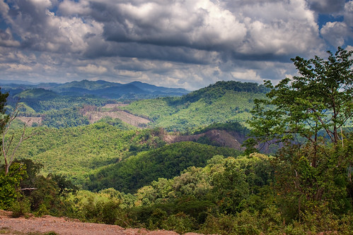
Elevation of Pangsai, Laos
Location: Laos > Luang Namtha Province >
Longitude: 101.036530
Latitude: 20.5834892
Elevation: 725m / 2379feet
Barometric Pressure: 93KPa
Related Photos:
Topographic Map of Pangsai, Laos
Find elevation by address:

Places near Pangsai, Laos:
Luang Namtha Province
Bokeo Province
Pak Tha
Huay Xai
Pak Beng
Chiang Khong Imigration Control Office
Chiang Khong District
Wiang Kaen District
Chiang Saen District
Ban Saeo
Four Seasons Tented Camp Golden Triangle, Thailand
Waterford Valley Chiangrai Golf Course And Resort
Mae Sai
Tachileik
Mae Chan District
Wiang Chiang Rung District
Wiang Phang Kham
Mae Sai District
Pong Pha
Tham Luang Cave Complex
Recent Searches:
- Elevation of Corso Fratelli Cairoli, 35, Macerata MC, Italy
- Elevation of Tallevast Rd, Sarasota, FL, USA
- Elevation of 4th St E, Sonoma, CA, USA
- Elevation of Black Hollow Rd, Pennsdale, PA, USA
- Elevation of Oakland Ave, Williamsport, PA, USA
- Elevation of Pedrógão Grande, Portugal
- Elevation of Klee Dr, Martinsburg, WV, USA
- Elevation of Via Roma, Pieranica CR, Italy
- Elevation of Tavkvetili Mountain, Georgia
- Elevation of Hartfords Bluff Cir, Mt Pleasant, SC, USA


