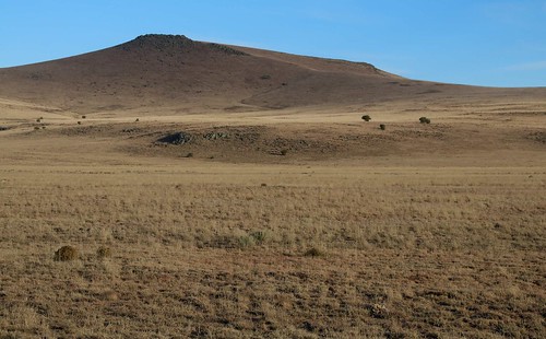
Elevation of Old Ranch Road, Old Ranch Rd, New Mexico, USA
Location: United States > New Mexico > Catron County > Red Hill >
Longitude: -108.88010
Latitude: 34.2458765
Elevation: 2189m / 7182feet
Barometric Pressure: 78KPa
Related Photos:
Topographic Map of Old Ranch Road, Old Ranch Rd, New Mexico, USA
Find elevation by address:

Places near Old Ranch Road, Old Ranch Rd, New Mexico, USA:
Red Hill
Zuñi Salt Lake
Fox Mountain
Hardcastle
Jones Peak
New Mexico 601
Spring Canyon Road
Jewett Gap Campground
Chapel
New Mexico Professional Big Game Hunting, Inc
Gallo Peak
Red Butte
Agua Fria Mountain
Bishop Peak
41357 Us-180
Turner Peak
1956 Park Pl
Quemado
62 Us-180
Apache Mountain
Recent Searches:
- Elevation of Corso Fratelli Cairoli, 35, Macerata MC, Italy
- Elevation of Tallevast Rd, Sarasota, FL, USA
- Elevation of 4th St E, Sonoma, CA, USA
- Elevation of Black Hollow Rd, Pennsdale, PA, USA
- Elevation of Oakland Ave, Williamsport, PA, USA
- Elevation of Pedrógão Grande, Portugal
- Elevation of Klee Dr, Martinsburg, WV, USA
- Elevation of Via Roma, Pieranica CR, Italy
- Elevation of Tavkvetili Mountain, Georgia
- Elevation of Hartfords Bluff Cir, Mt Pleasant, SC, USA


