Elevation of Mount Ford, Fraser Valley B, BC V0X, Canada
Location: Canada > British Columbia > Hope >
Longitude: -121.0722222
Latitude: 49.2522222
Elevation: 2077m / 6814feet
Barometric Pressure: 0KPa
Related Photos:
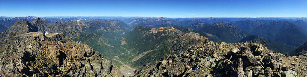
Silvertip Mt Summit View to the North
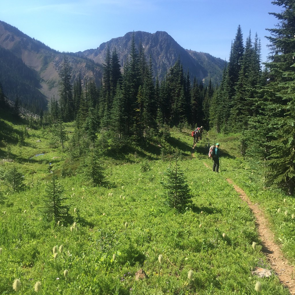
View of the meadow leading up to Silvertip Mt

Roadside view

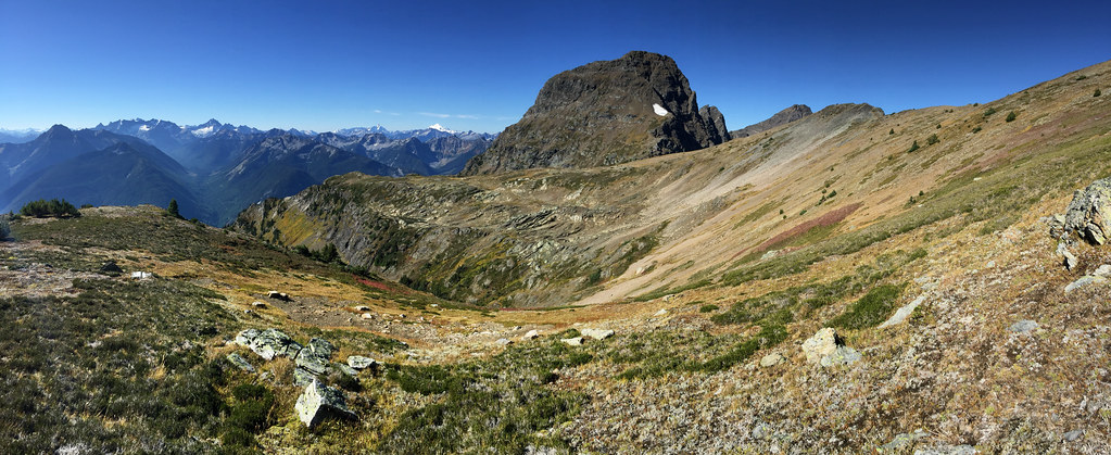
View From Saddle beside Mt Snass
2015 Day 186 - Heading Towards Punchbowl Lake
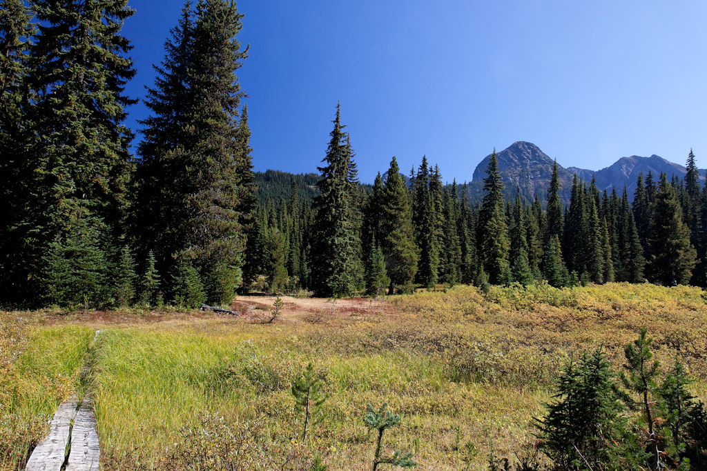
Snass View Camp

Views from the Whatcom Trail
Topographic Map of Mount Ford, Fraser Valley B, BC V0X, Canada
Find elevation by address:

Places near Mount Ford, Fraser Valley B, BC V0X, Canada:
Mount Dewdney
Battleford Peak
Mount Davis
Mount Outram
Snass Mountain
Mount Manson
Mount Hatfield
Johnson Peak
Tulameen Mountain
Macleod Peak
Sunshine Valley Rv Resort & Cabins
Sunshine Valley
Fraser Valley B
14371 Alpine Blvd
14371 Alpine Blvd
Parkhill Boulevard
Parkview Avenue
Mount Sutter
Mount Potter
Mount Snider
Recent Searches:
- Elevation of 2881, Chabot Drive, San Bruno, San Mateo County, California, 94066, USA
- Elevation of 10370, West 107th Circle, Westminster, Jefferson County, Colorado, 80021, USA
- Elevation of 611, Roman Road, Old Ford, Bow, London, England, E3 2RW, United Kingdom
- Elevation of 116, Beartown Road, Underhill, Chittenden County, Vermont, 05489, USA
- Elevation of Window Rock, Colfax County, New Mexico, 87714, USA
- Elevation of 4807, Rosecroft Street, Kempsville Gardens, Virginia Beach, Virginia, 23464, USA
- Elevation map of Matawinie, Quebec, Canada
- Elevation of Sainte-Émélie-de-l'Énergie, Matawinie, Quebec, Canada
- Elevation of Rue du Pont, Sainte-Émélie-de-l'Énergie, Matawinie, Quebec, J0K2K0, Canada
- Elevation of 8, Rue de Bécancour, Blainville, Thérèse-De Blainville, Quebec, J7B1N2, Canada
- Elevation of Wilmot Court North, 163, University Avenue West, Northdale, Waterloo, Region of Waterloo, Ontario, N2L6B6, Canada
- Elevation map of Panamá Province, Panama
- Elevation of Balboa, Panamá Province, Panama
- Elevation of San Miguel, Balboa, Panamá Province, Panama
- Elevation of Isla Gibraleón, San Miguel, Balboa, Panamá Province, Panama
- Elevation of 4655, Krischke Road, Schulenburg, Fayette County, Texas, 78956, USA
- Elevation of Carnegie Avenue, Downtown Cleveland, Cleveland, Cuyahoga County, Ohio, 44115, USA
- Elevation of Walhonding, Coshocton County, Ohio, USA
- Elevation of Clifton Down, Clifton, Bristol, City of Bristol, England, BS8 3HU, United Kingdom
- Elevation map of Auvergne-Rhône-Alpes, France