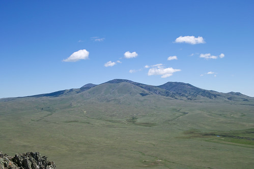
Elevation of Mount Brown, Mt Brown, Montana, USA
Location: United States > Montana > Whitlash >
Longitude: -111.13914
Latitude: 48.8738921
Elevation: 1983m / 6506feet
Barometric Pressure: 80KPa
Related Photos:
Topographic Map of Mount Brown, Mt Brown, Montana, USA
Find elevation by address:

Places near Mount Brown, Mt Brown, Montana, USA:
Whitlash, MT, USA
Whitlash
Sweet Grass Hills
Galata
Ferdig Rd, Oilmont, MT, USA
Toole County
Oilmont
Welker Farms
Sunburst
Shelby
O'haire Manor Motel Of Shelby
1948 W Roosevelt Hwy
US-2, Shelby, MT, USA
U.s. Customs And Border Protection
64 1st Ave
Sweet Grass
Potter Rd, Shelby, MT, USA
Faris School Rd, Brady, MT, USA
Milk River
950 Main St Nw
Recent Searches:
- Elevation of Corso Fratelli Cairoli, 35, Macerata MC, Italy
- Elevation of Tallevast Rd, Sarasota, FL, USA
- Elevation of 4th St E, Sonoma, CA, USA
- Elevation of Black Hollow Rd, Pennsdale, PA, USA
- Elevation of Oakland Ave, Williamsport, PA, USA
- Elevation of Pedrógão Grande, Portugal
- Elevation of Klee Dr, Martinsburg, WV, USA
- Elevation of Via Roma, Pieranica CR, Italy
- Elevation of Tavkvetili Mountain, Georgia
- Elevation of Hartfords Bluff Cir, Mt Pleasant, SC, USA

