Elevation of Morigaon, Assam, India
Location: India > Assam >
Longitude: 92.2630393
Latitude: 26.2599654
Elevation: 56m / 184feet
Barometric Pressure: 101KPa
Elevation Map:
Satellite Map:
Related Photos:

Lesser Adjutant Stork
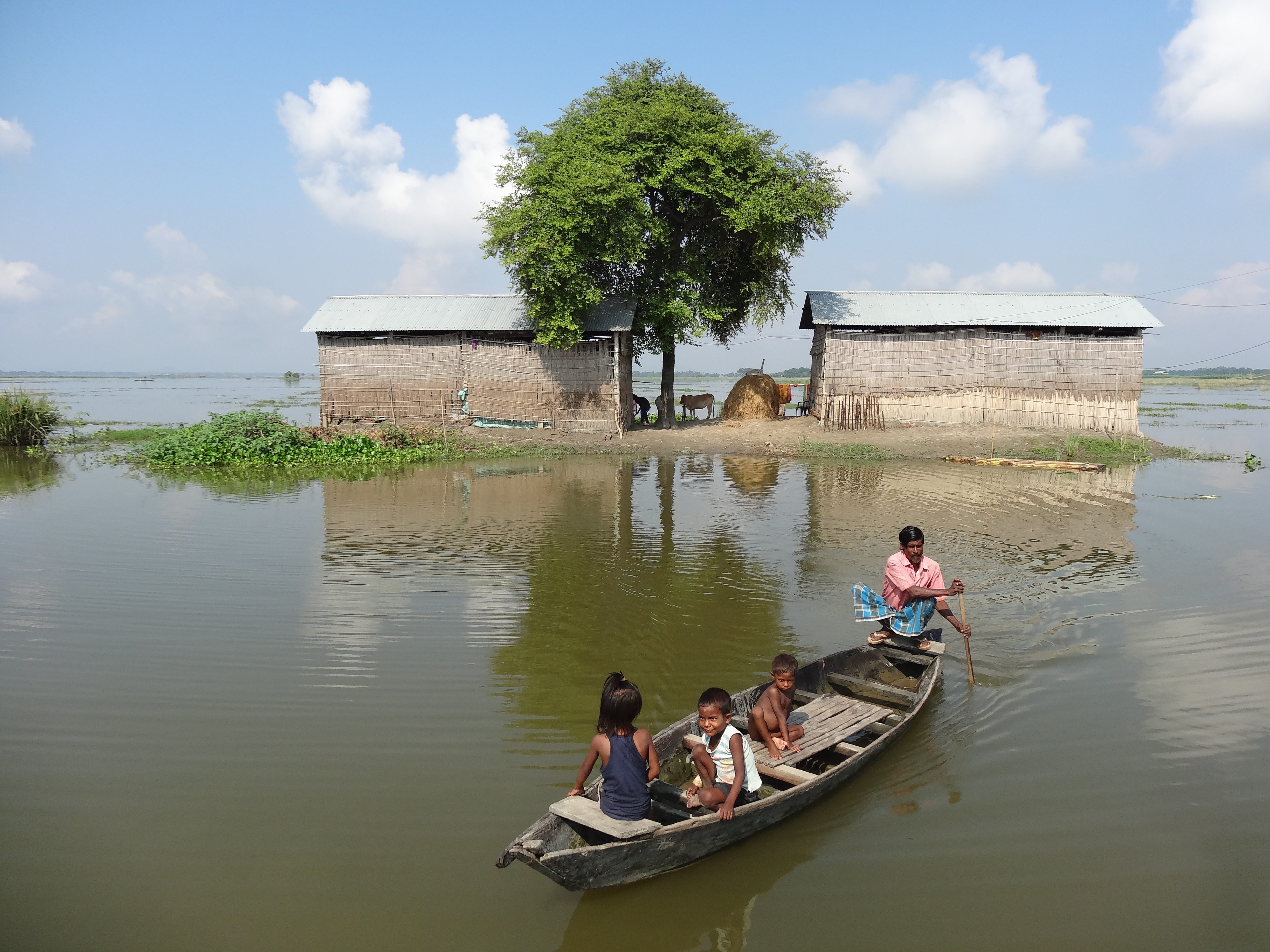
When isolated by floodwaters, families have no choice but to use boats for transportation; even children must learn the survival tool of rowing. Credit: Priyanka Borpujari/IPS
Day 101 Assam India flood worsens

Floods in Morigaon have submerged about 45 roads in the district. Most people wade through the water, believing this is quicker than waiting for a rickety boat to transport them across. Credit: Priyanka Borpujari/IPS

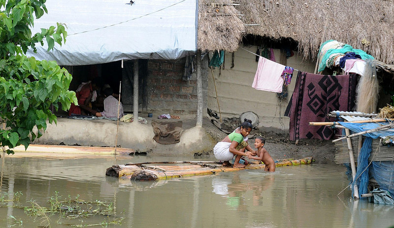
Diving into the river is an easy solution to a lack of bathrooms for children and men. Skin rashes are the most common ailment caused by contact with unclean water, according to village doctors. Credit: Priyanka Borpujari/IPS

A woman dries blankets after her home went underwater for five days in one of the villages of the Morigaon district. The woven bamboo sheet beyond the clothesline used to be the walls of her family’s toilet. Credit: Priyanka Borpujari/IPS
Topographic Map of Morigaon, Assam, India
Find elevation by address:

Places in Morigaon, Assam, India:
Places near Morigaon, Assam, India:
Morigaon
Pabitara
Pobitora ???? Wildlife Sanctuary
Darrang
Brahmaputra Valley
Nagaon
Nagaon
Khanapara
Dispur
Umling
Ri-bhoi
Aseb Road
Ulubari
Hamren
Guwahati
Gauripur
Kali Mandir
Nursery
Bhubaneswari Temple
Bhubneswari Temple Viewpoint
Recent Searches:
- Elevation of Corso Fratelli Cairoli, 35, Macerata MC, Italy
- Elevation of Tallevast Rd, Sarasota, FL, USA
- Elevation of 4th St E, Sonoma, CA, USA
- Elevation of Black Hollow Rd, Pennsdale, PA, USA
- Elevation of Oakland Ave, Williamsport, PA, USA
- Elevation of Pedrógão Grande, Portugal
- Elevation of Klee Dr, Martinsburg, WV, USA
- Elevation of Via Roma, Pieranica CR, Italy
- Elevation of Tavkvetili Mountain, Georgia
- Elevation of Hartfords Bluff Cir, Mt Pleasant, SC, USA