Elevation of Mohanpur, West Bengal, India
Location: India > West Bengal > West Medinipur > Kharagpur >
Longitude: 87.4232306
Latitude: 21.8398171
Elevation: 13m / 43feet
Barometric Pressure: 101KPa
Elevation Map:
Satellite Map:
Related Photos:

Good Night
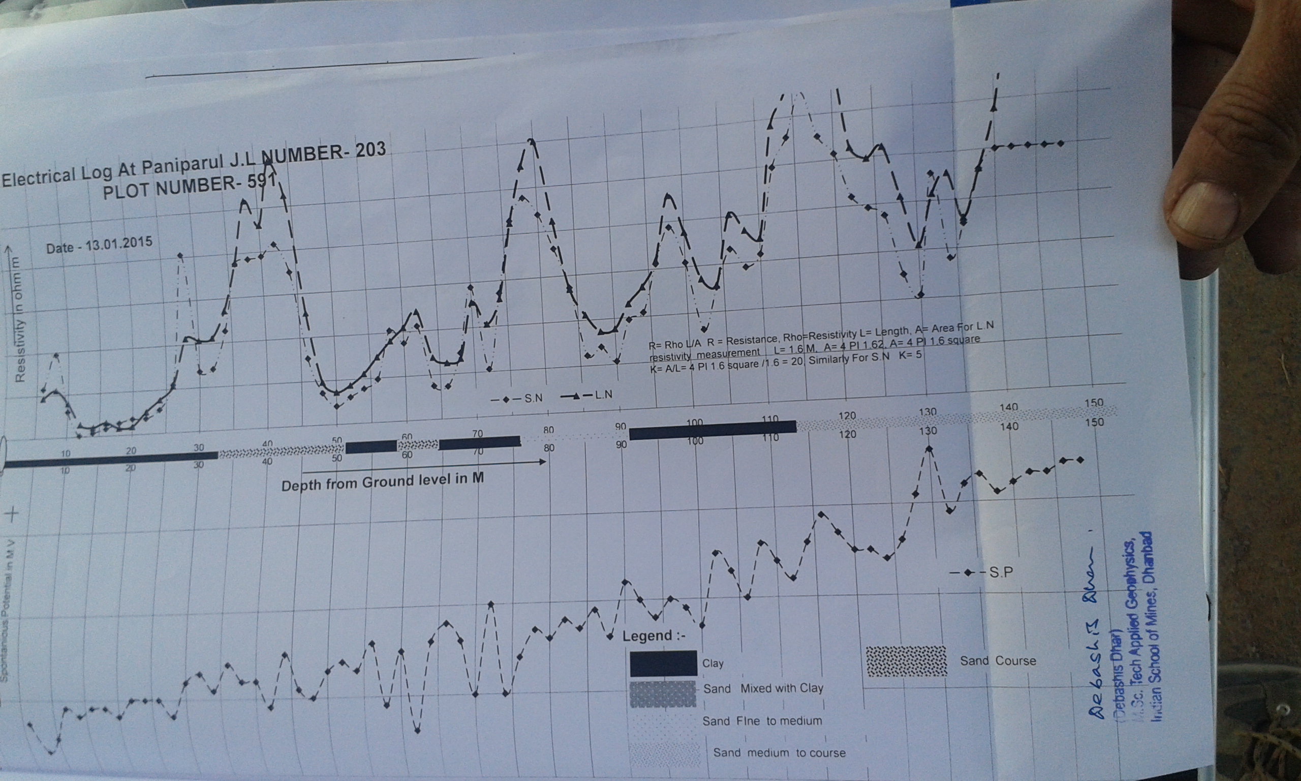
20150302(paniparul ldtw)

20150302_PANIPARUL LDTW
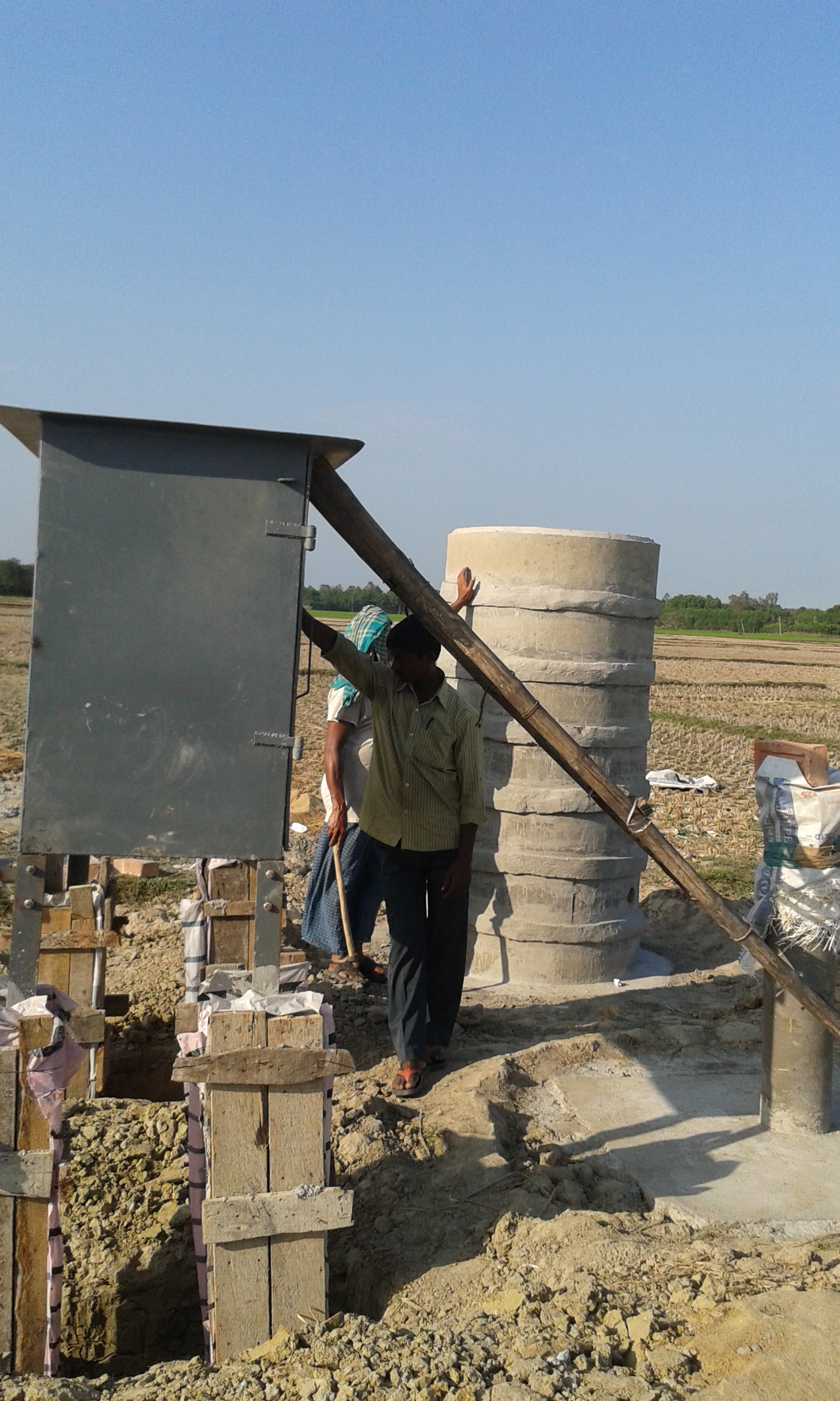
20150302_PANIPARUL LDTW
Topographic Map of Mohanpur, West Bengal, India
Find elevation by address:

Places near Mohanpur, West Bengal, India:
Kharagpur
Hugli
Baguran Jalpai
Purba Medinipur
Kharagpur
West Medinipur
Medinipur
Ulta
Haldia
Uluberia
South 24 Parganas
137, School Rd
Gangapuri
Kudghat Bazar
W2c-s-18
Golf Green
Bijoygarh, Narikel Bagan
9/19/1, Jadavpur Central Rd, Narikel Bagan
19, East Rd, Bidhanpally
19, East Rd, Bidhanpally
Recent Searches:
- Elevation of Corso Fratelli Cairoli, 35, Macerata MC, Italy
- Elevation of Tallevast Rd, Sarasota, FL, USA
- Elevation of 4th St E, Sonoma, CA, USA
- Elevation of Black Hollow Rd, Pennsdale, PA, USA
- Elevation of Oakland Ave, Williamsport, PA, USA
- Elevation of Pedrógão Grande, Portugal
- Elevation of Klee Dr, Martinsburg, WV, USA
- Elevation of Via Roma, Pieranica CR, Italy
- Elevation of Tavkvetili Mountain, Georgia
- Elevation of Hartfords Bluff Cir, Mt Pleasant, SC, USA