Latitude: 38.9753619
Longitude: -76.155713
Elevation: 5 meters / 16 feet
Barometric Pressure 1013KPa

Related Photos

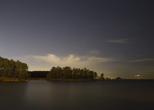
Light Trail Under the Moon by Randy • R, This is at night at Ocean Gateway close to Queenstown, MD. Practising "Long Exposure". Tak
Light Trail Under the Moon by Randy • R
Hot & Cold [Explore #82] by Gary Ngo | Photography, Color casting from most ND filter isn't an appreciated thing for most photographer, but sometimes, i
Hot & Cold [Explore #82] by Gary Ngo | Photography
Green Day by Randy • R, I took this at Wye Island, MD. Why not a greenish Waterscape this time? :)epl1 md maryland microfour
Green Day by Randy • R
The Green Wheat Field by Randy • R, This is a wheat field close to my house located in Queen Anne's, MD US. This field is immense but al
The Green Wheat Field by Randy • R
Green Day at Lake by Randy • R, I took this at Wye Island, MDtrees light summer usa lake tree green beach nature water beautiful bea
Green Day at Lake by Randy • R
View from the back deck on an autumn morning by vmi63,
View from the back deck on an autumn morning by vmi63
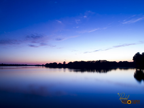
Peaceful Sunset by Randy • R, This is at sunset at Wye Island Rd in Queenstown, MD. Practising "Long Exposure". Is actua
Peaceful Sunset by Randy • R
The Sunset At Wye by Randy • R, This is at Wye Island Rd at Queenstown, MD. A beautiful Sunset take it from a bridge.blue sunset sum
The Sunset At Wye by Randy • R
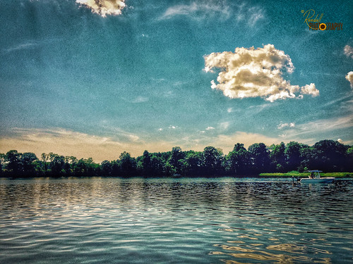
Dreaming Landscape by Randy • R, I took this in a lake at Wye Mills, MD. I use Photoshop to modify this picture just to have somethin
Dreaming Landscape by Randy • R
Queen Anne’s County, Maryland by Point_and_Shooter, bw blackandwhite blackwhite landscape sonyphotographing sony chesapeakebay water reflection serenity
Queen Anne’s County, Maryland by Point_and_Shooter
The Green Wheat by Randy • R, This is a field of wheat close to my house located in Queen Anne's, MD US. This field is immense but
The Green Wheat by Randy • R
Green Wheat Stand Up by Randy • R, This is a field of wheat close to my house located in Queen Anne's, MD US. This field is immense but
Green Wheat Stand Up by Randy • R
Starry Night, Moonless Sky by jeffweese, Taken at 9:00 at night...well after dusk on a clear night with no moon.  F/3.5, 30 second exposure,
Starry Night, Moonless Sky by jeffweese
RED FOX by nflravens, The preferred habitat of red foxes is a mixed landscape—comprising patches of forests, grasslands, a
RED FOX by nflravens
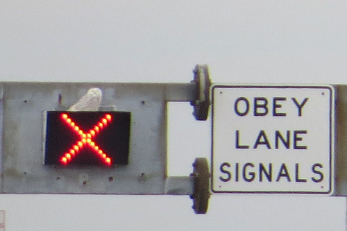
X marks the spot by cullerfuls, eBird documentation shot.  A Snowy Owl rests upon a signal box over the east bound lane of the Willi
X marks the spot by cullerfuls
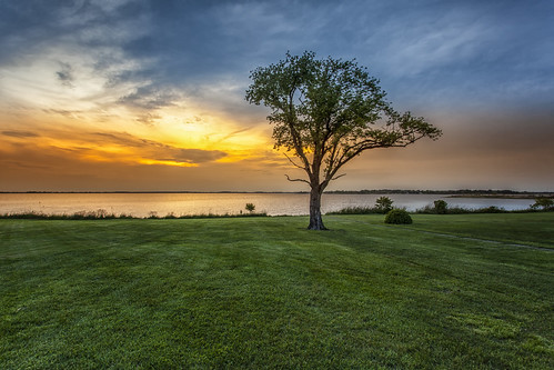
embrace the solitude by dK.i photography, A single oak on the front lawn of the old McCormick House on Parson Island, once owned by McCormick
embrace the solitude by dK.i photography

Beautiful Ground by Randy • R, Note: I’ll be using 500px as my main photography sharing site from now on. If you use 500px please f
Beautiful Ground by Randy • R
Eastern Neck National Wildlife Refuge by U. S. Fish and Wildlife Service - Northeast Region, Credit: USFWSneck landscape md wildlife maryland national eastern usfws refuge nationalwildliferefug
Eastern Neck National Wildlife Refuge by U. S. Fish and Wildlife Service - Northeast Region
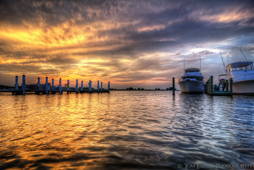
Chesapeake Day's End by Tom Lussier Photography, Looking northwest toward the open Chesapeake Bay from a dock(literally on the dock) of one of the ma
Chesapeake Day's End by Tom Lussier Photography
Wye Island NRMA in Queen Anne's County, Md. by chesbayprogram, A 290-year-old American holly grows at Wye Island Natural Resources Management Area in Queen Anne's
Wye Island NRMA in Queen Anne's County, Md. by chesbayprogram
Restored wetlands in Queen Anne's County, Maryland by chesbayprogram, Bloomfield Farm, seen on July 20, 2017, is a permanently protected 318-acre property with roughly 10
Restored wetlands in Queen Anne's County, Maryland by chesbayprogram
Eastern Neck National Wildlife Refuge controlled burn by U. S. Fish and Wildlife Service - Northeast Region, March, 2011, Eastern Neck National Wildlife Refuge, Maryland:  A controlled burn helps keep invasive
Eastern Neck National Wildlife Refuge controlled burn by U. S. Fish and Wildlife Service - Northeast Region
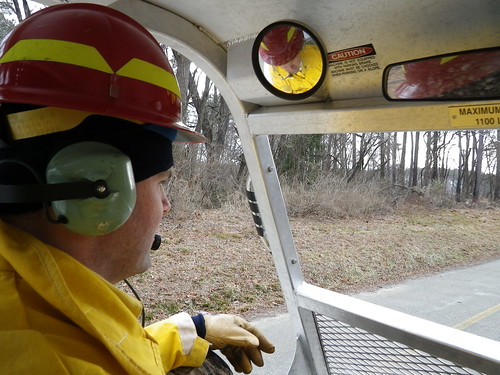
View from inside Marshmaster by U. S. Fish and Wildlife Service - Northeast Region, March, 2011, Eastern Neck National Wildlife Refuge, Maryland.  A firefighter drives a tracked, amphi
View from inside Marshmaster by U. S. Fish and Wildlife Service - Northeast Region
St. Joseph's near Cordova, Maryland, 1765 by Big Mike 42, Headquarters of Jesuit missionary activity in the mid-Delmarva Pensula from 1765 until 1874.  Cathol
St. Joseph's near Cordova, Maryland, 1765 by Big Mike 42
Ferry Point Park in Kent Narrows, Md. by chesbayprogram, An eroding marsh is seen in Kent Narrows, Md., on Feb. 14, 2011. (Photo by Matt Rath/Chesapeake Bay
Ferry Point Park in Kent Narrows, Md. by chesbayprogram
Restored wetlands in Queen Anne's County, Maryland by chesbayprogram, Bloomfield Farm, seen on July 20, 2017, is a permanently protected 318-acre property with roughly 10
Restored wetlands in Queen Anne's County, Maryland by chesbayprogram
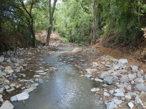
Centreville Dam rock ramp, downstream view by U. S. Fish and Wildlife Service - Northeast Region, This Hurricane Sandy resilience project removes the Centreville Dam in Centreville, Maryland, provid
Centreville Dam rock ramp, downstream view by U. S. Fish and Wildlife Service - Northeast Region
Restored wetlands in Queen Anne's County, Maryland by chesbayprogram, Bloomfield Farm, seen on July 20, 2017, is a permanently protected 318-acre property with roughly 10
Restored wetlands in Queen Anne's County, Maryland by chesbayprogram
Riparian forest buffer in Queen Anne's County, Md. by chesbayprogram, A recently planted riparian forest buffer borders an agricultural field along Emory Creek, which flo
Riparian forest buffer in Queen Anne's County, Md. by chesbayprogram
Chesapeake Bay Environmental Center in Queen Anne's County, Md. by chesbayprogram, A loblolly pine tree grows near marsh at Chesapeake Bay Environmental Center in Grasonville, Md., on
Chesapeake Bay Environmental Center in Queen Anne's County, Md. by chesbayprogram
Eastern Neck National Wildlife Refuge in Kent County, Md. by chesbayprogram, Phragmites and other shoreline wetland plants grow near a restoration project that uses a living sho
Eastern Neck National Wildlife Refuge in Kent County, Md. by chesbayprogram
Wye Mills Lake Spill by starg82343, Format: Anaglyph Color Version.
Red/Cyan 3D glasses required for viewing.

OOF (Out Of Frame), also
Wye Mills Lake Spill by starg82343
Restored wetlands in Queen Anne's County, Maryland by chesbayprogram, Bloomfield Farm, seen on July 20, 2017, is a permanently protected 318-acre property with roughly 10
Restored wetlands in Queen Anne's County, Maryland by chesbayprogram
Corsica River living shoreline in Queen Anne's County, Maryland by chesbayprogram, A living shoreline built to withstand sea level rise due to climate change is seen on July 20, 2017,
Corsica River living shoreline in Queen Anne's County, Maryland by chesbayprogram
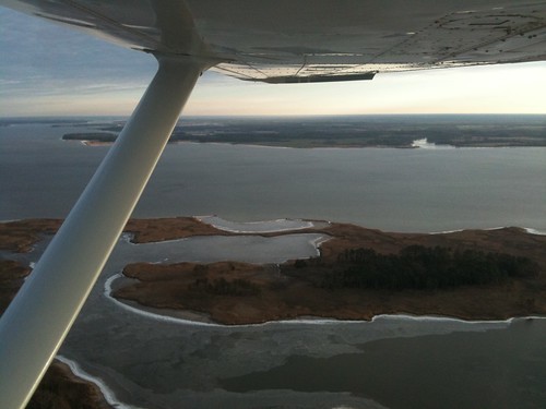
Aerial view of Hale Cove by U. S. Fish and Wildlife Service - Northeast Region, Eastern Neck National Wildlife Refuge. Credit: USFWSneck landscape md wildlife maryland aerial natio
Aerial view of Hale Cove by U. S. Fish and Wildlife Service - Northeast Region
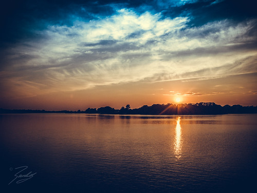
End View by Randy • R, Note: I’ll be using 500px as my main photography sharing site from now on. If you use 500px please f
End View by Randy • R
Restored wetlands in Queen Anne's County, Maryland by chesbayprogram, Bloomfield Farm, seen on July 20, 2017, is a permanently protected 318-acre property with roughly 10
Restored wetlands in Queen Anne's County, Maryland by chesbayprogram
Restored wetlands in Queen Anne's County, Maryland by chesbayprogram, Bloomfield Farm, seen on July 20, 2017, is a permanently protected 318-acre property with roughly 10
Restored wetlands in Queen Anne's County, Maryland by chesbayprogram
drama queen by dK.i photography, Something so majestic and dramatic when the storm clouds start rolling in, especially near sunset. T
drama queen by dK.i photography
Restored wetlands in Queen Anne's County, Maryland by chesbayprogram, Bloomfield Farm, seen on July 20, 2017, is a permanently protected 318-acre property with roughly 10
Restored wetlands in Queen Anne's County, Maryland by chesbayprogram
Corsica River living shoreline in Queen Anne's County, Maryland by chesbayprogram, A living shoreline built to withstand sea level rise due to climate change is seen on July 20, 2017,
Corsica River living shoreline in Queen Anne's County, Maryland by chesbayprogram
Corsica River living shoreline in Queen Anne's County, Maryland by chesbayprogram, A living shoreline built to withstand sea level rise due to climate change is seen on July 20, 2017,
Corsica River living shoreline in Queen Anne's County, Maryland by chesbayprogram
Corsica River living shoreline in Queen Anne's County, Maryland by chesbayprogram, A living shoreline built to withstand sea level rise due to climate change is seen on July 20, 2017,
Corsica River living shoreline in Queen Anne's County, Maryland by chesbayprogram
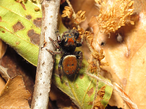
Pretty Jumper In Beautiful Litter by zxgirl, I was excited to find this red gem in the woods during a bio blitz this spring. Good info from BugGu
Pretty Jumper In Beautiful Litter by zxgirl
Wye Mills Lake Spill by starg82343, Format: Crossview Grayscale Version.
Gently converge (cross) your eyes and focus on the middle image
Wye Mills Lake Spill by starg82343
Nature Strength by Randy • R, Note: I’ll be using 500px as my main photography sharing site from now on. If you use 500px please f
Nature Strength by Randy • R
Fuzzy Red Jumper by zxgirl, Good ID info in the comments on BugGuide:
<a href="http://bugguide.net/node/view/1069956/bgimage" re
Fuzzy Red Jumper by zxgirl
the house by slider72, <a href="http://bighugelabs.com/flickr/onblack.php?id=2881504054">View On Black</a>

texture by grou
the house by slider72
Wye Mills Lake Spill by starg82343, Format: Anaglyph Grayscale Version.
Red/Cyan 3D glasses required for viewing.

OOF (Out Of Frame), a
Wye Mills Lake Spill by starg82343
Corsica River living shoreline in Queen Anne's County, Maryland by chesbayprogram, A living shoreline built to withstand sea level rise due to climate change is seen on July 20, 2017,
Corsica River living shoreline in Queen Anne's County, Maryland by chesbayprogram
Corsica River living shoreline in Queen Anne's County, Maryland by chesbayprogram, A living shoreline built to withstand sea level rise due to climate change is seen on July 20, 2017,
Corsica River living shoreline in Queen Anne's County, Maryland by chesbayprogram
Tufted Duck in Maryland by Dave W., (First of two) I joined my friend William Leigh for a trip to Kent Narrows to see if we could spot t
Tufted Duck in Maryland by Dave W.
Restored wetlands in Queen Anne's County, Maryland by chesbayprogram, Bloomfield Farm, seen on July 20, 2017, is a permanently protected 318-acre property with roughly 10
Restored wetlands in Queen Anne's County, Maryland by chesbayprogram
Stripy by zxgirl, Another like yesterday's <a href="https://www.flickr.com/photos/zxgirl/21842328099/">portrait shot</
Stripy by zxgirl
Kent Island Sunset by Squirrel Girl cbk, pink blue sunset orange pier dock md january maryland chesapeakebay 2015 kentisland hemmingwaysresta
Kent Island Sunset by Squirrel Girl cbk
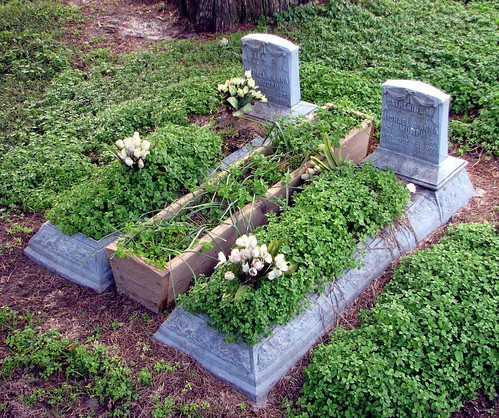
Budded on Earth to Bloom in Heaven by Big Mike 42, Grave markers of baby girls in the cemetery adjacent to St. Joseph's Catholic Church near Cordova, M
Budded on Earth to Bloom in Heaven by Big Mike 42
Terrapin Nature Park in Queen Anne's County, Md. by chesbayprogram, Water flows through salt marsh at Terrapin Nature Park in Stevensville, Md., on Jan. 31, 2016. The p
Terrapin Nature Park in Queen Anne's County, Md. by chesbayprogram
STANDING TALL by nflravens, Today, Jan 16, 2009, the Eagle pair were perched in a tree alongside the road. In front of nesting a
STANDING TALL by nflravens
VIEWPOINT by nflravens, Today, Jan 9, 2009, the Eagle pair were perched in a tree alongside the road. In front of nesting ar
VIEWPOINT by nflravens
Queen Anne's County Courthouse, 1796 by Big Mike 42, <a href="http://bighugelabs.com/flickr/onblack.php?id=200351626&size=large">View On Black</a>
Ce
Queen Anne's County Courthouse, 1796 by Big Mike 42