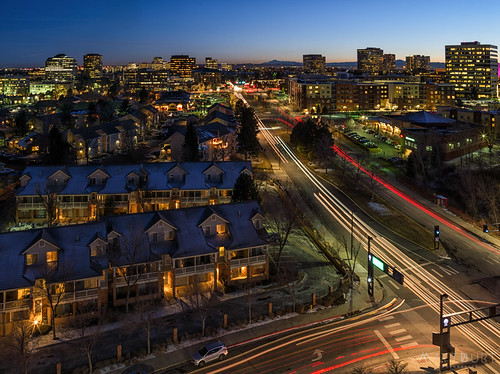
Elevation of Heatherwood Ct, Littleton, CO, USA
Location: United States > Colorado > Arapahoe County > Littleton > Southridge >
Longitude: -104.94666
Latitude: 39.5314863
Elevation: 1812m / 5945feet
Barometric Pressure: 81KPa
Related Photos:
Topographic Map of Heatherwood Ct, Littleton, CO, USA
Find elevation by address:

Places near Heatherwood Ct, Littleton, CO, USA:
10103 Meadowbriar Ln
Southridge
3900 Grace Blvd
9632 Dunning Cir
Grace Boulevard
10228 Rustic Redwood Ln
2789 Timberchase Trail
3700 E Highlands Ranch Pkwy
10831 Trotwood Way
4688 E Ketchwood Cir
4870 Kingston Ave
10799 Valleybrook Ct
10270 Charissglen Cir
9644 Newcastle Dr
11030 Valleybrook Cir
9367 Weeping Willow Ct
9174 Sugarstone Cir
9254 Buttonhill Ct
9685 Promenade Pl
1332 Beacon Hill Dr
Recent Searches:
- Elevation of Corso Fratelli Cairoli, 35, Macerata MC, Italy
- Elevation of Tallevast Rd, Sarasota, FL, USA
- Elevation of 4th St E, Sonoma, CA, USA
- Elevation of Black Hollow Rd, Pennsdale, PA, USA
- Elevation of Oakland Ave, Williamsport, PA, USA
- Elevation of Pedrógão Grande, Portugal
- Elevation of Klee Dr, Martinsburg, WV, USA
- Elevation of Via Roma, Pieranica CR, Italy
- Elevation of Tavkvetili Mountain, Georgia
- Elevation of Hartfords Bluff Cir, Mt Pleasant, SC, USA
