Elevation of County Road, County Rd, Texas, USA
Location: United States > Texas > Orange County > Orange >
Longitude: -93.880739
Latitude: 30.2725234
Elevation: 14m / 46feet
Barometric Pressure: 101KPa
Elevation Map:
Satellite Map:
Related Photos:

SRN 1751 | EMD GP7 | Sabine River & Northern

KCS IMXSH 27, Mauriceville, TX

KCS GKCMX 22, Maruiceville, TX

Sabine River & Northern SRN 1751 (GP7) Orange, Texas

Sabine River & Northern Orange, Texas
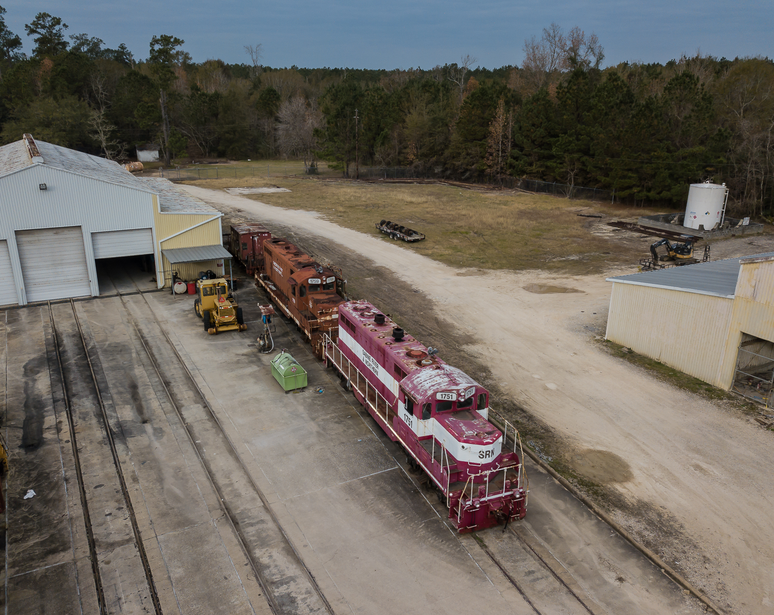
Sabine River & Northern

Banana Spider

I took the bridge less traveled,

The gator(s) were not ready for a close-up shot today.

KCS MNSEW25, Mauriceville, TX

TX FM 1441

KCS 2GBVKC 06, Lemonville, TX

KCS XWLRSH 13, Lemonville, TX

2012 road trip
Topographic Map of County Road, County Rd, Texas, USA
Find elevation by address:

Places near County Road, County Rd, Texas, USA:
County Road 3143
County Road 3142
422 County Rd 3140
422 County Rd 3140
County Road 3149
County Road 3139
430 Co Rd 825
439 Co Rd 825
674 Co Rd 797
1913 Fm 105
4770 Co Rd 716
County Road 894
U.S. 96 S, Buna, TX, USA
Evadale
Old Evadale Rd, Silsbee, TX, USA
Walmart Supercenter
5441 Matthews Dr
Highway 96 North
112 Wilson Ln
9249 Village Creek Loop
Recent Searches:
- Elevation of Corso Fratelli Cairoli, 35, Macerata MC, Italy
- Elevation of Tallevast Rd, Sarasota, FL, USA
- Elevation of 4th St E, Sonoma, CA, USA
- Elevation of Black Hollow Rd, Pennsdale, PA, USA
- Elevation of Oakland Ave, Williamsport, PA, USA
- Elevation of Pedrógão Grande, Portugal
- Elevation of Klee Dr, Martinsburg, WV, USA
- Elevation of Via Roma, Pieranica CR, Italy
- Elevation of Tavkvetili Mountain, Georgia
- Elevation of Hartfords Bluff Cir, Mt Pleasant, SC, USA