Elevation of Costerfield VIC, Australia
Location: Australia > Victoria > Greater Bendigo City >
Longitude: 144.781718
Latitude: -36.866095
Elevation: 214m / 702feet
Barometric Pressure: 99KPa
Elevation Map:
Satellite Map:
Related Photos:

Southern sky view
Enjoy the views - Strange formations

Panorama of Lake Eppalock

Lake Eppalock

Sunset on 2015

New Years with the Stars

Gold mining aftermath, Heathcote, Victoria

Emu Rising

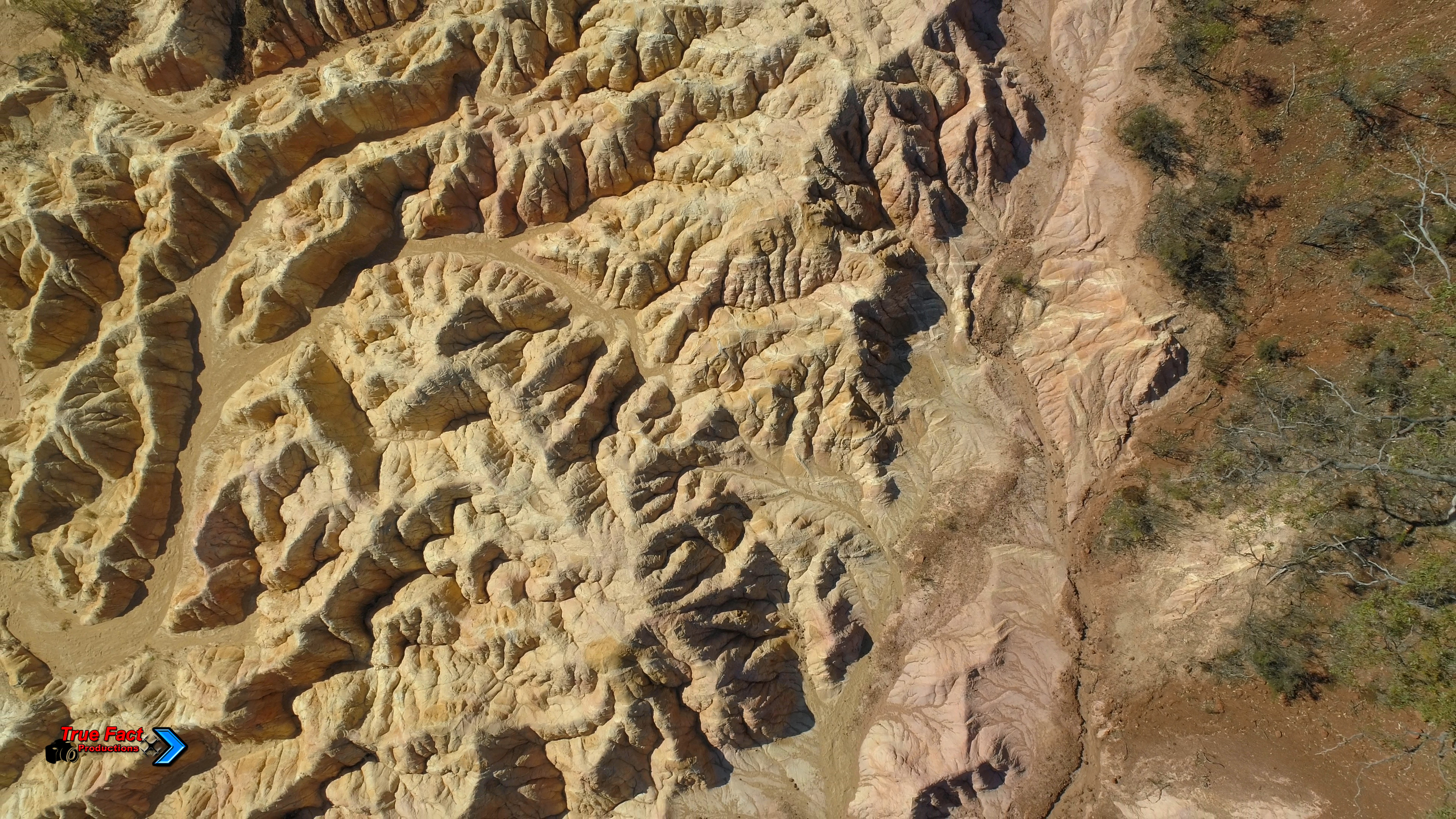
The Pink Cliffs Geological Park, Heathcote

Heathcote Pink Cliffs, 2011-12-29 (_MG_1321/2/3)

Heathcote Pink Cliffs 2011-12-29 (_MG_1318_9_0)

Mars Scape

The Pink Cliffs Geological Park, Heathcote

The Pink Cliffs Geological Park, Heathcote

The Pink Cliffs Geological Park, Heathcote

Approaching sunset

The Pink Cliffs Geological Park, Heathcote

The Pink Cliffs Geological Park, Heathcote
Topographic Map of Costerfield VIC, Australia
Find elevation by address:

Places near Costerfield VIC, Australia:
1097-1099 Heathcote-north Costerfield Rd
Toolleen
58 Cornella-toolleen Rd
1130 Burke And Wills Track
1130 Burke And Wills Track
Benloch
Baynton Springs
888 Burke And Wills Track
930 Burke And Wills Track
930 Burke And Wills Track
930 Burke And Wills Track
Langley
Axe Creek
Turpins Falls S.r.
11 Patons Rd
60 High St
Metcalfe East
Greater Bendigo City
101 Verekers Ln
Ascot
Recent Searches:
- Elevation of Corso Fratelli Cairoli, 35, Macerata MC, Italy
- Elevation of Tallevast Rd, Sarasota, FL, USA
- Elevation of 4th St E, Sonoma, CA, USA
- Elevation of Black Hollow Rd, Pennsdale, PA, USA
- Elevation of Oakland Ave, Williamsport, PA, USA
- Elevation of Pedrógão Grande, Portugal
- Elevation of Klee Dr, Martinsburg, WV, USA
- Elevation of Via Roma, Pieranica CR, Italy
- Elevation of Tavkvetili Mountain, Georgia
- Elevation of Hartfords Bluff Cir, Mt Pleasant, SC, USA