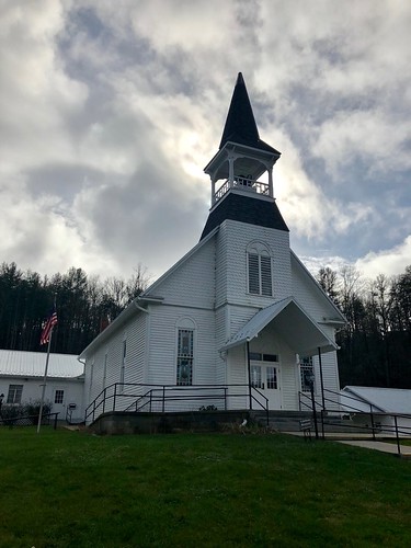
Latitude: 35.2413033
Longitude: -83.3480154
Elevation: 765 meters / 2510 feet
Barometric Pressure 925KPa

Related Photos

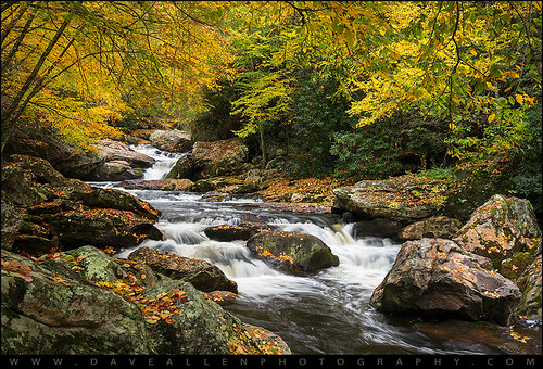
North Carolina Highlands NC Autumn River Gorge by Dave Allen Photography, Be Still and Breathe - North Carolina Highlands NC Autumn River Gorge

A peaceful autumn scene along
North Carolina Highlands NC Autumn River Gorge by Dave Allen Photography
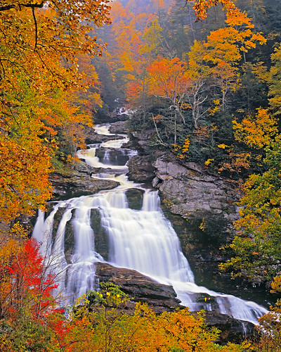
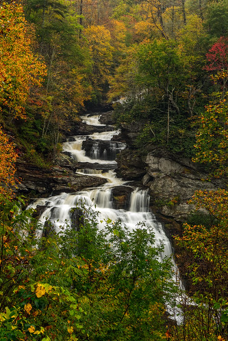
Cullasaja Falls by snapdragginphoto, Seen roadside off NC64 between Highlands and Franklin, North Carolina, Cullasaja Falls is one of NCs
Cullasaja Falls by snapdragginphoto
Cullasaja Falls, Redux by snapdragginphoto, Cullasaja Falls is perhaps my favorite waterfall in North Carolina, and has been since my first enco
Cullasaja Falls, Redux by snapdragginphoto
Upper Cullasaja Falls by andrew_v, This was taken off of Highlands Rd. between Highlands & Franklin in North Carolina.  Cullasaja F
Upper Cullasaja Falls by andrew_v
Cullasaja Falls by Frank Kehren, Cullasaja Falls, Cullasaja River Gorge, Nantahala National Forest, near Highlands, North Carolina

<
Cullasaja Falls by Frank Kehren
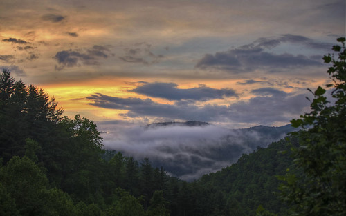
Smoky Mountains by mokastet, sunset cloudy
Smoky Mountains by mokastet
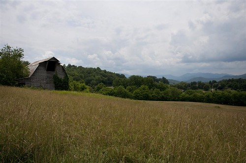
Fields of Gold | Franklin, NC by Me and My Photos :), A highway sight between Franlin, NC and Bryson City, NC on Highway 28.
Fields of Gold | Franklin, NC by Me and My Photos :)
Bridal Veil Falls (Highlands) by waterfallshiker,
Bridal Veil Falls (Highlands) by waterfallshiker
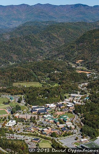
Western Carolina University Campus by David Oppenheimer, Western Carolina University - WCU campus - University of North Carolina in Cullowhee, NC aerial phot
Western Carolina University Campus by David Oppenheimer
Fugue by Jeff NC, A wider view, stitched from six portrait-orientation exposures at 30mm

Cullasaja River
Nantahala Na
Fugue by Jeff NC
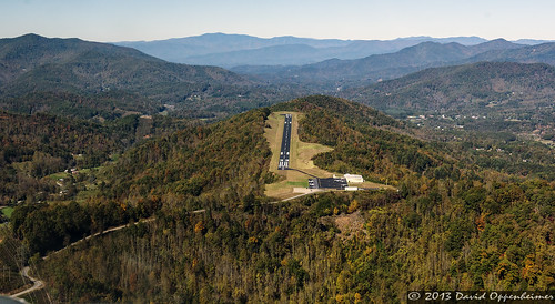
Jackson County Airport 24A in Cullowhee, NC by David Oppenheimer, Jackson County Airport 24A in Cullowhee, North Carolina - © 2013 David Oppenheimer - Performance Imp
Jackson County Airport 24A in Cullowhee, NC by David Oppenheimer
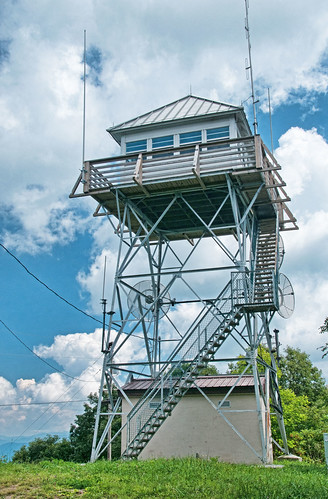
Cowee Bald Fire Tower - North Carolina by Timothy Wildey, You can walk the steps up the Tower but there is a locked heavy steel door at the top. All views and
Cowee Bald Fire Tower - North Carolina by Timothy Wildey
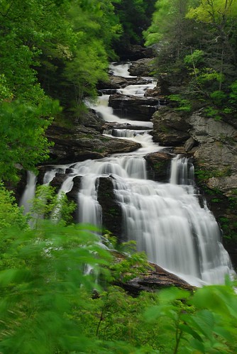
Cullasaja Falls, NC by VermontDreams, Cullasaja Falls is a beautiful falls located along a very dangerous stretch of Hwy 64. The 250' fall
Cullasaja Falls, NC by VermontDreams
Cullasaja Falls - Highlands, North Carolina. by VonShawn, This might be the most dangerous waterfall I've photographed and not because you're in danger from f
Cullasaja Falls - Highlands, North Carolina. by VonShawn
Cullasaja Falls, Cullasaja River Gorge, Nantahala National Forest, Macon County, North Carolina 3 by Alan Cressler, This is one of the most impressive waterfalls in Western North Carolina. It is also not easy to visi
Cullasaja Falls, Cullasaja River Gorge, Nantahala National Forest, Macon County, North Carolina 3 by Alan Cressler
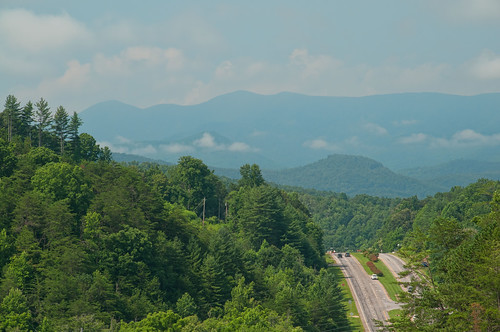
Franklin, North Carolina by Timothy Wildey, US 441, US 23
franklin nc northcarolina us23 maconcounty us441 franklinnc brendletown
Franklin, North Carolina by Timothy Wildey
Jackson County Airport 24A in Cullowhee, NC by David Oppenheimer, Jackson County Airport 24A in Cullowhee, North Carolina - © 2013 David Oppenheimer - Performance Imp
Jackson County Airport 24A in Cullowhee, NC by David Oppenheimer
Cullasaja Falls Mid-Section by Darrell Duke, Cullasaja Falls mid section isolation shot - Highlands North Carolina USA
Cullasaja Falls Mid-Section by Darrell Duke
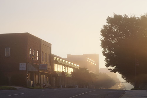
Morning on Main Street by Jeff NC, Franklin, NC. Based on my month here, morning fog is so common as to be unremarkable, but I never ti
Morning on Main Street by Jeff NC
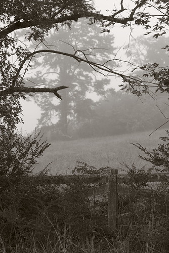
Town and country by Jeff NC, Franklin, NC

Pentax K-1
SMC Pentax 1:1.8 85mm
Iridient Developerwesternnorthcarolina fog pentax k1
Town and country by Jeff NC
Mountain Waters Scenic Byway, Between Franklin and Highlands, North Carolina by Ken Lund, The Mountain Waters Scenic Byway is a two-lane highway in North Carolina, which travels through the
Mountain Waters Scenic Byway, Between Franklin and Highlands, North Carolina by Ken Lund
Mountain Waters Scenic Byway, Between Franklin and Highlands, North Carolina by Ken Lund, The Mountain Waters Scenic Byway is a two-lane highway in North Carolina, which travels through the
Mountain Waters Scenic Byway, Between Franklin and Highlands, North Carolina by Ken Lund
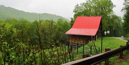
Mountain Waters Scenic Byway, Between Franklin and Highlands, North Carolina by Ken Lund, The Mountain Waters Scenic Byway is a two-lane highway in North Carolina, which travels through the
Mountain Waters Scenic Byway, Between Franklin and Highlands, North Carolina by Ken Lund
Mountain Waters Scenic Byway, Between Franklin and Highlands, North Carolina by Ken Lund, The Mountain Waters Scenic Byway is a two-lane highway in North Carolina, which travels through the
Mountain Waters Scenic Byway, Between Franklin and Highlands, North Carolina by Ken Lund
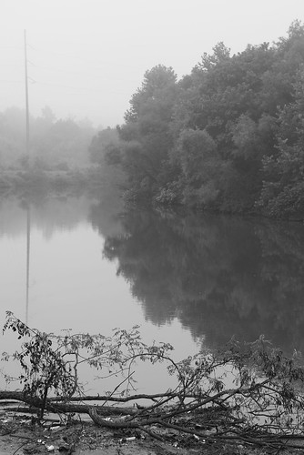
Between the river and the fog by Jeff NC, Franklin, NC

#3 from a morning walk on Monday, August 13, 2018.

Pentax K-1
SMC Pentax 1:1.8 85mm
I
Between the river and the fog by Jeff NC
Mountain Waters Scenic Byway, Between Franklin and Highlands, North Carolina by Ken Lund, The Mountain Waters Scenic Byway is a two-lane highway in North Carolina, which travels through the
Mountain Waters Scenic Byway, Between Franklin and Highlands, North Carolina by Ken Lund
Mountain Waters Scenic Byway, Between Franklin and Highlands, North Carolina by Ken Lund, The Mountain Waters Scenic Byway is a two-lane highway in North Carolina, which travels through the
Mountain Waters Scenic Byway, Between Franklin and Highlands, North Carolina by Ken Lund
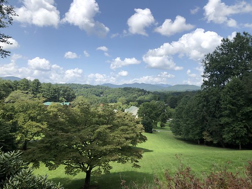
Mountains and clouds, view from Jimmy and Beth's place, Franklin, North Carolina by Paul McClure DC, northcarolina maconcounty aug2021 franklin mountains scenery tree cloud sky
Mountains and clouds, view from Jimmy and Beth's place, Franklin, North Carolina by Paul McClure DC
Mountain Waters Scenic Byway, Between Franklin and Highlands, North Carolina by Ken Lund, The Mountain Waters Scenic Byway is a two-lane highway in North Carolina, which travels through the
Mountain Waters Scenic Byway, Between Franklin and Highlands, North Carolina by Ken Lund
PrrysWtrGrdn_0817_edit.jpg by C.Fredrickson Photography, flower franklin nc july northcarolina impression topaz sps 2015 perryswatergarden carlfredrickson ©c
PrrysWtrGrdn_0817_edit.jpg by C.Fredrickson Photography
Ruby City by Jeff NC, Main Street
Franklin, North Carolina

IR-converted Pentax K-5
SMC Pentax 1:3.5 18mm
Iridient Develop
Ruby City by Jeff NC
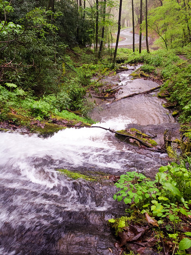
The road at the end of the falls by d-day buff, The winding road at the bottom of Cullowhee Falls from "the top of the middle" on a rainy
The road at the end of the falls by d-day buff
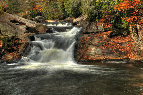
Quarry Falls by the waterfallhunter, Always have to stop here when driving through the Cullasaja Gorge. Not a huge spectacular falls howe
Quarry Falls by the waterfallhunter
Mountain Roads by keroq, travel blue autumn trees usa mountains fall colors america canon eos 50mm united nowhere north roadt
Mountain Roads by keroq
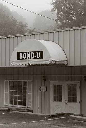
For when U need it by Jeff NC, Google Street View doesn't update so often in out-of-the-way places; it shows this business targetin
For when U need it by Jeff NC
Almost sunset, mountain view, Franklin, North Carolina by Paul McClure DC, franklin maconcounty northcarolina feb2025 sky cloud sunset scenery tree
Almost sunset, mountain view, Franklin, North Carolina by Paul McClure DC
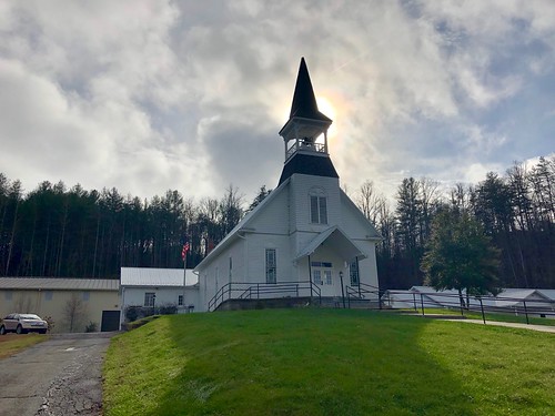
Webster Baptist Church, Webster, NC by w_lemay, This is the Webster Baptist Church, located along North Carolina Highway 116 and the Tuckaseigee Riv
Webster Baptist Church, Webster, NC by w_lemay
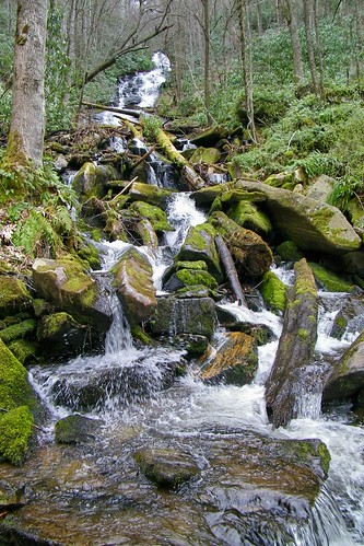
Alarka Falls by greer82496, Nantahala National Forestwaterfall north carolina nantahala alarka
Alarka Falls by greer82496
Webster Baptist Church, Webster, NC by w_lemay, This is the Webster Baptist Church, located along North Carolina Highway 116 and the Tuckaseigee Riv
Webster Baptist Church, Webster, NC by w_lemay
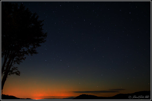
Peaceful View by Darrell Duke, Night sky view from this year's fall cabin, which just happened to be named "Peaceful View"
Peaceful View by Darrell Duke
Cullasaja Falls by mcmillend, Nantahala National Forest, North Carolina

a few more waterfalls from last week's quick visit to Nor
Cullasaja Falls by mcmillend
Dry Falls by power slave, Fall is just around the corner..fall colors franklin nc highlands waterfalls manaskarekar
Dry Falls by power slave
Marshy area in Franklin NC by Edith Frost,
Marshy area in Franklin NC by Edith Frost
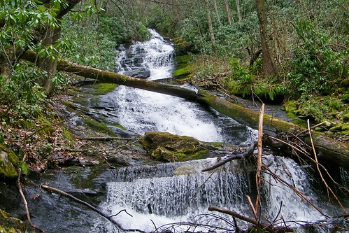
Alarka Falls by greer82496, Nantahala National Forestwaterfall north carolina nantahala alarka
Alarka Falls by greer82496
Webster Baptist Church, Webster, NC by w_lemay, This is the Webster Baptist Church, located along North Carolina Highway 116 and the Tuckaseigee Riv
Webster Baptist Church, Webster, NC by w_lemay
Webster Baptist Church, Webster, NC by w_lemay, This is the Webster Baptist Church, located along North Carolina Highway 116 and the Tuckaseigee Riv
Webster Baptist Church, Webster, NC by w_lemay
Webster Baptist Church, Webster, NC by w_lemay, This is the Webster Baptist Church, located along North Carolina Highway 116 and the Tuckaseigee Riv
Webster Baptist Church, Webster, NC by w_lemay
Webster Baptist Church, Webster, NC by w_lemay, This is the Webster Baptist Church, located along North Carolina Highway 116 and the Tuckaseigee Riv
Webster Baptist Church, Webster, NC by w_lemay
Not lacking for water at Cullasaja Falls. by MTBradley, <a href="http://youtu.be/rO-8dqSHqR8" rel="nofollow">after the big rain</a> over the last couple of
Not lacking for water at Cullasaja Falls. by MTBradley
Mountain view from Tisit Drive, Franklin, North Carolina by Paul McClure DC, Aunt Mona's 99th birthday partyfranklin maconcounty northcarolina feb2025 scenery sky cloud tree
Mountain view from Tisit Drive, Franklin, North Carolina by Paul McClure DC
Webster Baptist Church, Webster, NC by w_lemay, This is the Webster Baptist Church, located along North Carolina Highway 116 and the Tuckaseigee Riv
Webster Baptist Church, Webster, NC by w_lemay
Webster Baptist Church, Webster, NC by w_lemay, This is the Webster Baptist Church, located along North Carolina Highway 116 and the Tuckaseigee Riv
Webster Baptist Church, Webster, NC by w_lemay
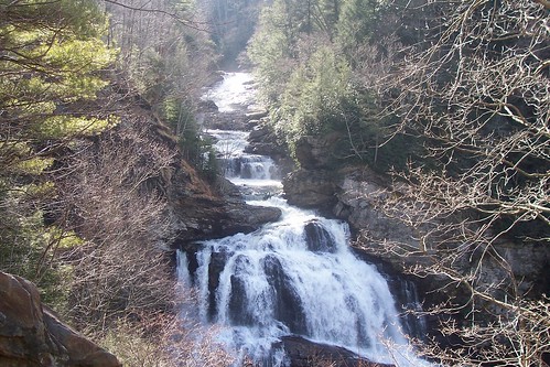
Cullasaja Falls by greer82496, Nantahala National Forestwaterfall north carolina nantahala cullasaja
Cullasaja Falls by greer82496
Mountain Sky by Mamluke, Appalachians in North Carolinamountain mountains mountainous appalachians appalachianmountians north
Mountain Sky by Mamluke
Webster Baptist Church, Webster, NC by w_lemay, This is the Webster Baptist Church, located along North Carolina Highway 116 and the Tuckaseigee Riv
Webster Baptist Church, Webster, NC by w_lemay
Webster Baptist Church, Webster, NC by w_lemay, This is the Webster Baptist Church, located along North Carolina Highway 116 and the Tuckaseigee Riv
Webster Baptist Church, Webster, NC by w_lemay
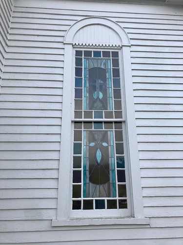
Webster Baptist Church, Webster, NC by w_lemay, This is the Webster Baptist Church, located along North Carolina Highway 116 and the Tuckaseigee Riv
Webster Baptist Church, Webster, NC by w_lemay
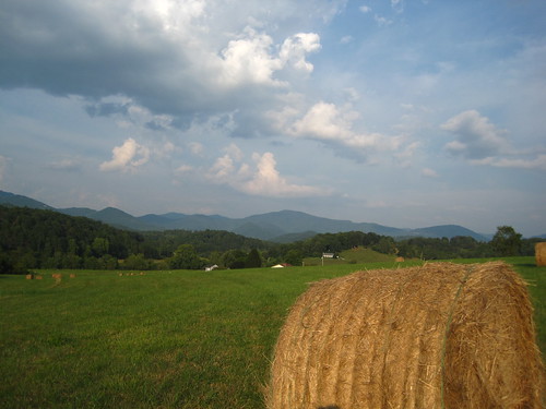
The Cowee Mountains. by MTBradley, sky field clouds geotagged us nc view unitedstates scenic berge vista hay bergen 山 appalachia montañ
The Cowee Mountains. by MTBradley
Webster Baptist Church, Webster, NC by w_lemay, This is the Webster Baptist Church, located along North Carolina Highway 116 and the Tuckaseigee Riv
Webster Baptist Church, Webster, NC by w_lemay
Nikwasi Mound, Franklin, NC by w_lemay, Built circa 1000 AD, this mound was historically the center of the Cherokee town of Nikwasi, located
Nikwasi Mound, Franklin, NC by w_lemay