Elevation of Bangarapet, Karnataka, India
| Latitude | 12.9923861 |
|---|---|
| Longitude | 78.1767503 |
| Elevation | 824m / 2703feet |
| Barometric Pressure | 918KPa |
Related Photos:

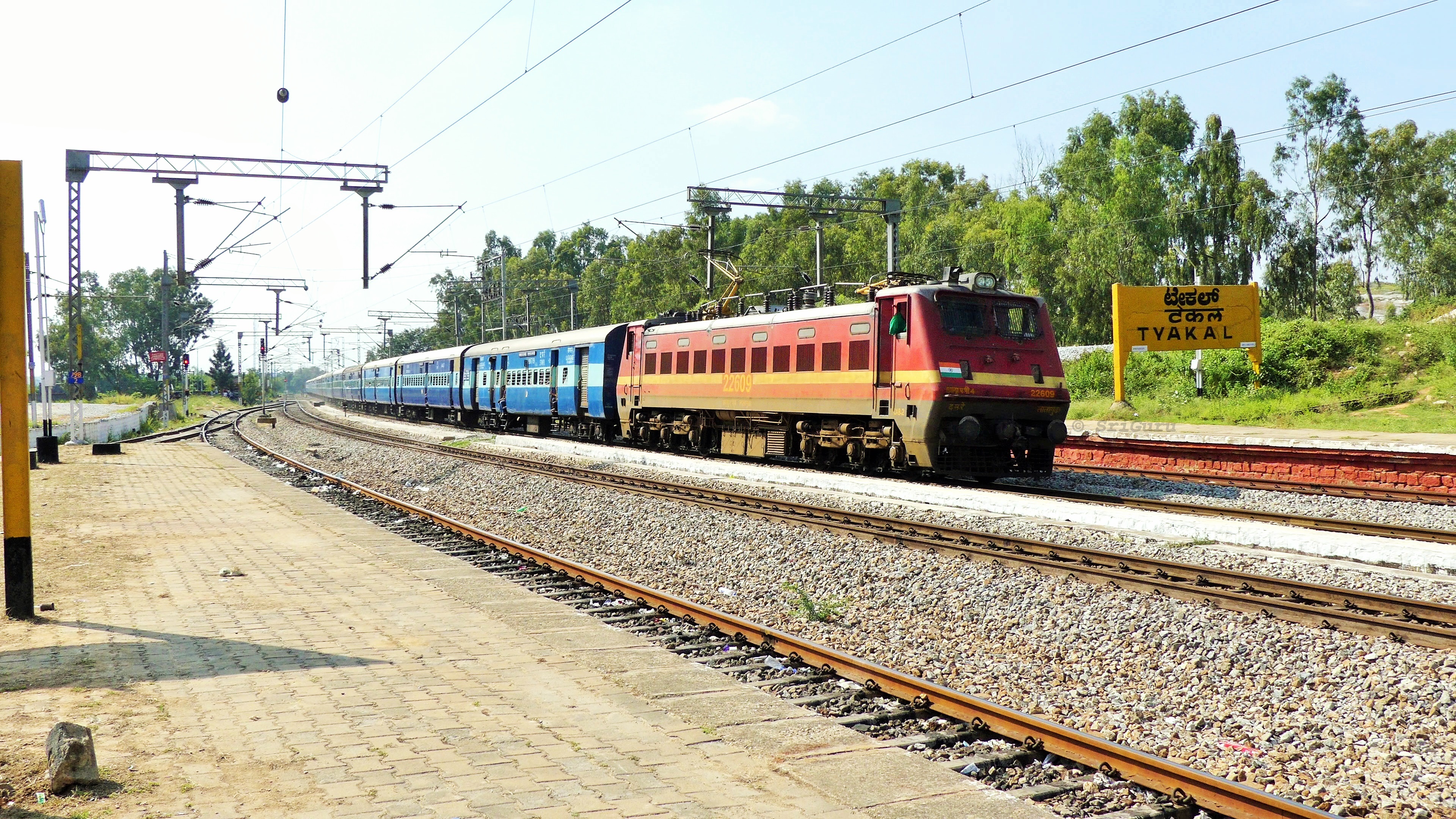
#DabbaDeckker greets us before vanishing into the landscape of Tyakal :-) Led by it's a handsome white stallion of Royapuram

Hubli WDP-4 20006 CST Mumbai Nagercoil Jn Express

Kotilingeshwara Temple

Kotilingeshwara Temple

Kotilingeshwara Temple

Kotilingeshwara Temple

Kotilingeshwara Temple

Kotilingeshwara Temple
Lallaguda WAP-4 negotiating curve in aggression with Anga Express

ETC Memorial Hospital, Kolar

WAP 7 LGD 30309

Kotilingeshwara Temple

Kotilingeshwara Temple

Kotilingeshwara Temple

Kotilingeshwara Temple

Kotilingeshwara Temple

Kotilingeshwara Temple

Kotilingeshwara Temple

Kotilingeshwara Temple

Kotilingeshwara Temple

Kotilingeshwara Temple
Topographic Map of Bangarapet, Karnataka, India
Find elevation by address:
Places near Bangarapet, Karnataka, India:
Kolar
Kolar
Kothigutlahalli
Blooms Eco Village
Blooms Eco Village
Doddagounipalli
Gangamadugu
Blooms Eco Farm
Alphonso By The Lake Farm
Alphonso By The Lake Farm
Peryathammandrapalli
Kuppam
Venkatagirikota
Thambigani Palli
Attur
Bagalur
Shoolagiri
Dasarahalli
Hoskote
Kamandoddi
Recent Searches:
- Elevation of 104, Chancery Road, Middletown Township, Bucks County, Pennsylvania, 19047, USA
- Elevation of 1212, Cypress Lane, Dayton, Liberty County, Texas, 77535, USA
- Elevation map of Central Hungary, Hungary
- Elevation map of Pest, Central Hungary, Hungary
- Elevation of Pilisszentkereszt, Pest, Central Hungary, Hungary
- Elevation of Dharamkot Tahsil, Punjab, India
- Elevation of Bhinder Khurd, Dharamkot Tahsil, Punjab, India
- Elevation of 2881, Chabot Drive, San Bruno, San Mateo County, California, 94066, USA
- Elevation of 10370, West 107th Circle, Westminster, Jefferson County, Colorado, 80021, USA
- Elevation of 611, Roman Road, Old Ford, Bow, London, England, E3 2RW, United Kingdom
- Elevation of 116, Beartown Road, Underhill, Chittenden County, Vermont, 05489, USA
- Elevation of Window Rock, Colfax County, New Mexico, 87714, USA
- Elevation of 4807, Rosecroft Street, Kempsville Gardens, Virginia Beach, Virginia, 23464, USA
- Elevation map of Matawinie, Quebec, Canada
- Elevation of Sainte-Émélie-de-l'Énergie, Matawinie, Quebec, Canada
- Elevation of Rue du Pont, Sainte-Émélie-de-l'Énergie, Matawinie, Quebec, J0K2K0, Canada
- Elevation of 8, Rue de Bécancour, Blainville, Thérèse-De Blainville, Quebec, J7B1N2, Canada
- Elevation of Wilmot Court North, 163, University Avenue West, Northdale, Waterloo, Region of Waterloo, Ontario, N2L6B6, Canada
- Elevation map of Panamá Province, Panama
- Elevation of Balboa, Panamá Province, Panama