Latitude: 53.4817207
Longitude: -1.6021234
Elevation: 195 meters / 640 feet
Barometric Pressure 990KPa

Related Photos

View from the top (explored) by Phil-Gregory, Ladybower reservoir taken from bamford edge,peak District Derbyshire/south Yorkshire
View from the top (explored) by Phil-Gregory
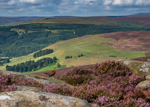
Derbyshire Ravens by Peter Quinn1, Ravens are becoming a more common sight on the moors near Sheffield. These two were cronking overhea
Derbyshire Ravens by Peter Quinn1
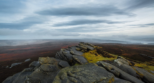
Long view (explored) by Phil-Gregory, Last one for now  from up on Derwent edge
Long view (explored) by Phil-Gregory
Back Tor View by johngregory250666, Another View from Back Tor , on Derwent Edge Deceember 2019, Peak District, Derbyshire, UKthe river
Back Tor View by johngregory250666
East by Jawad Q, Taken from the Sheffield department store Atkinsons car park looking East. <a href="https://www.flic
East by Jawad Q
Red Grouse by Peter Quinn1, redgrouse derbyshire derwentedge peakdistrict heather
Red Grouse by Peter Quinn1
Frosty by Phil-Gregory, Ladybower from Bamford edge Peak District Derbyshire ladybowerreservoir derbyshire nikon d7200 peakd
Frosty by Phil-Gregory
Back Tor.... by johngregory250666, View from Back Tor, on Dewent Edge, December 2019, Peak District, Derbyshire UKthe river derwent rur
Back Tor.... by johngregory250666
atmosphere by Phil-Gregory, stanage edge , the end of a long walk the light started to go but gave this nice effect down the hop
atmosphere by Phil-Gregory
Elephant & Castle, Holmfirth by Kev Walker ¦ Thanks comments or views, The Elephant & Castle Inn in Holmfirth, West Yorkshire, is a charming village pub located in the
Elephant & Castle, Holmfirth by Kev Walker ¦ Thanks comments or views
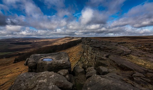
Rocky road by Phil-Gregory, Stanage edge, peak district Derbyshire uknikon d7200 tokina1120mmatx tokina peakdistrict national na
Rocky road by Phil-Gregory
Sunrise by Phil-Gregory, Peak District early morning January peakdistrictderbyshire tokina1120mmatx tokina wideangle ultrawid
Sunrise by Phil-Gregory
colourful by Phil-Gregory, a view down the the valley with higger tor and over owler tor covered in the purple Heather nikon d7
colourful by Phil-Gregory
Kestrel over the moors by Peter Quinn1, I took this image from the road below Stanage Edge. There have been a number of Kestrels here all ye
Kestrel over the moors by Peter Quinn1
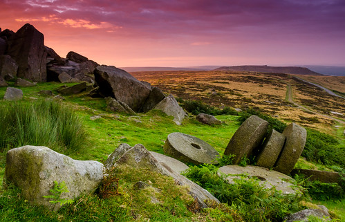
Stanage Millstones at Dawn by Peter Quinn1, A shot from an unsettled morning in the summer which fairly fleetingly gave some great colour in the
Stanage Millstones at Dawn by Peter Quinn1
The Salt Cellar by Peter Quinn1, Derwent Edge, Derbyshireoutcrop landscape derbyshire peakdistrict tor gritstone derwentedge saltcell
The Salt Cellar by Peter Quinn1
Dusk & Decay by Andrew Shenton, The remains of a once vibrant canalside industrial past reflect at dusk in the still waters of the S
Dusk & Decay by Andrew Shenton
Misty Morning, Bamford by Peter Quinn1, Only the steeple of St. Michael's church penetrating the low-lying mist on Saturday morning. Image t
Misty Morning, Bamford by Peter Quinn1
please close the gate by Phil-Gregory, peak district derbyshire nr the A57 snake pass after visiting alport castleskinder peakdistrict niko
please close the gate by Phil-Gregory
Quietly Flows the Don by Andrew Shenton, Carefully resting the camera on the lip of Norfolk Bridge Weir (on a dry part that is) and watching
Quietly Flows the Don by Andrew Shenton
Peak view by Phil-Gregory, ladybower reservoir from derwent edge, peak district uknikon d7200 tokina tokina1120mmatx ladybowerr
Peak view by Phil-Gregory
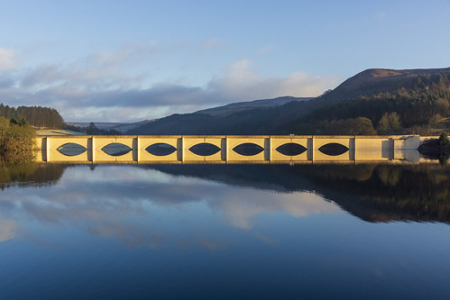
Ashopton Viaduct by l4ts, Ashopton Viaduct which carries the A57 Snake Pass Road across Ladybower Reservoir.landscape derbyshi
Ashopton Viaduct by l4ts
All Hallows Churchyard, Kirkburton by Kev Walker ¦ Thanks comments or views, A cold, foggy afternoon in Kirkburton. The graveyard around the All Hallows Church, in Kirkburton, h
All Hallows Churchyard, Kirkburton by Kev Walker ¦ Thanks comments or views
Crook Hill by l4ts, The twin tops of Crook Hill above Ladybower Reservoir.landscape derbyshire peakdistrict darkpeak woo
Crook Hill by l4ts
Red Wood by BrianBallPhotography, 5 Pic HDR hope you like :)
colour landscape hdr
Red Wood by BrianBallPhotography
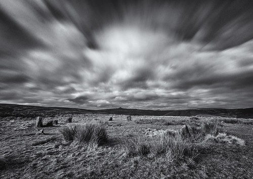
Hordron Edge Stone Circle by l4ts, A stone circle known as the Seven Stones of Hordron on Moscar Moor.landscape derbyshire peakdistrict
Hordron Edge Stone Circle by l4ts
Ashopton Viaduct by l4ts, Ashopton Viaduct carrying the A57 Snake Pass road across an arm of Ladybower Reservoir. 
Two images
Ashopton Viaduct by l4ts
Hood Brook by l4ts, A long exposure image of one of the small cascades on this little stream which drains down from Stan
Hood Brook by l4ts
Crook Hill Panorama by l4ts, Early morning light on the summit rocks of Crook Hill above Ladybower Reservoir.landscape derbyshire
Crook Hill Panorama by l4ts
Heather by l4ts, Heather in bloom on the northern side of Win Hill.landscape derbyshire peakdistrict darkpeak heather
Heather by l4ts
Kirkburton by Kev Walker ¦ Thanks comments or views, yorkshiredales atlas background batley beautiful border capital claytonwest cleckheaton continent co
Kirkburton by Kev Walker ¦ Thanks comments or views
Tree by l4ts, Alport Castles.landscape derbyshire peakdistrict darkpeak alportdale alportcastles landslip tree bla
Tree by l4ts
My route lies ahead. by A tramp in the hills, This is the view from the start of my walk yesterday,up alongside Blackden brook and up onto Kinder
My route lies ahead. by A tramp in the hills
Stanage Edge by l4ts, Stanage Edge on a very windy day with rapidly changing lighting conditions.landscape derbyshire peak
Stanage Edge by l4ts
Hallam Moors by l4ts, Another view of the derelict cottage by Oaking Clough reservoir on the Hallam Moors. Probably built
Hallam Moors by l4ts
All Hallows Church, Kirkburton by Kev Walker ¦ Thanks comments or views, Kirkburton Church is dedicated to All Hallows. It was built in 1190, and is a Grade I listed buildin
All Hallows Church, Kirkburton by Kev Walker ¦ Thanks comments or views
High Neb by l4ts, High Neb on Stanage Edge with a snow shower blowing in from the direction of Kinder Scout.landscape
High Neb by l4ts
Lane Head Lane, Kirkburton by Kev Walker ¦ Thanks comments or views, “It's not that we spend five days looking forward to just two. It's that most people do what they en
Lane Head Lane, Kirkburton by Kev Walker ¦ Thanks comments or views
Anvil Stone by l4ts, Another view of the Anvil Stone at Bleaklow Stones, perhaps showing better how it got its name.lands
Anvil Stone by l4ts
Derwent Edge by l4ts, The view south along Derwent Edge seen from Back Tor.landscape derbyshire peakdistrict darkpeak derw
Derwent Edge by l4ts
Lose Hill by l4ts, Lose Hill at the eastern end of the Great Ridge which separates the Hope Valley from the Vale of Eda
Lose Hill by l4ts
Ladybower Reservoir by l4ts, 
The western spillway or 'plughole' of a dry-looking Ladybower Reservoir.
Oh and could the person wh
Ladybower Reservoir by l4ts
Rays by l4ts, Crepuscular rays shining down through the misty woodland by Ladybower Reservoir.landscape derbyshire
Rays by l4ts
Crook Hill by l4ts, Hills of the High Peak seen across Ladybower Reservoir from Derwent Edge.landscape derbyshire peakdi
Crook Hill by l4ts
Crow Stones by l4ts, The view from the Crow Stones out over the Upper Derwent Valley.landscape derbyshire peakdistrict da
Crow Stones by l4ts
Ashopton Viaduct by l4ts, A long exposure image of Ashopton Viaduct and Ladybower Reservoir taken using a 10 stop filter.lands
Ashopton Viaduct by l4ts
Grainfoot Clough by l4ts, Grainfoot Clough below Derwent Edge. landscape derbyshire peakdistrict darkpeak upperderwentvalley d
Grainfoot Clough by l4ts
Stanage Edge by l4ts, The view along Stanage Edge towards a sunlit High Neb.landscape derbyshire peakdistrict darkpeak gol
Stanage Edge by l4ts
Derwent Reservoir by l4ts, A view of the very dry northern end of Derwent Reservoir. On the right of the image can be seen the
Derwent Reservoir by l4ts
Stanage by l4ts, Stanage Edge and the view over Bamford Moor.landscape derbyshire peakdistrict darkpeak stanageedge b
Stanage by l4ts
Boots by l4ts, Having a rest and enjoying the view from the top of Win Hill.landscape derbyshire peakdistrict darkp
Boots by l4ts
Worsbrough Water Mill by Kev Walker ¦ Thanks comments or views, Just a quick note: I have many more photos from my vacation/holiday. I’ll be sharing them in batches
Worsbrough Water Mill by Kev Walker ¦ Thanks comments or views
Crook Hill Panorama by l4ts, A panorama from the summit of Crook Hill above Ladybower Reservoir shortly after sunrise. This takes
Crook Hill Panorama by l4ts
Ladybower Reservoir by l4ts, The western spillway of Ladybower Reservoir standing high and dry above the water level of the reser
Ladybower Reservoir by l4ts
Win Hill by l4ts, Another view of Win Hill emerging from the temperature inversion in the Derwent Valley seen from Bam
Win Hill by l4ts
Dovestones Tor by l4ts, Dovestones Tor on Derwent Edge.landscape derbyshire peakdistrict darkpeak derwentedge doevestonestor
Dovestones Tor by l4ts
Ashopton Viaduct by l4ts, Ashopton Viaduct which carries the A57 Snake Pass Road across Ladybower Reservoir.landscape derbyshi
Ashopton Viaduct by l4ts
Edale by l4ts, The view along the Vale of Edale from Hope Brink on Win Hill.landscape derbyshire peakdistrict darkp
Edale by l4ts
High Peak by l4ts, The view north and east from Win Hill Pike.landscape derbyshire peakdistrict darkpeak winhill derwen
High Peak by l4ts
Ladybower Reservoir by l4ts, Ladybower Reservoir seen shortly after sunrise from the lower slopes of Crook Hill.landscape derbysh
Ladybower Reservoir by l4ts