Elevation of 20 Rhodesia Beach Rd, South Bend, WA, USA

Location: United States > Washington > Pacific County > South Bend >

Longitude: -123.95642

Latitude: 46.6139347

Elevation: -10000m / -32808feet

Barometric Pressure: 295KPa

Elevation Map:

elevation map of 20 Rhodesia Beach Rd, South Bend, WA, USA

Satellite Map:

Satellite map of 20 Rhodesia Beach Rd, South Bend, WA, USA

Related Photos:

geotagged geo:dir=229 geo:lat=467475 geo:lon=123884
17175.jpg
geotagged geo:lat=46487 geo:lon=1240305 geo:dir=2603
18232.jpg
geotagged geo:lon=1238975 geo:lat=465295 geo:dir=1065
19466.jpg
geotagged geo:lat=465783333333333 geo:lon=123912166666667 geo:dir=1078
19343.jpg
geotagged geo:lat=46618 geo:lon=123903666666667 geo:dir=595
19264.jpg
geotagged geo:lat=465093333333333 geo:lon=1239225 geo:dir=1105
19530.jpg
geotagged geo:lon=123955666666667 geo:dir=2183 geo:lat=466351666666667
19402.jpg
sky clouds watercolor bay pier boat nikon decay working hero pacificnorthwest pnw willapabay resilience baycenter researchvessel scrappiness baycenterwa mvherobaycenterwa mvhero rvherobaycenterwa
R/V Hero, Bay Center WA
geotagged geo:lat=46685 geo:lon=123804166666667 geo:dir=2057
16753.jpg
geotagged geo:lat=467026666666667 geo:lon=123972166666667
16338.jpg
geotagged geo:lat=466476666666667 geo:dir=35 geo:lon=123884666666667
19211.jpg
geotagged geo:lon=123898833333333 geo:lat=46613 geo:dir=3293
19273.jpg
geotagged geo:lon=123918 geo:lat=465635 geo:dir=528
19447.jpg
geotagged geo:lat=467153333333333 geo:lon=1239935
16350.jpg
geotagged geo:dir=305 geo:lat=465523333333333 geo:lon=123903
19454.jpg
geotagged geo:lat=46688 geo:lon=123817166666667 geo:dir=411
16740.jpg
geotagged geo:lat=466828333333333 geo:lon=123828666666667 geo:dir=1967
17089.jpg
geotagged geo:lon=1240445 geo:dir=3399 geo:lat=466268333333333
18315.jpg
geotagged geo:dir=17 geo:lat=466331666666667 geo:lon=123929
19243.jpg
geotagged geo:lat=46742 geo:lon=123875166666667 geo:dir=3236
17181.jpg
geotagged geo:lon=124025833333333 geo:lat=465863333333333 geo:dir=2379
18283.jpg
clouds coast coastline landscape landscapephotography nature naturephotography northamerica originalphotographers pacificcounty pacificnorthwest photooftheday photographersontumblr photography shore shoreline unitedstates usa washington washingtonstate water willapabay winter
North Shore, Willapa Bay, Washington, Winter 2017
Just a stormy day at the beach!
geotagged geo:lat=46708 geo:lon=123974166666667
16344.jpg
cedarriver creek forest landscape landscapephotography nature naturephotography northamerica originalphotographers pacificcounty pacificnorthwest photooftheday photographersontumblr photography river stream trees unitedstates usa washington washingtonstate water willapabay winter
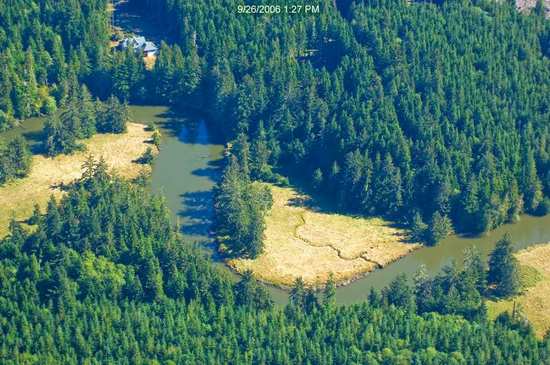
Unknown Creek, Pacific County, Washington, Winter 2017
geotagged geo:lat=467545 geo:lon=123980833333333 geo:dir=1864
16698.jpg
geotagged geo:dir=407 geo:lat=4669 geo:lon=123818666666667
16739.jpg
geotagged geo:lon=123978833333333 geo:lat=467551666666667 geo:dir=562
16700.jpg
estuary landscape landscapephotography nature naturephotography niawiakumriver northamerica originalphotographers pacificcounty pacificnorthwest photooftheday photographersontumblr photography trees unitedstates usa washington washingtonstate water willapabay winter
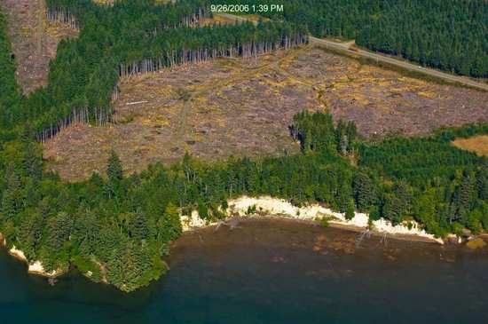
Estuary, Niawiakum River Natural Area, Washington, Winter 2017
blackandwhite blackandwhitephotography clouds coast coastline dock landscape landscapephotography monochrome nature naturephotography northamerica originalphotographers pacificcounty pacificnorthwest photooftheday photographersontumblr photography pilings rural ruralphotography shore shoreline sky tokeland unitedstates usa washington washingtonstate water willipabay winter
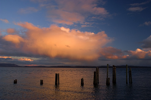
Old Dock, Tokeland, Washington, Winter 2017
ocean sunset water waves 366
366/245 - 9/1/12 - Almost gone!
pacificnorthwest washington nature water photographersontumblr northwest mudflats originalphotographers blackandwhitephotography naturephotography lowtide trees photooftheday beach unitedstates tree blackandwhite landscapephotography photography northamerica outdoors outdoorphotography usa coast willapabay pacificcounty southbend us
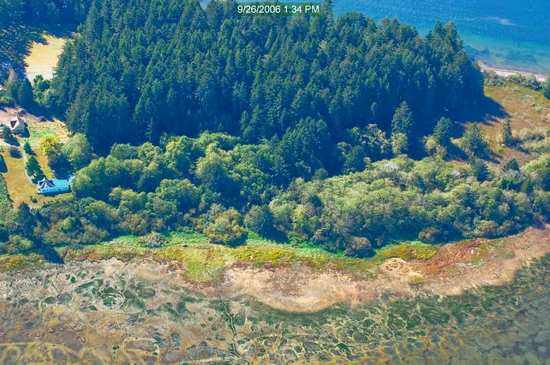
Conifer Island at Low Tide, Willapa Bay, Washington, Winter 2018
washington pacific
Photo May 28, 11 57 40 AM
sunset clouds landscape pier tokeland willapabay supershot wasshington
ST-DK-00019
ocean sunset water birds sand pacificocean 366
366/250 - 9/6/12 - Sunset on the Pacific Ocean!
grass delicate odc1
8/12/12 "DELICATE"
tree fence appletree pacificcounty longbeachpeninsula oystervillewa
Apple Tree
ocean beach water washington sand highkey odc1
365/77 - 3/18/13 - HIGH KEY is the topic for Monday 18th March 2013
365/53 - 2/22/13 - Fun stormy day at the beach!