Elevation of 1, Patterson, NC, USA
Location: United States > North Carolina > Alamance County >
Longitude: -79.492885
Latitude: 35.9100286
Elevation: 217m / 712feet
Barometric Pressure: 99KPa
Elevation Map:
Satellite Map:
Related Photos:

Belmont Cotton Mills, Graham, NC

150801-2040 Alamance

The view that greeted us this morning. Blissful. #saxapahaw #northcarolina
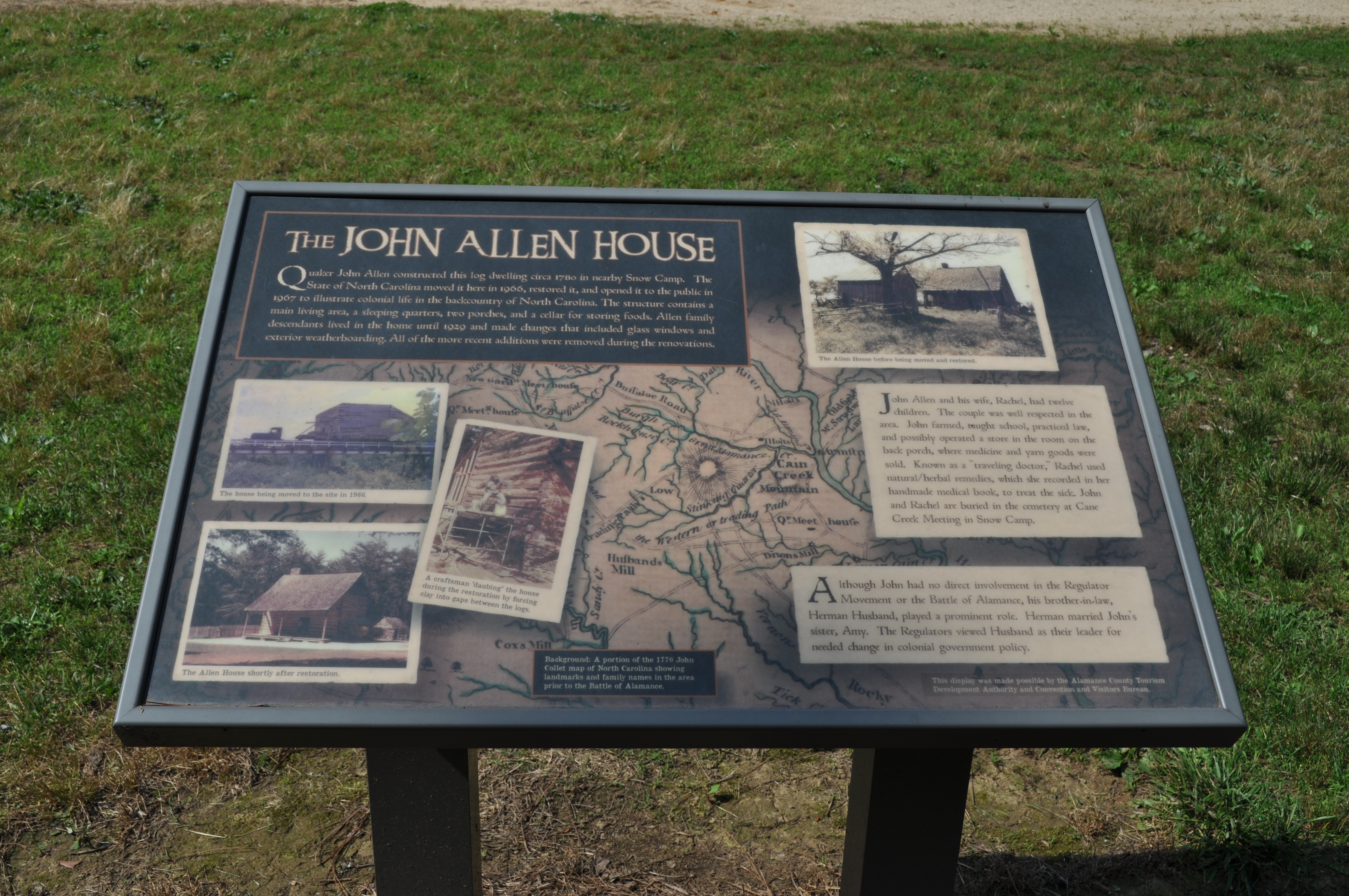
1162 The John Allen House Img_15756
150801-2050 Alamance

150801-2058 Alamance

Alamance Battleground State Historic Site (N.C.), 2 July 1972

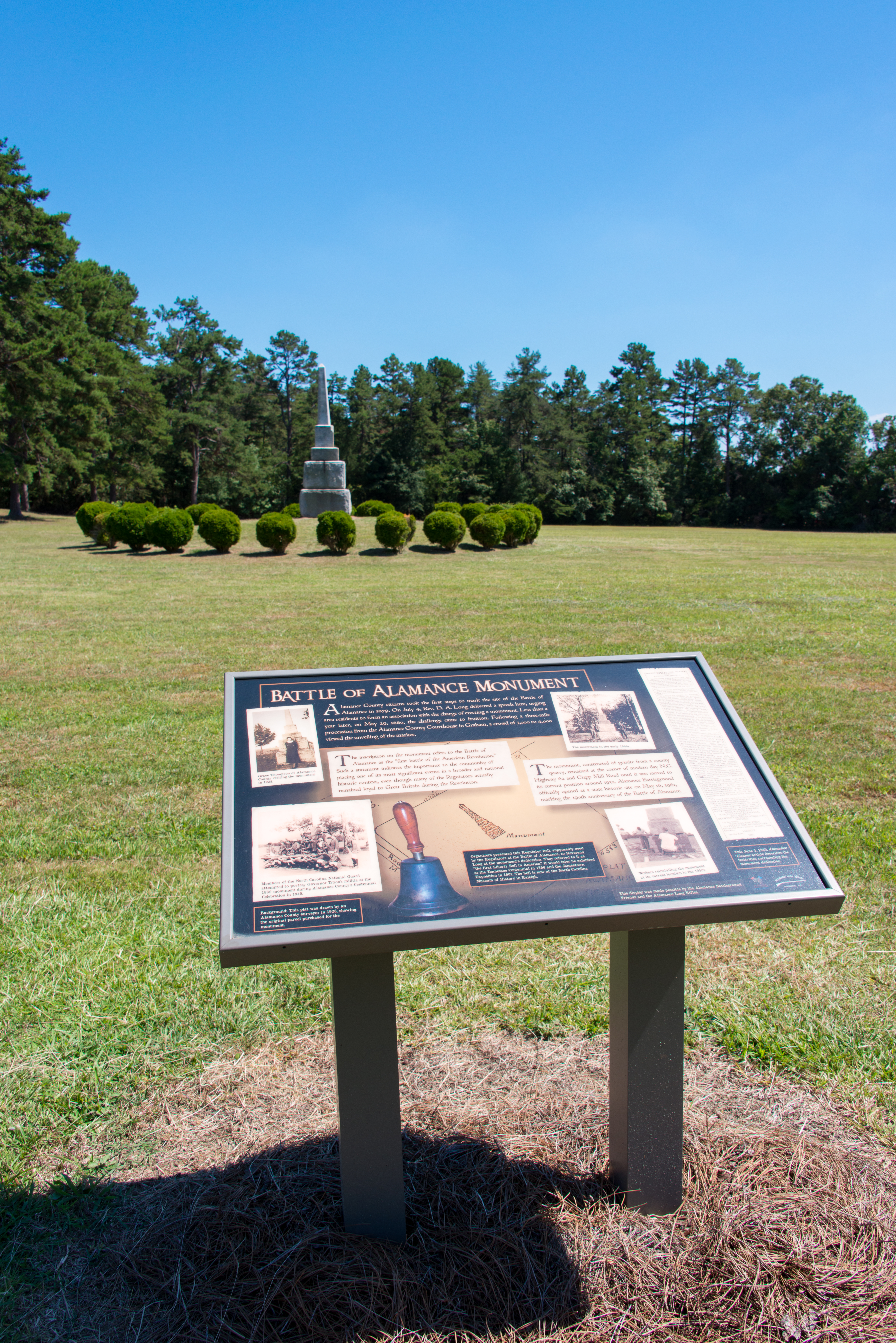
1179 Battle Of Alamance Monument Img_15773

The Trees in Line

Cane Creek Farm Cookout

Cane Creek Farm

Cane Creek Farm Cookout

Pine shadows

Magic trail at golden hour, east coast style. #saxapahaw #northcarolina #saxapahawlove #getoutside

On our nightly walk ritual we stumbled on a giant fallen tree in the river, the perfect invitation to perch. #saxapahaw #northcarolina #saxapahawlove #getoutside

Haw River Trail Saxapahaw NC 6519

Kimesville Dam

Haw River Trail Saxapahaw NC 6450

Kimesville Dam Waterfall

Small Waterfall

Haw River Trail Saxapahaw NC 6434

Haw River Trail Saxapahaw NC 6464

Haw River Trail Saxapahaw NC 6433

Haw River Trail Saxapahaw NC 6494

Haw River Trail Saxapahaw NC 6449

Haw River Trail Saxapahaw NC 6514

Haw River Trail Saxapahaw NC 6513

Haw River Trail Saxapahaw NC 6429
We'll never get over these sunsets. #saxapahaw #northcarolina
Topographic Map of 1, Patterson, NC, USA
Find elevation by address:

Places near 1, Patterson, NC, USA:
2201 Ralph Overman Ln
3006 Songbird Pl
4259 W Greensboro Chapel Hill Rd
Rock Creek
NC-49, Burlington, NC, USA
2, Coble
Liberty
Liberty, NC, USA
NC-62, Burlington, NC, USA
Climax
Forest Oaks
4600 Forest Oaks Dr
4309 Lormar Rd
4307 Lormar Rd
4303 Lormar Rd
4303 Lormar Rd
2318 Carlford Rd
5618 Dashwood Dr
4622 Liberty Rd
5409 Running Mead Rd
Recent Searches:
- Elevation of Corso Fratelli Cairoli, 35, Macerata MC, Italy
- Elevation of Tallevast Rd, Sarasota, FL, USA
- Elevation of 4th St E, Sonoma, CA, USA
- Elevation of Black Hollow Rd, Pennsdale, PA, USA
- Elevation of Oakland Ave, Williamsport, PA, USA
- Elevation of Pedrógão Grande, Portugal
- Elevation of Klee Dr, Martinsburg, WV, USA
- Elevation of Via Roma, Pieranica CR, Italy
- Elevation of Tavkvetili Mountain, Georgia
- Elevation of Hartfords Bluff Cir, Mt Pleasant, SC, USA