Elevation of th St, Dike, IA, USA
Location: United States > Iowa > Grundy County > Beaver > Stout >
Longitude: -92.707825
Latitude: 42.5277422
Elevation: 307m / 1007feet
Barometric Pressure: 98KPa
Elevation Map:
Satellite Map:
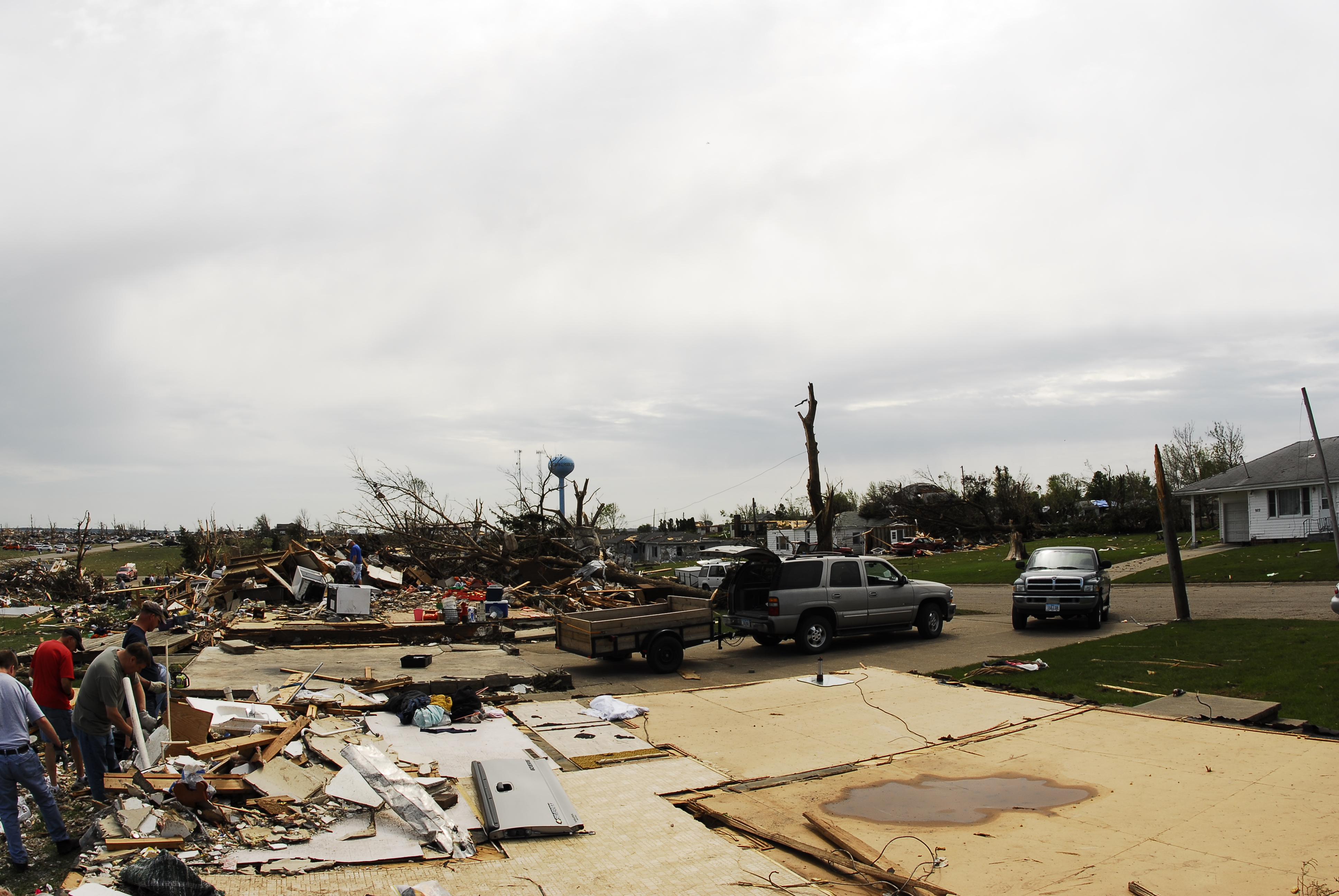
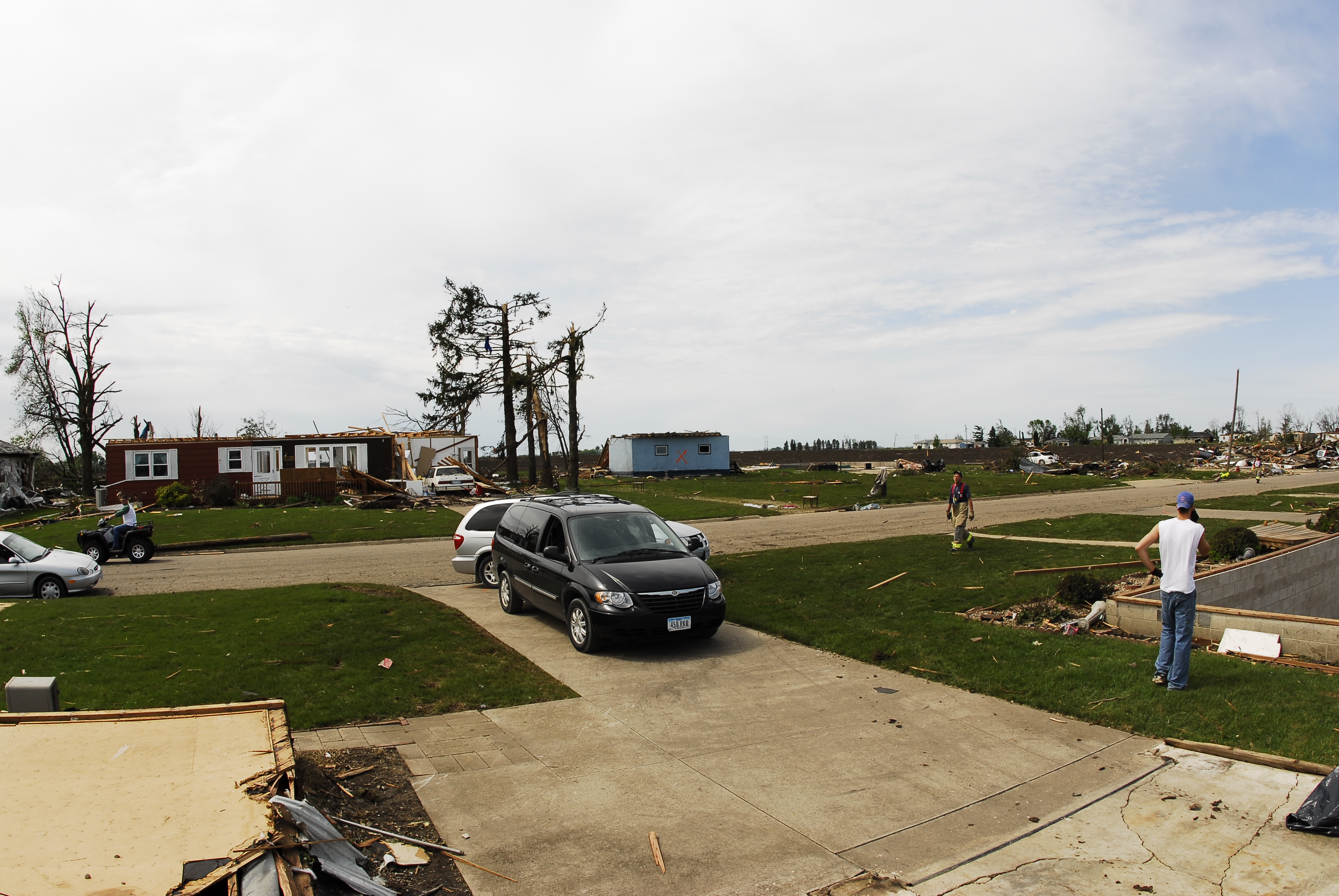
Related Photos:
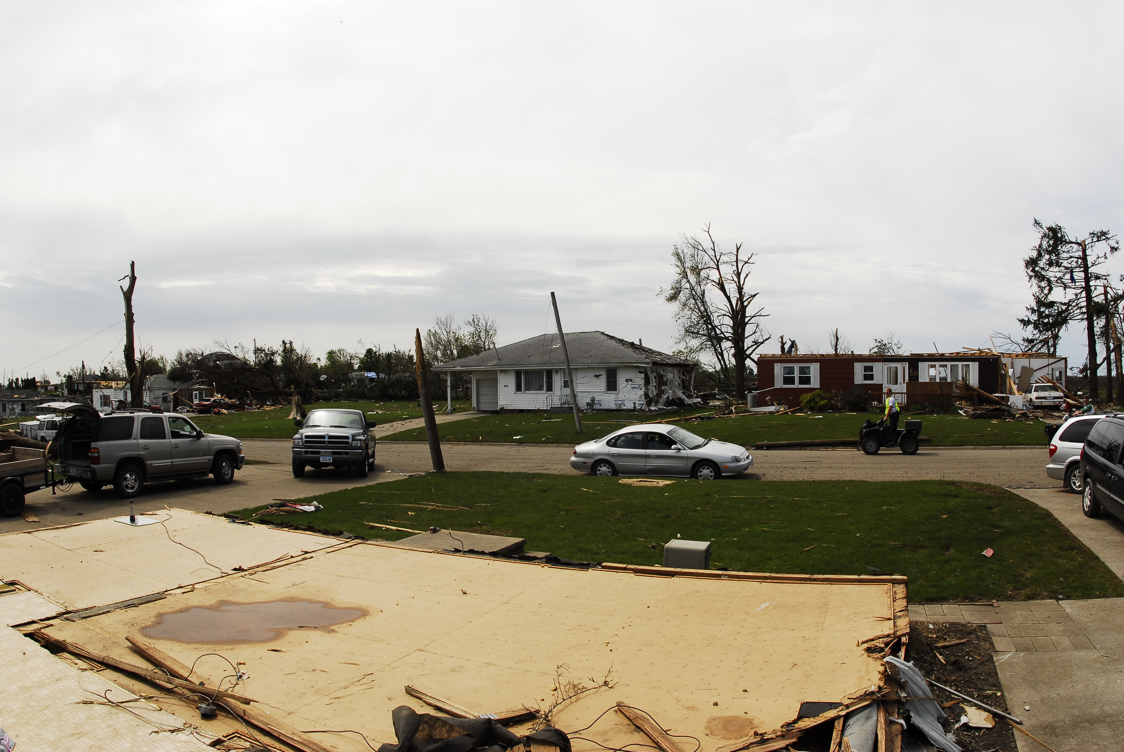
Parkersburg Tornado 71
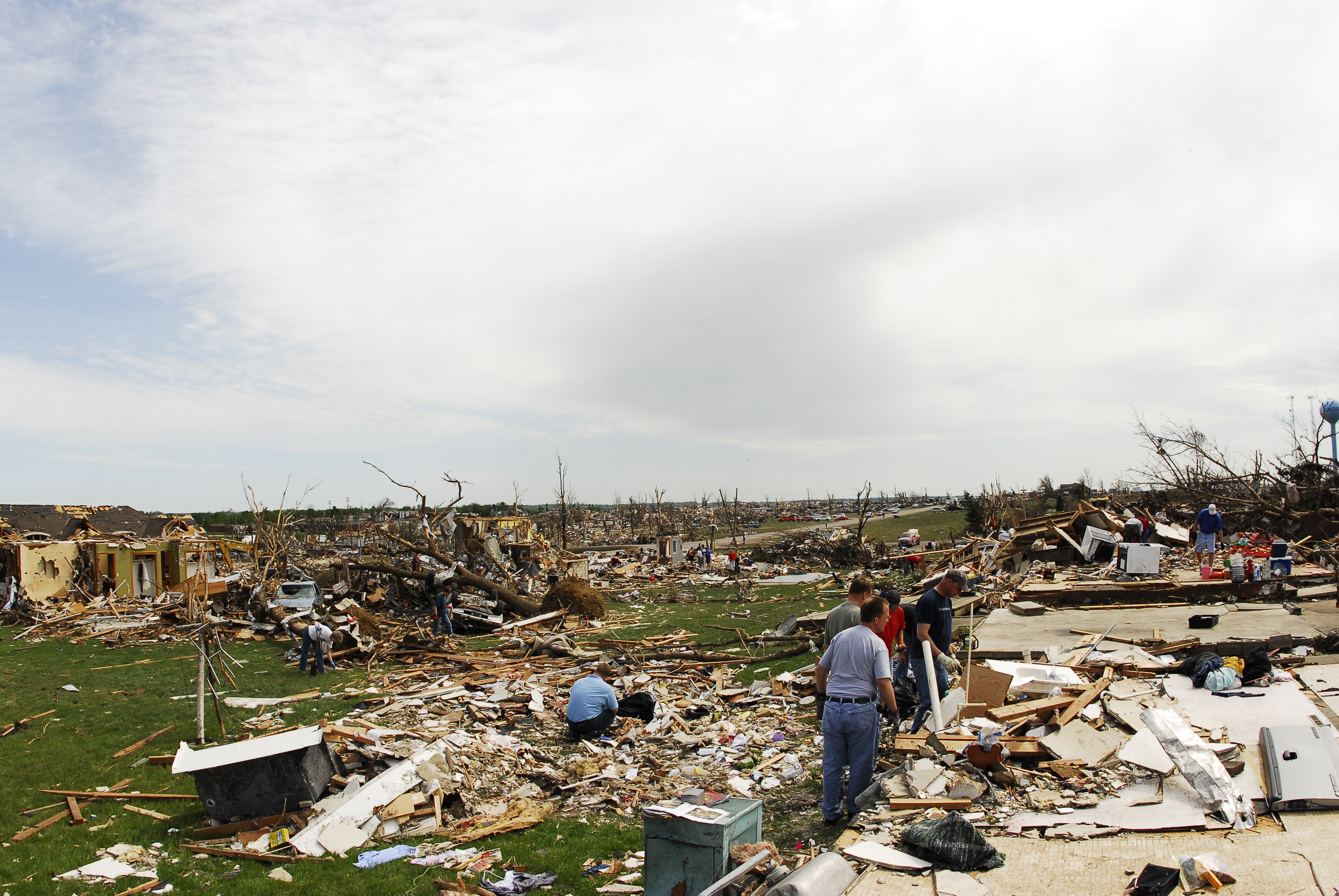
Parkersburg Tornado 69

Parkersburg Tornado 67
Parkersburg Tornado 70
Parkersburg Tornado 66
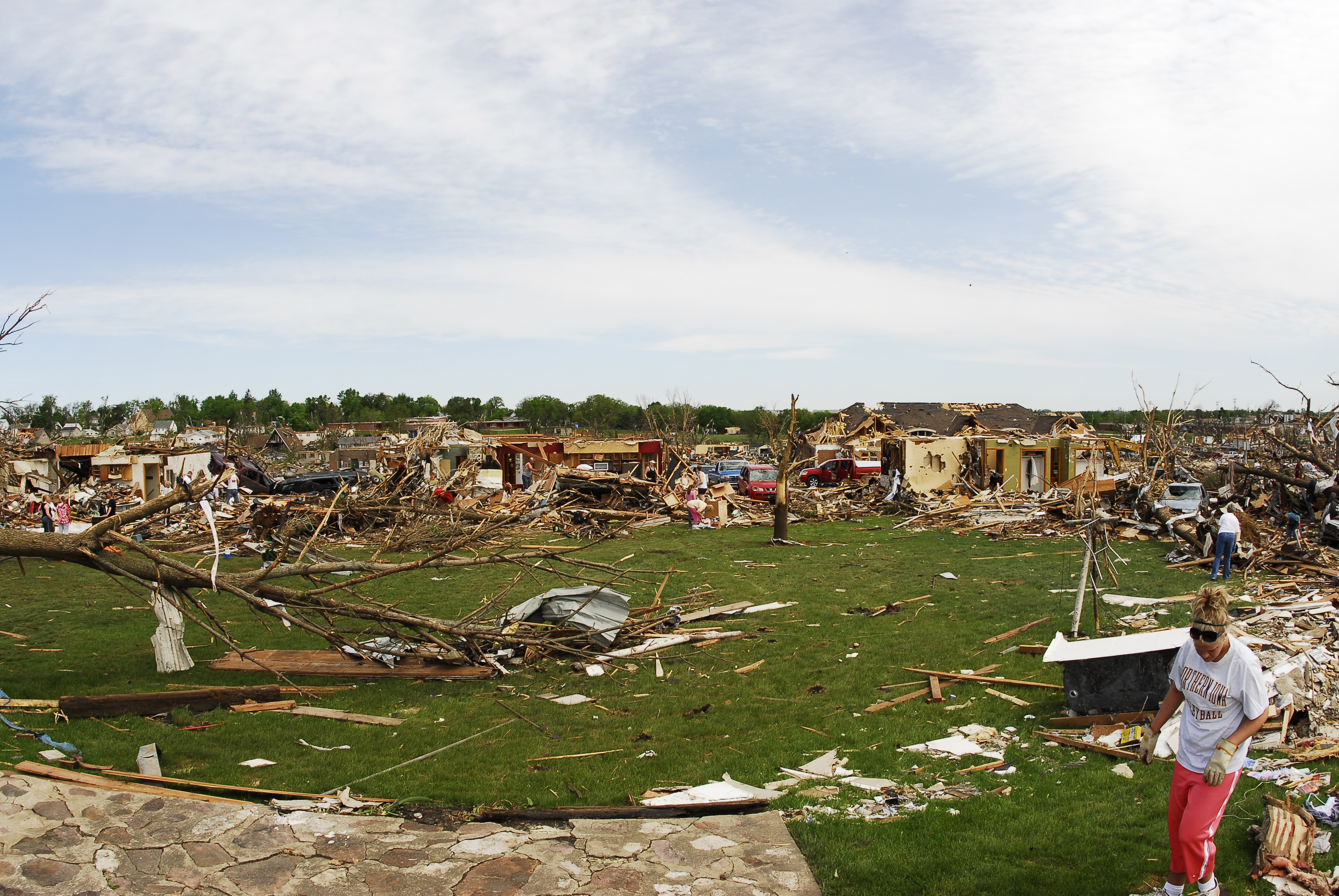
Parkersburg Tornado 68
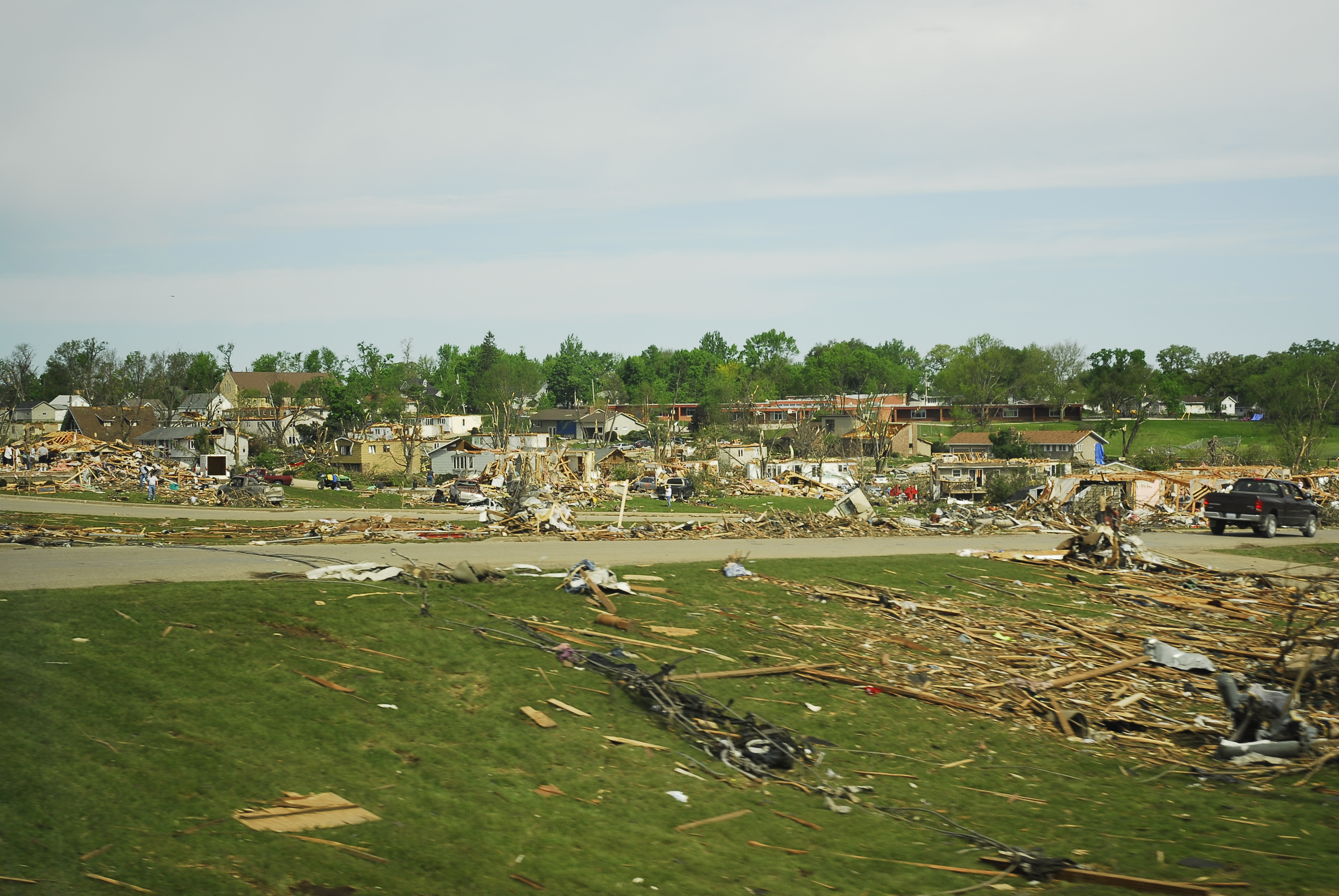
Parkersburg Tornado 4

Sledding with cousins
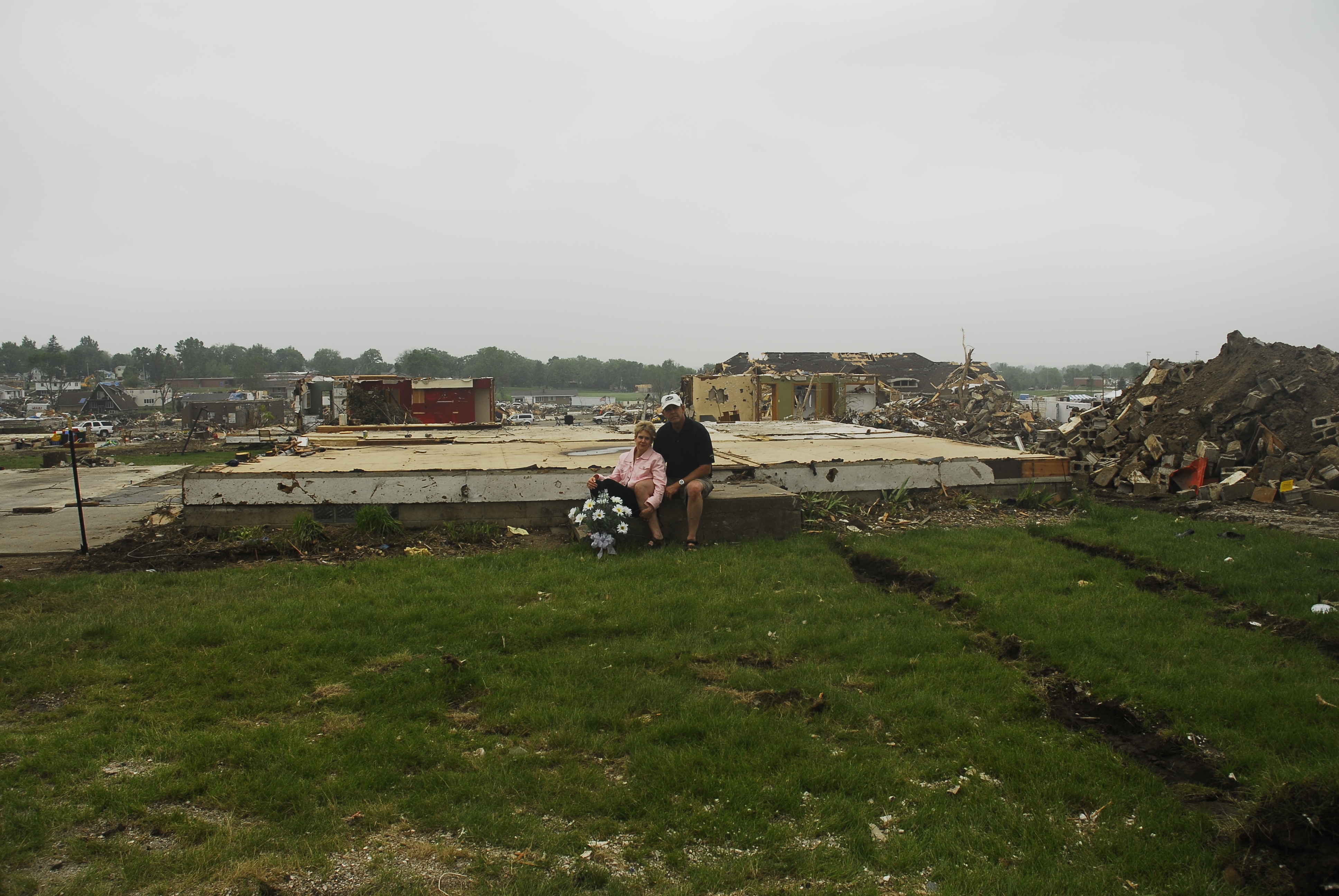
Parkersburg Tornado 88
Topographic Map of th St, Dike, IA, USA
Find elevation by address:

Places near th St, Dike, IA, USA:
Main St, Dike, IA, USA
Stout
Beaver
New Hartford
29475 290th St
Beaver
4th Ave N, Holland, IA, USA
W 1st St, Cedar Falls, IA, USA
4th St, Grundy Center, IA, USA
Grundy Center
Cedar Falls
IA-14, Allison, IA, USA
Finchford Rd, Janesville, IA, USA
Union
Shell Rock
Union Rd, Cedar Falls, IA, USA
Shell Rock
S Cherry St, Shell Rock, IA, USA
th St, Janesville, IA, USA
University Of Northern Iowa
Recent Searches:
- Elevation of Slanický ostrov, 01 Námestovo, Slovakia
- Elevation of Spaceport America, Co Rd A, Truth or Consequences, NM, USA
- Elevation of Warwick, RI, USA
- Elevation of Fern Rd, Whitmore, CA, USA
- Elevation of 62 Abbey St, Marshfield, MA, USA
- Elevation of Fernwood, Bradenton, FL, USA
- Elevation of Felindre, Swansea SA5 7LU, UK
- Elevation of Leyte Industrial Development Estate, Isabel, Leyte, Philippines
- Elevation of W Granada St, Tampa, FL, USA
- Elevation of Pykes Down, Ivybridge PL21 0BY, UK