Elevation of Spicers Mill Rd, Orange, VA, USA

Location: United States > Virginia > Orange County > > Orange >

Longitude: -78.119694

Latitude: 38.2513528

Elevation: 148m / 486feet

Barometric Pressure: 100KPa

Elevation Map:

elevation map of Spicers Mill Rd, Orange, VA, USA

Satellite Map:

Satellite map of Spicers Mill Rd, Orange, VA, USA

Related Photos:

trees mountains clouds fence virginia smell blueridge monpelier odc1
Fresh Mountain Air
virginia plantation mansion constitution orangecounty montpelier potus jamesmadison presidentoftheunitedstates
Montpelier - View of the Manor House from the Back Lawn
virginia plantation mansion constitution orangecounty blueridgemountains montpelier potus jamesmadison presidentoftheunitedstates
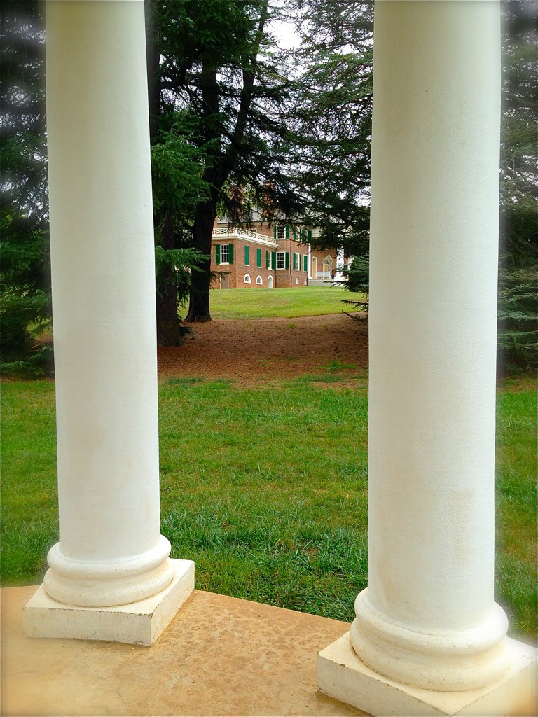
Montpelier - View from the Front of the Manor House
november virginia fallcolor churches blueskies orangecounty 2012 baptistchurches gordonsville canon24105l newhopebaptistchurch countrychurches november2012
New Hope Baptist Church
virginia madison dolly montpelier jamesmadison 4thpresident
Mother Madison's Kitchen Window
2018-07-10 10.53.24
jamesmadisonshomeatmontpelierva montpelierva jamesmadison jamesmadison4thpresidentoftheunitedstates montpelierorangecountyva orangecountyva panoramaviewwestfromjamesmadisonsmontpelierestateorangecountyva panorama roncogswell viewnorthwestfromjamesmadisonsmontpelierestateorangecountyva
Panorama -- View Northwest from James Madison's Montpelier Estate (Orange County, VA)
jamesmadison president montpelier charlottesville virginia orangecounty estate mountains trees
View from James Madison's Montpelier
pakistan sky colour heritage weather fort royal mode lahore 40d sajjadphotoarts gettyimagespakistanq12012
an other view lahore fort lahore.
orange virginia headquarters civilwar va lantern troop italianate nationalregister nationalregisterofhistoricplaces mayhurst orangevirginia mayhurstinn
Mayhurst Inn, Orange (Orange County), VA
virginia orangecounty gordonsville louisacounty
Gordonsville, Virginia
montpelier jamesmadison orangeva
kitchen view
cemetery virginia constitution orangecounty slavery montpelier potus jamesmadison presidentoftheunitedstates
Montpelier - Slave Cemetery
ground level ridingmowerjohn deeregrassodc1from
Oh Deere, we're being attacked by a green monster!
virginia march orangecounty 2012 exchangehotel gordonsville nrhp canon24105l commercialbuildings march2012
Exchange Hotel, Civil War Hospital
orange mountain snow virginia blueridgemountains montpelier jamesmadison montpelierstation jamesmadisonsmontpelier
Blue Ridge view
d20 montebello zacharytaylor route33 greekrevivalarchitecture gordonsvillevirginia orangecountyvirginia 19thcenturyfarms virginiaconservationanddevelopmentcommission spotswoodtrail historicalhighwaymarkers 12thunitedstatespresident
Montebello (c. 1803) in Orange County, Virginia
virginia constitution orangecounty slavery montpelier potus jamesmadison presidentoftheunitedstates
Montpelier - South Yard Slave Quarter Site
old house mountains history beautiful station garden james virginia pretty president madison mansion montpelier
View from James Madison's Montpelier
route33 virginiawineries gordonsvillevirginia orangecountyvirginia hortonvineyards spotswoodtrail hortoncellars
Horton Vineyards in Gordonsville, Virginia
virginia madison montpelier jamesmadisonsmontpelier uploaded:by=flickrmobile flickriosapp:filter=nofilter
View from the front porch of Montpelier
2018yip rapidanriver virginia rapidanvirgina gristmill abandonedfactory scenery landscape landscapephotography tacphotography tomclarknet
historic Mill on the Rapidan River, Virginia
2016 water lake lakeorange virginia va usa landscape park
Lake Orange
garden virginia constitution orangecounty montpelier potus jamesmadison presidentoftheunitedstates
Montpelier - Annie duPont Formal Garden
orange virginia montpelier
Montpelier Orange Virginia
orange virginia montpelier
Montpelier Orange Virginia
orange virginia montpelier
Montpelier Orange Virginia
orange virginia montpelier
Montpelier Orange Virginia
virginia unitedstates environment geocity geo:country=unitedstates camera:make=canon exif:make=canon geostate exif:lens=ef2470mmf28lusm exif:aperture=ƒ80 exif:focallength=58mm exif:isospeed=400 camera:model=canoneos5dmarkiv exif:model=canoneos5dmarkiv baybarometer baybarometerrelease aerial transportation nonprofits southwings stateofconservationrelease
Madison County, Va.
restoredwalledgardenmontpelierorangecountyva cedaroflebanon tree cedaroflebanonjamesmadisonsmontpelierorangecountyva roncogswell evergreen evergreenconifer nationalemblemoflebanon
Cedar of Lebanon -- James Madison's Montpelier Orange County (VA) June 2018
orangecounty va virginia usa road dirtroad farms countryroad countrylane landscape
Dirt Road
orangecounty va virginia field farm farmanimal cattle sunset
The Sentry
restoredwalledgardenmontpelierorangecountyva cedaroflebanon tree cedaroflebanonjamesmadisonsmontpelierorangecountyva roncogswell evergreenconifer
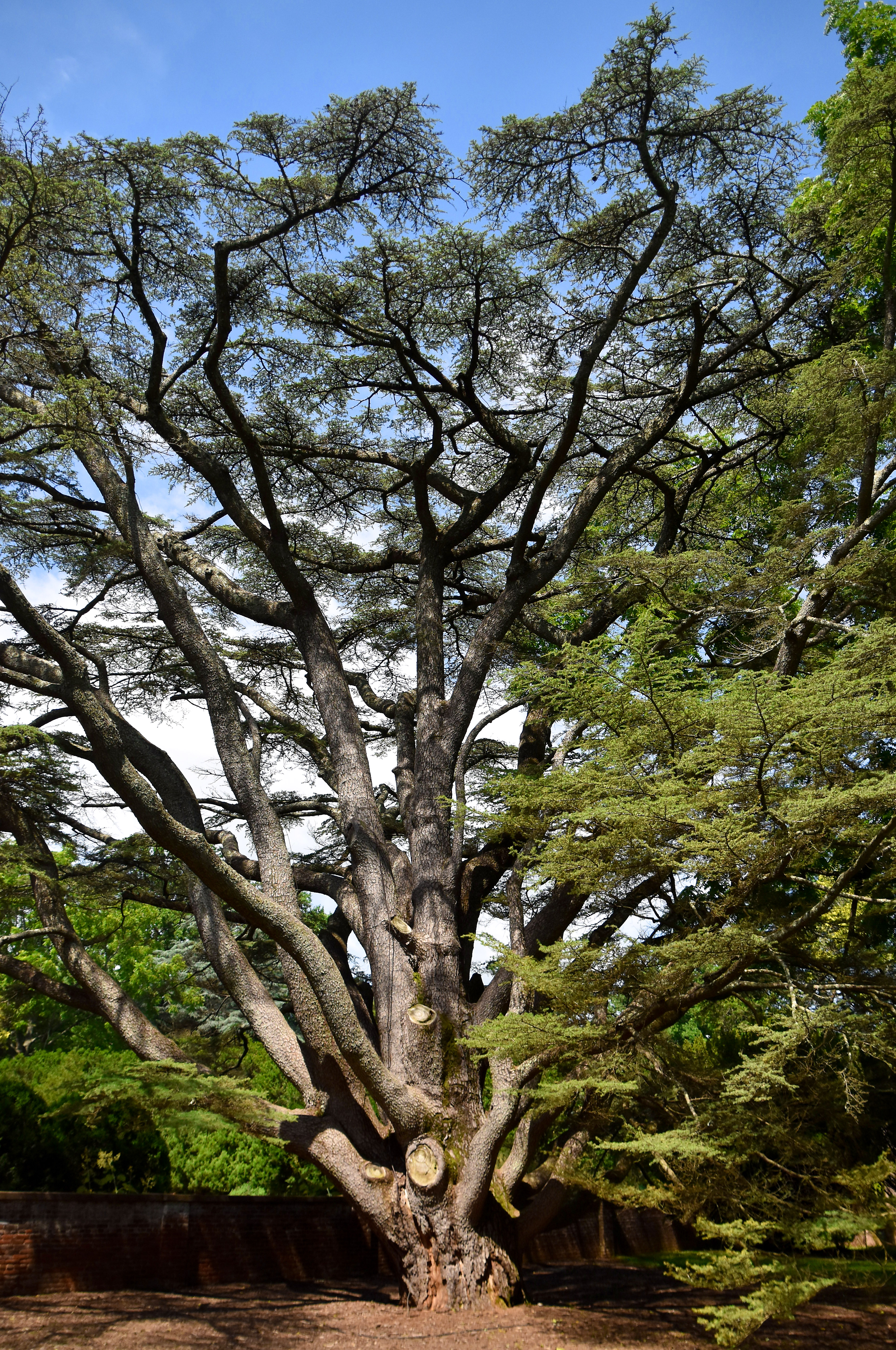
Cedar of Lebanon -- Montpelier Orange County (VA) June 2018
architecture garden landscape temple columns classical 18thcentury montpelier jamesmadison dolleymadison
Montpelier, James and Dolley Madison's country house in Virginia . . .
cloud sky landscape field meadow rural sountryside virginia cedarmountain culpeppercounty pentax km digital monochrome infrared pentaxaf250mmlens redfilter pentaxart
Cloud Over Cedar Mountain
spring rural farm house barn field tractor johndeere virginia culpeppercounty colour digital pentax km f3556 1855 mm lens landscape
Springtime on Cedar Mountain
landscape road rural countryside farm virginia cedarmountain culpeppercounty pentax km colour digital spring pentaxaf250mmlens prime
The Road Home
storm rural farm cedarmountain virginia clouds colour contrast trees pentax km pentaxdaf35561855mmallens digital pentaxart landscape culpeppercounty dark moody
Storm - Cedar Mountain
forest virginia trail constitution orangecounty montpelier potus jamesmadison presidentoftheunitedstates
Montpelier - James Madison Landmark Forest