Elevation of Shawnee Township, MO, USA
Location: United States > Missouri > Henry County >
Longitude: -93.804483
Latitude: 38.5284265
Elevation: 267m / 876feet
Barometric Pressure: 98KPa
Elevation Map:
Satellite Map:
Related Photos:
Town Creek Bridge-Side View

Yellow Tree [HDR]

Impailed Hopper Carcus

Yellow Tree

Tractor, Baler and Hay Bale
Cows bathing at dusk
winter wonderLANE

Feelin' Froggie
Moon phases complete

Lunar Eclipse blood moon

Jacob 013

Jacob 021

Jacob 022

Jacob 024

Jacob 30
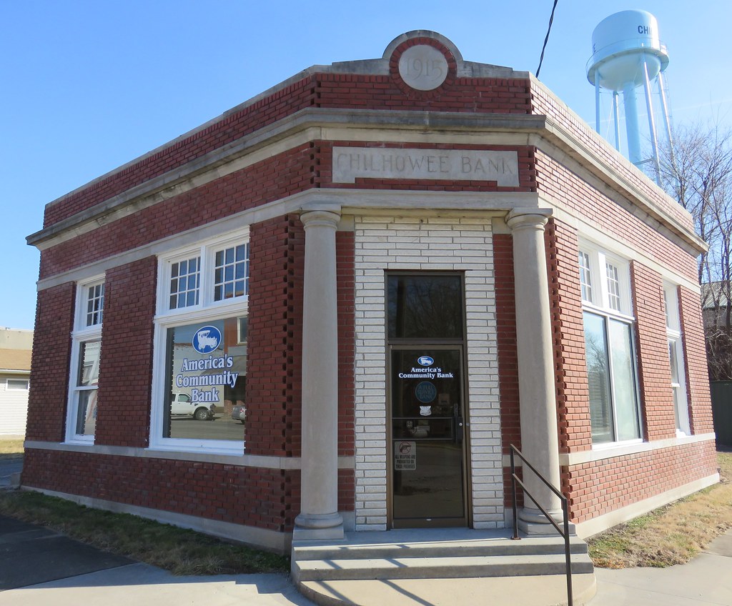
Old Chilhowee Bank (Chilhowee, Missouri)
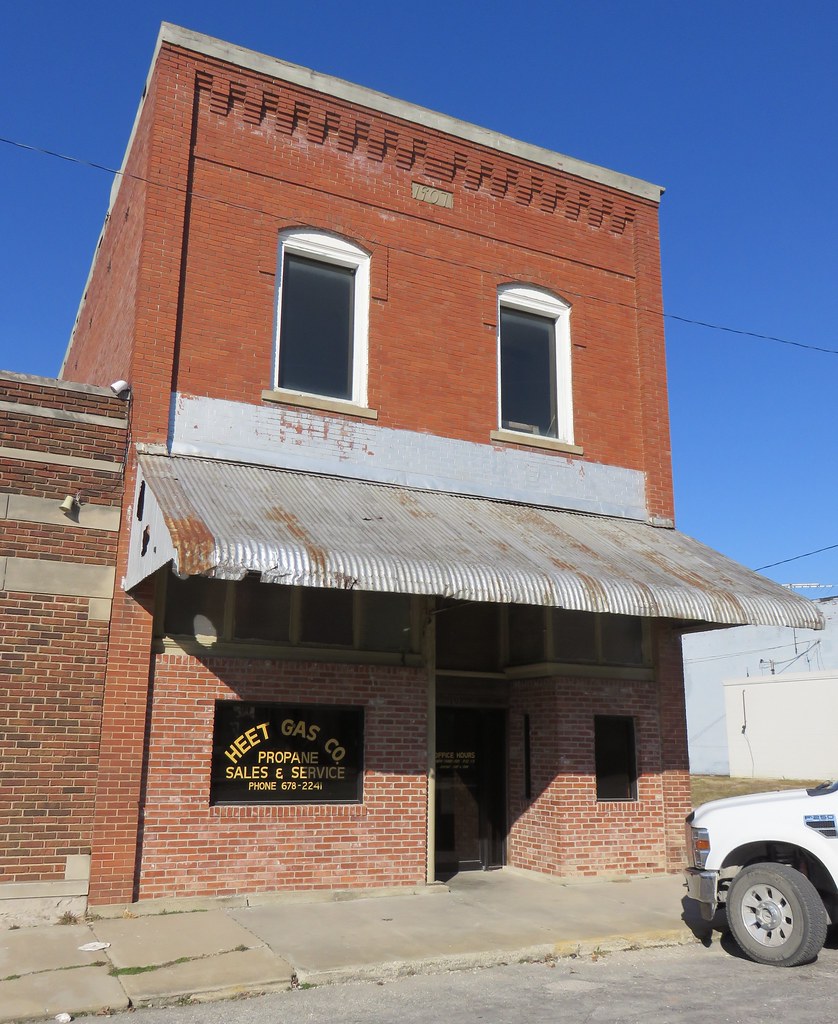
Storefront Building (Chilhowee, Missouri)
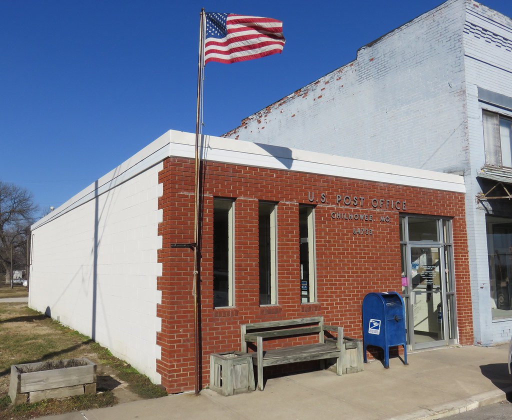
Post Office 64733 (Chilhowee, Missouri)
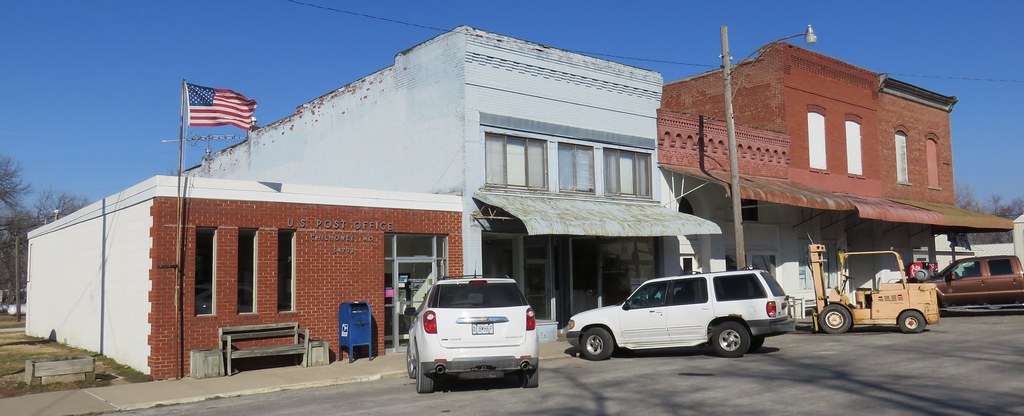
Storefront Block (Chilhowee, Missouri)
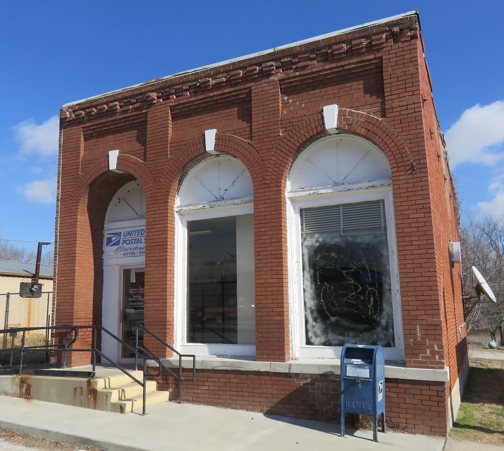
Post Office 64726 (Blairstown, Missouri)
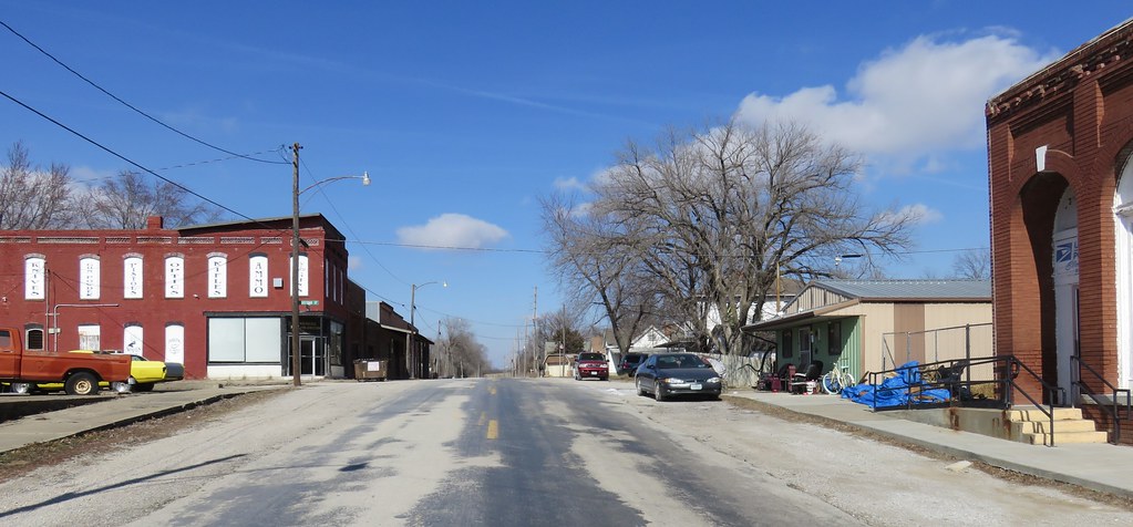
Downtown Blairstown, Missouri
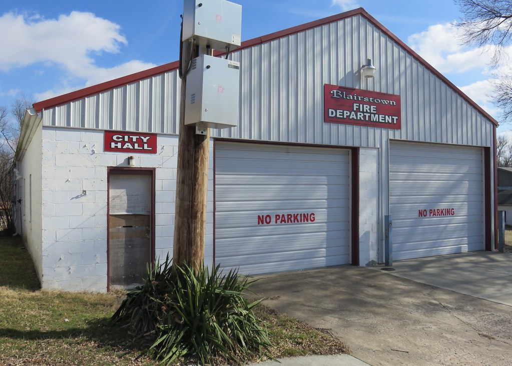
Blairstown, Missouri City Hall and Fire Department
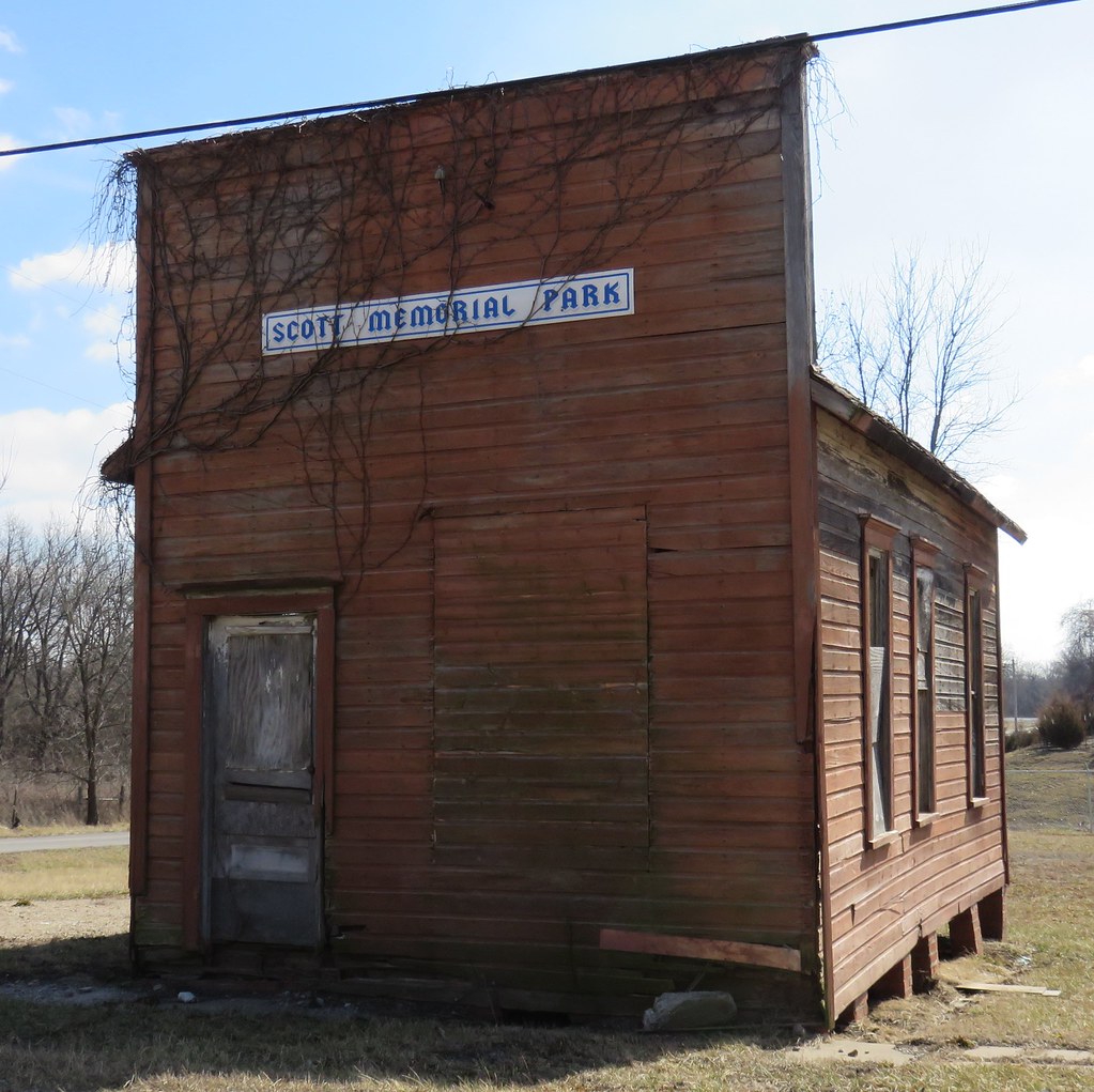
Old Storefront Building (Blairstown, Missouri)

Blood Moon

lightening Strike

Jesus take the Wheel

Petrified Mushrooms on dead tree
Topographic Map of Shawnee Township, MO, USA
Find elevation by address:

Places in Shawnee Township, MO, USA:
Places near Shawnee Township, MO, USA:
MO-13, Clinton, MO, USA
52 Ne 400 Rd
Johnson County
SW st Rd, Holden, MO, USA
MO-7, Urich, MO, USA
301 N 2nd St
S Washington St, Clinton, MO, USA
Clinton
Davis Township
35 Sw 365th Rd
Henry County
521 Ne Hwy Yy
Urich
Main St, Urich, MO, USA
227 Sw Hwy T
Clinton Township
585 Ne Hwy V
27 MO-13 Business, Warrensburg, MO, USA
White Oak Township
Southeast 100 Road
Recent Searches:
- Elevation of Corso Fratelli Cairoli, 35, Macerata MC, Italy
- Elevation of Tallevast Rd, Sarasota, FL, USA
- Elevation of 4th St E, Sonoma, CA, USA
- Elevation of Black Hollow Rd, Pennsdale, PA, USA
- Elevation of Oakland Ave, Williamsport, PA, USA
- Elevation of Pedrógão Grande, Portugal
- Elevation of Klee Dr, Martinsburg, WV, USA
- Elevation of Via Roma, Pieranica CR, Italy
- Elevation of Tavkvetili Mountain, Georgia
- Elevation of Hartfords Bluff Cir, Mt Pleasant, SC, USA