Elevation of Rubicon Road, California, USA

Location: United States > California > El Dorado County > Georgetown >

Longitude: -120.68679

Latitude: 39.0029125

Elevation: 1108m / 3635feet

Barometric Pressure: 89KPa

Elevation Map:

elevation map of Rubicon Road, California, USA

Satellite Map:

Satellite map of Rubicon Road, California, USA

Related Photos:

california road ca mountains sports sport race forest landscape gold view marathon grandcanyon extreme topv999 deep running run canyon racing international lottery rush vista runners gorge athlete sierranevada topv9999 runner ultra forests 28135mm entry vistapoint goldrush northfork placercounty americanriver goldcountry wser ws sierranevadamountains ultramarathon ultrarunning middlefork landscapephotography 1849 westernstatestrail ws100 westernstates landscapephotos mosquitoridgeroad northforkofthemiddlefork landscapephoto americanrivercanyon westernstates100mileendurancerun mosquitoridge foresthilldivide northforkofthemiddleforkoftheamericanriver
The American River Gorge – A Semi-Grand Canyon
california ca rock wall landscape geotagged gold photo interestingness funny photos topv999 humor pic explore walls funnypics topv9999 28135mm placercounty funnyphotos goldmine funnyphoto landscapephotography funnypic top500 tahoenationalforest interestingness401 i500 landscapephotos mosquitoridgeroad handstacked funnyfeature
Hand Stacked Rock Wall – Can You Find the Funny Feature?
california ca sports sport race kiss andrea marathon brian volunteers extreme topv999 competition auburn running run racing lottery squawvalley crew wife runners info fans athletes athlete morrison jogging runner information ultra 2009 jog foresthill 28135mm entry results checkpoint placercounty facts brianmorrison wser ws ultramarathon aidstation westernstatestrail ws100 inov westernstates nuun westernstatesendurancerun westernstates100 pointtheway americanrivercanyon seattlerunningcompany westernstates100mileendurancerun foresthilldivide dustycorners westernstates100mile teaminov
Brian Morrison at Dusty Corners - Everyone Needs a Kiss after 38 Miles
california clouds bench interestingness bravo picnic view explore foresthill 57 sierrafoothills blueribbonwinner 1raw impressedbeauty sorrypaul dphdr
Before the Rain
bird grosbeak placercounty sierrafoothills blackheadedgrosbeak pheucticusmelanocephalus perchingbird femaleblackheadedgrosbeak
Black-headed Grosbeak
california summer canon fire july eldorado 7d firefighting tamron placer neu wildfire blm americanriver 2016 usfs eldoradonationalforest enf aeu calfire canon7dmarkii tamron150600mm trailheadfire
The view from Foresthill
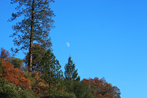
california blue sky moon mountain tree 20d canon landscape daylight photo sierra photograph half sacramento noon midday placercounty casch canon2880f284l familygetty
Midday Moon 1786
From Foresthill on my ride
View from almost the top of Ralston Ridge
foresthill placer neu blm usfs foresthillroad tnf 2013 americanfire
American Fire 08-16-13
wildfire tahoenationalforest americanfire
Southwest Airlines' flight from Las Vegas today flew over the American Fire. Image: Bill Roush
california ca trees lake mountains reflection tree green nature water reflections river season landscape geotagged landscapes interestingness still scenery seasons natural topv999 lakes tranquility reservoir explore rivers serenity waters serene sierranevada stillness tranquil 28135mm placercounty sierranevadamountains reservoirs landscapephotography top500 top20reflections interestingness375 i500 landscapephotos oxbowreservoir landscapephoto
Stillness, Reflected
2016 california summer canon 7d canon7dmarkii july enf eldorado placer eldoradonationalforest trailheadfire trailhead helicopter aeu neu tamron tamron150600mm n45917 61271 s61v1 sikorsky sillerhelicoptersinc
Returning for one more
california summer canon fire july eldorado 7d firefighting tamron placer neu wildfire blm americanriver 2016 usfs eldoradonationalforest enf aeu calfire canon7dmarkii tamron150600mm trailheadfire
Late afternoon drop
All Photos-8717
In Bear Country
california uswest usa yosemite georgetown unitedstates
American River Canyon
square squareformat hefe iphoneography instagramapp uploaded:by=instagram foursquare:venue=4dbb413a1e72b351ca94bd44
#rybridge wedding. Nice location.
whitewater rafting alloutdoors middleforkamerican
Rafting Tunnel Chute
california ca blue summer sky cloud lake reflection green water beautiful wall clouds reflections river dark landscape geotagged island islands interestingness high still scenery perfect skies 1st dam topv999 lakes tranquility canyon reservoir foliage explore rivers serenity stunning waters blogged serene firstplace tranquil 28135mm magnificent steep dams placercounty americanriver middlefork reservoirs landscapephotography top500 topvaa top20reflections interestingness427 i500 landscapephotos oxbowreservoir landscapephoto
American River Canyon at Oxbow Reservoir
wildfire tahoenationalforest americanfire
Southwest Airlines' flight from Las Vegas today flew over the American Fire. Image: Bill Roush
california unitedstates foresthill tahoenationalforest deadwoodcemetary americanfire
Deadwood Cemetary
california unitedstates foresthill
IMG_4486.jpg
justinsfpics
Lake Edson
Oxbow Reservoir
california unitedstates foresthill
IMG_4505.jpg
california unitedstates
IMG_4457.jpg
Giant Sequoia