Elevation of Hashemite - blue, Zarqa Governorate, Jordan

Location: Jordan > Zarqa Governorate > Hashemiyah District >

Longitude: 36.1154723

Latitude: 32.10604

Elevation: 547m / 1795feet

Barometric Pressure: 95KPa

Elevation Map:

elevation map of Hashemite - blue, Zarqa Governorate, Jordan

Satellite Map:

Satellite map of Hashemite - blue, Zarqa Governorate, Jordan

Related Photos:

aerialarchaeology aerialphotography middleeast airphoto archaeology ancienthistory
View North East near Abdullah Air Base
archaeology ancienthistory middleeast airphoto aerialphotography aerialarchaeology
Zarqa Tower? 3
exif:model=pentaxk100d exif:aperture=ƒ80 exif:make=pentax camera:make=pentax camera:model=pentaxk100d exif:focallength=58mm geocountry exif:isospeed=200 exif:lens=sigma aerialarchaeology aerialphotography middleeast airphoto archaeology ancienthistory
Suwaylih area
archaeology ancienthistory middleeast airphoto aerialphotography aerialarchaeology
Zarqa Tower? 4
exif:model=pentaxk100d exif:aperture=ƒ80 exif:make=pentax camera:make=pentax camera:model=pentaxk100d exif:isospeed=200 geocountry exif:lens=sigma exif:focallength=70mm aerialarchaeology aerialphotography middleeast airphoto archaeology ancienthistory
Suwaylih area
archaeology ancienthistory middleeast airphoto aerialphotography aerialarchaeology
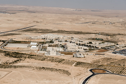
Zarqa Hashemite University
archaeology ancienthistory middleeast airphoto aerialphotography birah aerialarchaeology bireh jadis2417021 megaj7172 tellalbirah
Tell al-Birah
archaeology ancienthistory middleeast airphoto aerialphotography aerialarchaeology
Zarqa Tower? 4
archaeology ancienthistory middleeast airphoto aerialphotography aerialarchaeology
Zarqa Tower? 4
geotaggedbasedonsite aerialarchaeology aerialphotography middleeast airphoto archaeology ancienthistory
Sahab Bus Scrapyard
archaeology ancienthistory middleeast airphoto aerialphotography aerialarchaeology
Zarqa Tower? 3
archaeology ancienthistory middleeast airphoto aerialphotography aerialarchaeology
Zarqa Tower? 3
archaeology ancienthistory middleeast airphoto quarry aerialphotography groundphoto aerialarchaeology
Sahab Quarry 3
archaeology ancienthistory middleeast airphoto quarry aerialphotography groundphoto aerialarchaeology
Sahab Quarry 5
archaeology ancienthistory middleeast airphoto quarry aerialphotography groundphoto aerialarchaeology
Sahab Quarry 4
exif:model=pentaxk100d geocountry exif:make=pentax exif:aperture=ƒ45 camera:make=pentax camera:model=pentaxk100d exif:isospeed=200 exif:focallength=70mm exif:lens=sigma aerialarchaeology aerialphotography middleeast airphoto archaeology ancienthistory
Suwaylih area
exif:model=pentaxk100d exif:aperture=ƒ80 exif:make=pentax camera:make=pentax camera:model=pentaxk100d exif:focallength=58mm geocountry exif:isospeed=200 exif:lens=sigma aerialarchaeology aerialphotography middleeast airphoto archaeology ancienthistory
Suwaylih area
archaeology ancienthistory middleeast airphoto aerialphotography wadah aerialarchaeology jadis2417005 megaj7161 ودعه
Wad'ah
archaeology ancienthistory tell middleeast airphoto aerialphotography aerialarchaeology bireh jadis2417021 megaj7172 tellalbirah
Tell al-Birah
jordan scrapyard flight1 sahabbusscrapyard
Sahab Bus Scrapyard
exif:model=pentaxk100d exif:aperture=ƒ80 exif:make=pentax camera:make=pentax camera:model=pentaxk100d exif:focallength=58mm geocountry exif:isospeed=200 exif:lens=sigma aerialarchaeology aerialphotography middleeast airphoto archaeology ancienthistory
Suwaylih area
archaeology ancienthistory middleeast airphoto quarry aerialphotography groundphoto aerialarchaeology
Sahab Quarry 5