Elevation of Gajwel, Telangana, India
Location: India > Telangana > Medak >
Longitude: 78.681832
Latitude: 17.8451586
Elevation: 574m / 1883feet
Barometric Pressure: 95KPa
Elevation Map:
Satellite Map:
Related Photos:
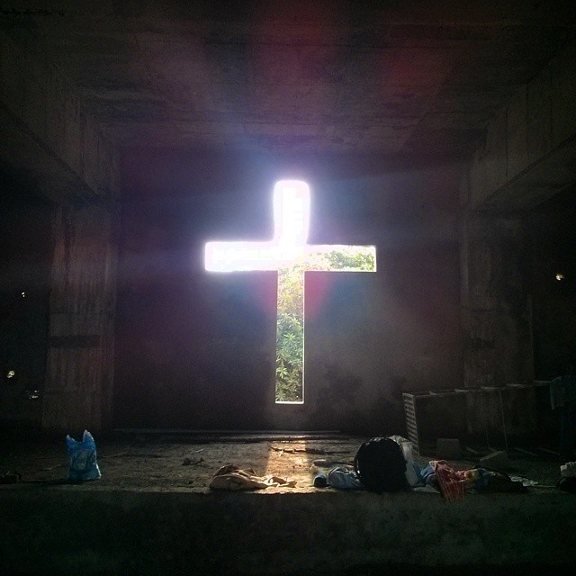
My uncle is the director of a school in Hyderabad which takes in orphans and children from broken homes. A chapel is being built so the children have a place to pray instead of underneath the scorching sun.
Topographic Map of Gajwel, Telangana, India
Find elevation by address:

Places near Gajwel, Telangana, India:
Konda Pochamma Sagar Reservoir
Thoguta
Ravelli
Mirdoddi
Ravalkole
Chegunta
Medchal
Shankarampet (r)
Shivampet
Dubbak
Lakadwala Colony
Ramayampet
7-136/2
Annaram
Tirupati Balaji Temple, Venkateshwara Nagar
Mallapur
Gajularamaram
Vani Nagar
Mahendra Hills
Siva Arun Colony
Recent Searches:
- Elevation of Kootenai Trail Rd, Bonners Ferry, ID, USA
- Elevation of Hickory Blvd, Bonita Springs, FL, USA
- Elevation of Lalagbene, Bayelsa, Nigeria
- Elevation of Ogbosuware Health Centre, 2WWJ+4PJ, Lalagbene, Bayelsa, Nigeria
- Elevation of Duckhorn Ct, Las Vegas, NV, USA
- Elevation of Garretts Run Rd, Ford City, PA, USA
- Elevation of N WI-55, Freedom, WI, USA
- Elevation map of Hadiya, Ethiopia
- Elevation of Hosaina, Ethiopia
- Elevation of Verde Terrace, North Port, FL, USA