Elevation of Fairview, IA, USA
Location: United States > Iowa > Monona County >
Longitude: -96.290713
Latitude: 42.1724136
Elevation: 325m / 1066feet
Barometric Pressure: 97KPa
Elevation Map:
Satellite Map:
Related Photos:

3D-05-30-08-0033a corn is up

3D-05-30-08-0036a beans are up

JimF_06-23-10-0039af fishing

JimF_06-23-10-0057af nice lake shore path

JimF_06-23-10-0033ab goose sternwheeler

JimF_06-23-10-0056a nice lake shore path

JimF_06-23-10-0035a late sun on geese

3D-05-30-08-0031a pleasant afternoon

JimF_06-23-10-0040a fishing

JimF_06-23-10-0052a boat launched

JimF_06-23-10-0042a fishing

JimF_06-23-10-0050a 1 of the 4 cabins available

Our view

Missouri River Valley (Burt County, Nebraska)

Missouri River Valley (Burt County, Nebraska)

Missouri River Valley (Burt County, Nebraska)

Dusk on the Water

Cool clouds over the sunset

Cool clouds over the sunset

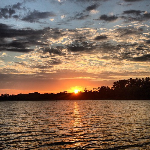
Sunset Over Brown's Lake

Rural Nebraska

Rocky Beach

Katie in twilight

Early Sunset

Early Sunset

Browns Lake

Browns Lake

Browns Lake

Google maps says there's a road between the river and that cliff. Oops. Back up the hill. I did get to see some pretty sweet cliff walls up close. #latergram #deadend #MissouriValley #googlemaps

Browns Lake
Sunset over Brown's Lake

IMG_1217 - Copy
Topographic Map of Fairview, IA, USA
Find elevation by address:

Places near Fairview, IA, USA:
10224 130th St
Whiting
Co Hwy K45, Whiting, IA, USA
Decatur
County Road W51
Main St, Walthill, NE, USA
West Fork
Decatur
24615 Co Hwy E16
1875 County Rd S T
2650 Iowa Ave N
Westendorf Mfg Co Inc
603 18th St
Logan
Quinnebaugh
County Road S
Onawa
Thurston County
Lyons
N Main St, Lyons, NE, USA
Recent Searches:
- Elevation of Congressional Dr, Stevensville, MD, USA
- Elevation of Bellview Rd, McLean, VA, USA
- Elevation of Stage Island Rd, Chatham, MA, USA
- Elevation of Shibuya Scramble Crossing, 21 Udagawacho, Shibuya City, Tokyo -, Japan
- Elevation of Jadagoniai, Kaunas District Municipality, Lithuania
- Elevation of Pagonija rock, Kranto 7-oji g. 8"N, Kaunas, Lithuania
- Elevation of Co Rd 87, Jamestown, CO, USA
- Elevation of Tenjo, Cundinamarca, Colombia
- Elevation of Côte-des-Neiges, Montreal, QC H4A 3J6, Canada
- Elevation of Bobcat Dr, Helena, MT, USA