Elevation of 38 Co Rd, Vernon, AZ, USA
Location: United States > Arizona > Apache County > Vernon >
Longitude: -109.79605
Latitude: 34.2917768
Elevation: 2085m / 6841feet
Barometric Pressure: 79KPa
Elevation Map:
Satellite Map:
Related Photos:

20181207-FS-APACHE-SITGREAVES-LSC-0054

20181207-FS-APACHE-SITGREAVES-LSC-0058

Fred's meadow (2)

Fred's meadow

Great afternoon light. Petrified National Park #petrifiedforest #instagramaz #instaaz #blue_planet #arizona #nps #parkservice #skyporn
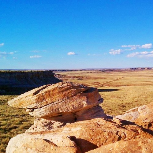
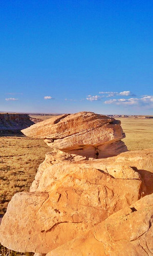
Slant Rock. ##geology #nps #blue_planet #parkservice #arizona #instagramaz #instaaz #petrifiedforest

#goodmorning #newmexico #nmroads #moon #fullmoon #roads #onmywaytowork #morningdrive #color #landscape
Park Week
Topographic Map of 38 Co Rd, Vernon, AZ, USA
Find elevation by address:

Places near 38 Co Rd, Vernon, AZ, USA:
71 Cr N8158
35775 Us-60
County Road 8030
County Road North
Vernon
3139 County Rd 3139
3139 County Rd 3139
Vernon, AZ, USA
3069 The Lords Way
9284 Chimisa Ranch Rd
9286 Grizzly Bear Rd
8935 Tomahawk Trail
1937 Lone Star Rd
1937 Lone Star Rd
Lakeside, AZ, USA
Porter Mountain Road
2356 Laguna Rd
Hill Place
2035 Silver Lake Blvd
6615 Tall Pine Dr
Recent Searches:
- Elevation of Beall Road, Beall Rd, Florida, USA
- Elevation of Leguwa, Nepal
- Elevation of County Rd, Enterprise, AL, USA
- Elevation of Kolchuginsky District, Vladimir Oblast, Russia
- Elevation of Shustino, Vladimir Oblast, Russia
- Elevation of Lampiasi St, Sarasota, FL, USA
- Elevation of Elwyn Dr, Roanoke Rapids, NC, USA
- Elevation of Congressional Dr, Stevensville, MD, USA
- Elevation of Bellview Rd, McLean, VA, USA
- Elevation of Stage Island Rd, Chatham, MA, USA