Elevation of Valentine St, Oakland, CA, USA
Location: United States > California > Alameda County > Oakland > Eastmont Hills >

Longitude: -122.16296

Latitude: 37.773501

Elevation: 111m / 364feet

Barometric Pressure: 100KPa

Elevation Map:

elevation map of Valentine St, Oakland, CA, USA

Satellite Map:

Satellite map of Valentine St, Oakland, CA, USA

Related Photos:

sanfrancisco california city bridge black color silhouette northerncalifornia fog skyline night dark flow oakland spring nikon glow view over baybridge bayarea eastbay sas 80 alamedacounty 2016 boury pbo31 easternspan d810 hillerhighlands
parallel streams
baybridge goldengatebridge sanfranciscobay
Two Bridges at Twilight
america bayarea california eastbay holly hollypeterson jubileegutel mountainviewcemetery oakland sfbayarea usa unitedstates unitedstatesofamerica westcoast cemetery norcal silhouette sunset fav10 fav25 fav50 fav100
Oakland Sunsets
sanfrancisco sanfranciscobay alameda baybridge
San Francisco from Alameda (2 of 2)
oakland california eastbay alamedacounty july 2016 boury pbo31 nikon d810 over view dark night dusk city urban traffic lightstream motion color highway red 580 freeway expressway hillcrestknolls 150th overpass roadway black
150th avenue
california sunset fog berkeley raw day cloudy hdr grizzlypeak 3xp photomatix fav200 nex6 selp1650
The fog kept on rolling in
claremonthills sanfranciscobay oakland sanfrancisco steve omd olympus clouds bay landscape eastbaybridge
San Francisco Bay from Claremont Hills
portofoakland sanfranciscobay berkeley fog
Morning Fog over San Francisco Bay
sanfranciscobay sanfrancisco berkeley baybridge fog campanile salesforcetower
Morning Fog over San Francisco Bay
goldengatebridge sanfranciscobay
Morning Fog over San Francisco Bay
sanfrancisco sanfranciscobay alameda
San Francisco from Alameda (1 of 2)
sanleandro california unitedstatesofamerica sanleandromarina clarksgrebe nature northerncalifornia birds bayarea
Just Hangin Out
america bayarea california eastbay holly hollypeterson jubileegutel mountainviewcemetery oakland sfbayarea usa unitedstates unitedstatesofamerica westcoast cemetery norcal silhouette sunset fav10 fav25 fav50 fav100
Oakland Sunsets
sanfrancisco sunset fog architecture oakland twilight realestate baybridge mls tourfactory 1893melvinrd
Sunset, Fog and San Francisco
mountdiablo orinda california pixelmama december eastbayregionalparkdistrict tildenregionalpark sunrise winterrain berkeleyhills fog karlthefog
Mount Diablo from Berkeley Hills
bayarea california nikon d810 september 2020 boury pbo31 city urban sanfrancisco baybridge 80 color over oakland smoke easternspan emeryville wildfire tollplaza mountainview traffic orange sas mom
the wildfire smoke returns
california sunset fog clouds berkeley raw day cloudy hdr grizzlypeak 3xp photomatix fav200 nex6 sel55210
Put out the fire
california holiday motion black color halloween fog night dark oakland nikon october highway view over overcast ceiling baybridge bayarea vista 24 eastbay 80 alamedacounty 2015 lightstream boury pbo31 easternspan d810 hillarhighlands
low ceiling over the eastern span
california ca morning urban sunrise landscape oakland bay berkeley san francisco day cityscape view sunny hills clear area vista norcal northern development
Morning Over the City By The Bay
america bayarea california eastbay holly hollypeterson jubileegutel mountainviewcemetery oakland sfbayarea usa unitedstates unitedstatesofamerica westcoast cemetery norcal silhouette sunset fav10 fav25 fav50 fav100
Oakland Sunsets
america bayarea california eastbay holly hollypeterson jubileegutel mountainviewcemetery oakland sfbayarea usa unitedstates unitedstatesofamerica westcoast bw cemetery norcal silhouette sunset fav10 fav25 fav50 fav100
Oakland Sunsets
ridge ramage bayarea northern california
Hanging with the stones
berkeley california
Clarity after the Storm
ebparksok
Lake Chabot
spottedsandpiper elsieroemerbirdsanctuary
I'm sure this is the spot where she said to meet ...
blue nwn clouds
Loneliness.
redwoodroad alemedacounty greenhills clouds
While the Hills are Green!
lake lakemerritt oakland california adamspoint sunset island trees city skyline geese evening reflection
This evening at the lake
ebparksok
Hayward Regional Shoreline
ebparksok
Lake Chabot
ebparksok
Lake Chabot
ebparksok
Lake Chabot
trees newzealandtetrees lakemerritt adamspoint oakland california
Mom always liked you better...
supermoon superbluebloodmoon lunareclipse fullmoon bloodmoon
Super Blue Blood Moon Setting
california sunset motion color silhouette june fog oakland evening spring nikon highway marine view traffic over bayarea layer 24 eastbay curve alamedacounty 2016 lightstream boury pbo31 d810 hillerhighlands
lead us out of the fog
california sunset oakland sand san francisco samsung explore galaxy alameda footprint
Footprints in the Sand [Explored]
crepuscular rays redwoods ebparksok eprpd oakland canon t2i 550d stickneydesign lifelover4 efs1755mmf28isusm sequoiasempervirens ebmud explore explored interesting interestingness dpsbest2011 hike hiking nature outdoors california usa tpslandscape ebrpd sfgate stock hughstickney
Caught Up In The Rapture
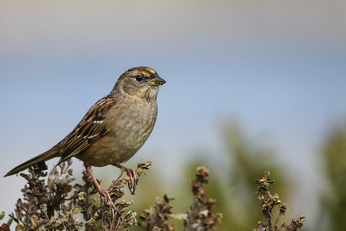
mlkjrregionalshoreline arrowheadmarsh goldencrownedsparrow oakland california unitedstates us
Golden-crowned Sparrow (1st winter)
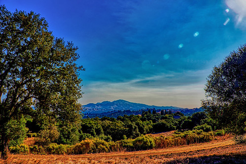
landscape mountain forest trees path olympus omd
Mt. Diablo View
huttonsvireo ucbotanicalgarden berkeley california unitedstates us
Hutton's Vireo