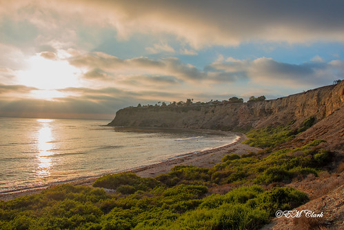
Elevation of Vía Lopez, Palos Verdes Estates, CA, USA
Location: United States > California > Los Angeles County >
Longitude: -118.40167
Latitude: 33.786714
Elevation: 230m / 755feet
Barometric Pressure: 99KPa
Related Photos:
Topographic Map of Vía Lopez, Palos Verdes Estates, CA, USA
Find elevation by address:

Places near Vía Lopez, Palos Verdes Estates, CA, USA:
Malaga Cove
1224 Vía Coronel
2031 Vía Visalia
609 Paseo Del Mar
2305 Vía Acalones
6108 Monero Dr
6576 Eddinghill Dr
Palos Verdes Estates
Grayslake Road
3 Hilltop Cir
Hesse Community Park
2501 Vía Pacheco
27128 Mesaba Dr
Basswood Avenue
Pavilions
432 Camino De Encanto
30316 Cam Porvenir
Highridge Road
Silver Spur Road
27118 Silver Spur Rd
Recent Searches:
- Elevation of Corso Fratelli Cairoli, 35, Macerata MC, Italy
- Elevation of Tallevast Rd, Sarasota, FL, USA
- Elevation of 4th St E, Sonoma, CA, USA
- Elevation of Black Hollow Rd, Pennsdale, PA, USA
- Elevation of Oakland Ave, Williamsport, PA, USA
- Elevation of Pedrógão Grande, Portugal
- Elevation of Klee Dr, Martinsburg, WV, USA
- Elevation of Via Roma, Pieranica CR, Italy
- Elevation of Tavkvetili Mountain, Georgia
- Elevation of Hartfords Bluff Cir, Mt Pleasant, SC, USA


