Elevation of Upper Denkyira, Ghana
Location: Ghana > Central >
Longitude: -1.714958
Latitude: 5.8538814
Elevation: 154m / 505feet
Barometric Pressure: 99KPa
Elevation Map:
Satellite Map:
Related Photos:
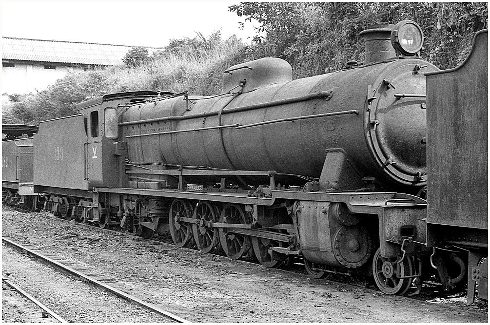
Dumped at Dunkwa
Topographic Map of Upper Denkyira, Ghana
Find elevation by address:

Places near Upper Denkyira, Ghana:
Obuasi Municipal
Oforikrom
Adansi South
Adansi North
Manso-nkwanta
Asanko Gold Mine Camp
Bekwai
Amansie West
Amansie East
Wasa Amenfi West
Asankragua
Atasomanso
Ahodwo
Owusu-ansah Avenue
Kumasi
Apemso
Kumasi City Mall
Kotei
Kwame Nkrumah University Of Science And Technology
Amakom
Recent Searches:
- Elevation of Corso Fratelli Cairoli, 35, Macerata MC, Italy
- Elevation of Tallevast Rd, Sarasota, FL, USA
- Elevation of 4th St E, Sonoma, CA, USA
- Elevation of Black Hollow Rd, Pennsdale, PA, USA
- Elevation of Oakland Ave, Williamsport, PA, USA
- Elevation of Pedrógão Grande, Portugal
- Elevation of Klee Dr, Martinsburg, WV, USA
- Elevation of Via Roma, Pieranica CR, Italy
- Elevation of Tavkvetili Mountain, Georgia
- Elevation of Hartfords Bluff Cir, Mt Pleasant, SC, USA