Elevation of University Heights, West Menlo Park, CA, USA

Location: United States > California > San Mateo County > Menlo Park >

Longitude: -122.20156

Latitude: 37.4336344

Elevation: 35m / 115feet

Barometric Pressure: 101KPa

Elevation Map:

elevation map of University Heights, West Menlo Park, CA, USA

Satellite Map:

Satellite map of University Heights, West Menlo Park, CA, USA

Related Photos:

snowyegret mountainviewshoreline
Snowy Egret
blackneckedstilt mountainviewshoreline caseyforebay
Black-necked Stilt
groundsquirrel mountainviewshoreline
California Ground Squirrel
marbledgodwit shorelineatmountainview paloalto california unitedstates us
Marbled Godwit
westerngull mountainviewshoreline caseyforebay
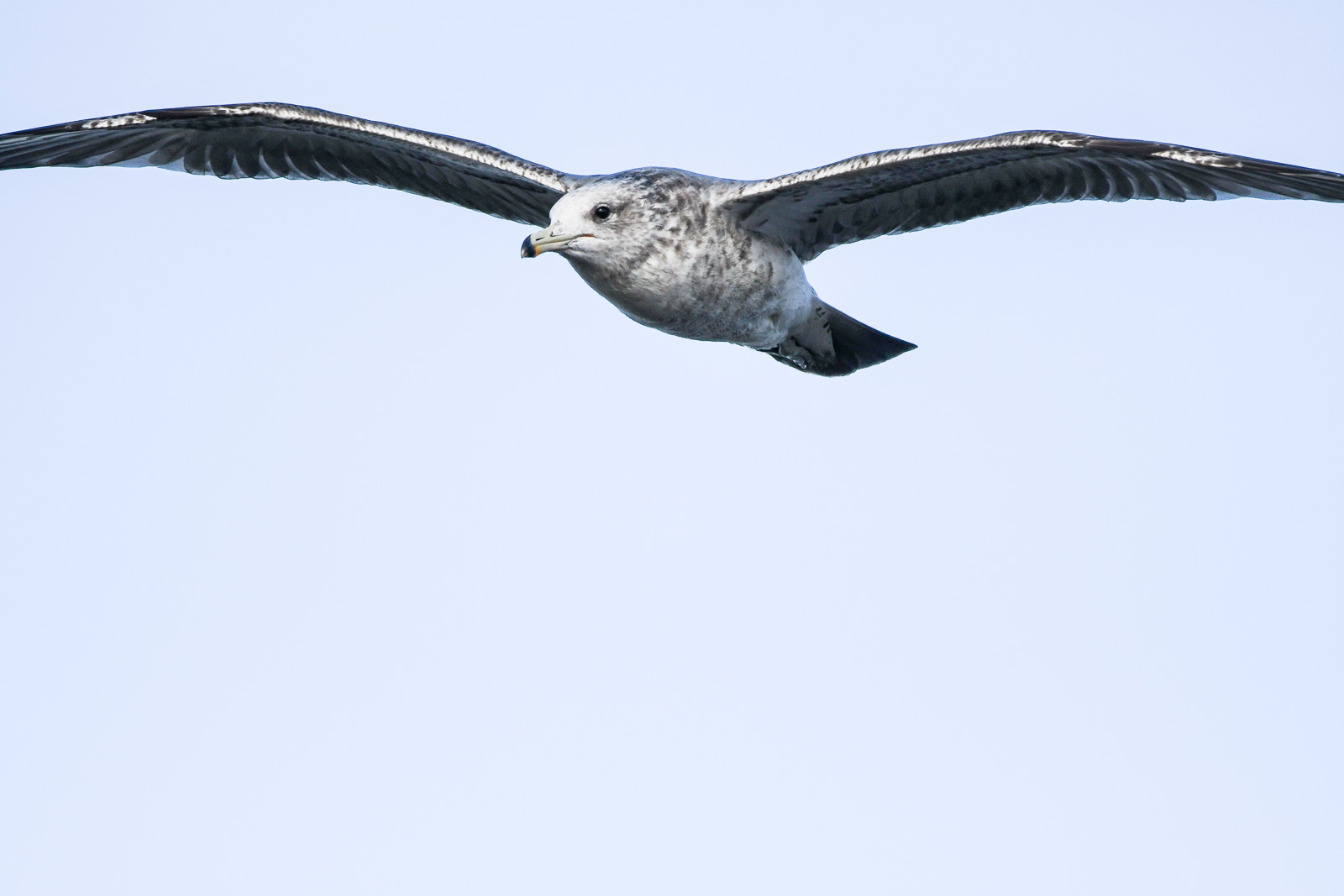
Western Gull (immature)
forsterstern shorelineatmountainview paloalto california unitedstates us
Proficient dive bomber - Forster's Tern
greenheron shorelineatmountainview paloalto california unitedstates us
Green Heron (1st summer)
shorelineatmountainview greateryellowlegs paloalto california unitedstates us
Greater Yellowlegs
barnswallow shorelineatmountainview paloalto california unitedstates us
Barn Swallow (immature)
forsterstern shorelineatmountainview paloalto california unitedstates us
Forster's Tern
forsterstern shorelineatmountainview paloalto california unitedstates us
Forster's Tern (1st year)
aerialphotograph nikkor nature paloaltoairport paloaltomunicipalgolfcourse duckpond baylandsnatureinterpretivecenter sanfranciscobay santaclaracounty sanmateocounty california eastpaloalto sanfrancisquitocreek paloalto aerial
Aerial view of Palo Alto Airport, Palo Alto Municipal Golf Course, the duck pond, the Baylands Nature Interpretive Center, and San Francisco Bay, Palo Alto, Santa Clara and San Mateo Counties, California.
white bird interestingness bravo 11 explore egret strut snowyegret shorebird egrettathula naturesfinest 255 theintimidator specanimal impressedbeauty avianexcellence
Egret Strut
mountainview california bay sanfranciscobay cloudy clouds day dusk nex6 selp1650 1xp raw hdr photomatix sanjose siliconvalley pond saltpond reflection waterreflection outdoor sky cloud water sunset boat shoreline shorelinepark park qualityhdr qualityhdrphotography serene waterfront landscape fav200
The sun settles at the shoreline
olympusxa neopan400 fujifilm california mountainview overpass road street ramp concrete acros
Mountain View, California // May 2013
californa canadiangeese canon5dmarkiii canonef24105mmf4lisusm geese lightroom5 mountainview santaclaracounty shoreline shorelinepark southbay southsanfranciscobay topazsw
Geese (HSS)
mountainview hdr nex6 selp1650 photomatix california longexposure dusk shorelinepark park lake clouds cloudy sunset fav200 sanjose siliconvalley
Place of reflection
budget motel mountain view california night long exposure velvia provia e100 light trails traffic cars streaks mixed sky flare neon old vintage roadside street road el camino real rz67 mamiya film
On A Budget in Mountain View
Eared Grebe (Podiceps nigricollis) in adult breeding plumage
whitetailedkites elanusleucurus
A nesting pair of White-tailed Kites (Elanus leucurus), just after a mouse transfer was made by the kite on the left
Black-tailed Jackrabbit (Lepus californicus)
california canon5dmarkiii canonef24105mmf4lisusm clouds edgewoodpreserve landscape lightroom5 muledeer sanmateocounty topazsw
A Cloudy Day
canon5dsr sunrise colour clouds sky landscape water reflection california usa outdoors nature dawn
Baylands Sunrise
california sunset nature grass landscape hdr rollinghills windingroads arastraderopreserve d7000 californiaoaktrees magicunicornverybest topazdetail galleryoffantasticshots
Heavenly Shades of Night are Falling -- Reprise
california nature grass landscape trails hdr rollinghills arastraderopreserve eucalyptustrees d7000 topazdetail rememberthatmomentlevel4 rememberthatmomentlevel1 rememberthatmomentlevel2 rememberthatmomentlevel3 rememberthatmomentlevel7 rememberthatmomentlevel5 rememberthatmomentlevel6
Gentle Afterglow
city bridge storm water rain clouds bay harbor san francisco power cloudy gray explore rainy rainstorm redwood pylons explored day29366 29jan16 366the2016edition 3662016 4b4a9329
29/2016 - The Redwood City Weather Forecast
california sunset nature grass fog landscape hdr rollinghills sanfranciscopeninsula windingroads californiaoaktrees magicunicornverybest topazdetail
Heavenly shades of night are falling, it's twilight time ...
Black and blue baylands
california mountainview wood sunset cloud horse abstract sky grass mountain unitedstates us
Sunset Wood Horse
california trees nature grass clouds landscape trails sunsets hdr rollinghills fieldsofgold arastraderopreserve d7000 daarklands magicunicornmasterpiece topazdetail explored7000
Fields of Gold
landscape canon5ds bright california montebello
through the looking grass
Baylands Inlet
ranchosanantonio cupertino california siliconvalley hiking lookout vistapoint hdr 1xp raw nex6 selp1650 photomatix fav100 clear day
You're my blue sky, you're my sunny day
simontsegay
Vivid Whispers
birds clouds sunrise reflections dawn bay san francisco peaceful estuary 100views palo alto baylands 7505 7506 vertorama
My Sunrise Place
california sunset nature grass landscape woodside legacy hdr rollinghills stormclouds hypothetical sanmateocounty windingroads d7000 californiaoaktrees topazdetail galleryoffantasticshots trueexcellence1
And the wind cries Mary
crystalsprings reservoir
Our Water
menlopark california unitedstates oldfashioned flickrfriday
20180908-DSCF4428
california cali bayarea skyline boulevard nature outdoors plants
Skyline boulvard