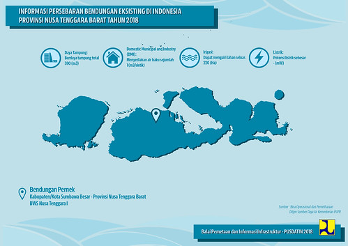
Elevation map of Sumbawa Regency, West Nusa Tenggara, Indonesia
Location: Indonesia > West Nusa Tenggara >
Longitude: 117.361647
Latitude: -8.6529334
Elevation: 457m / 1499feet
Barometric Pressure: 96KPa
Related Photos:

Bendungan Batu Bulan Sumbawa Sumbawa Island NTB, Indonesia @folkindonesia @ngobrolkota #indonesia #u_phy #infotourismindo #lumia1020 #switcheyesnap @natgeopro #nokia #idlumiaography #natgeo #instanusantara #kofipon #lumia #nothingbutanokia #nban #pichi

My children, my greatest blessing #kids #pocket_sky #pocket_beaches #tgif_sunset #sunsets #sunsetlovers #sunrise_sunsets_aroundworld #nature #nature_perfection #instakids #landscape #landscape_captures #world_bestsky #fiftyshades_of_nature #best_skyshots

Phoenix Sunset The Beauty Of Sumbawa Island #indonesia #u_phy #infotourismindo #switcheyesnap #instanusantara @instanusantara @infotourismindo #indonesia_photography @indonesia_photography #HDR #hdr_flair #sony #sonymirrorless #sony_indonesia #sonya6000
Topographic Map of Sumbawa Regency, West Nusa Tenggara, Indonesia
Find elevation by address:

Places in Sumbawa Regency, West Nusa Tenggara, Indonesia:
Places near Sumbawa Regency, West Nusa Tenggara, Indonesia:
West Nusa Tenggara
Sumbawa Besar
Seketeng
Sumbawa Sub-district
Kuang
Kuang
Taliwang
West Sumbawa Regency
Batu Hijau Mine
Recent Searches:
- Elevation of Corso Fratelli Cairoli, 35, Macerata MC, Italy
- Elevation of Tallevast Rd, Sarasota, FL, USA
- Elevation of 4th St E, Sonoma, CA, USA
- Elevation of Black Hollow Rd, Pennsdale, PA, USA
- Elevation of Oakland Ave, Williamsport, PA, USA
- Elevation of Pedrógão Grande, Portugal
- Elevation of Klee Dr, Martinsburg, WV, USA
- Elevation of Via Roma, Pieranica CR, Italy
- Elevation of Tavkvetili Mountain, Georgia
- Elevation of Hartfords Bluff Cir, Mt Pleasant, SC, USA


