Elevation of South King Street, S King St, Halifax, NC, USA
Location: United States > North Carolina > Halifax County > Halifax > Halifax >
Longitude: -77.593133
Latitude: 36.3215294
Elevation: 30m / 98feet
Barometric Pressure: 101KPa
Elevation Map:
Satellite Map:
Related Photos:

Roanoke River Mill (Inside View)

Mayo's Grocery - Black and White

Weldon NC: Crossing the Roanoke River in the Fall

DSC_3688 (Copy)
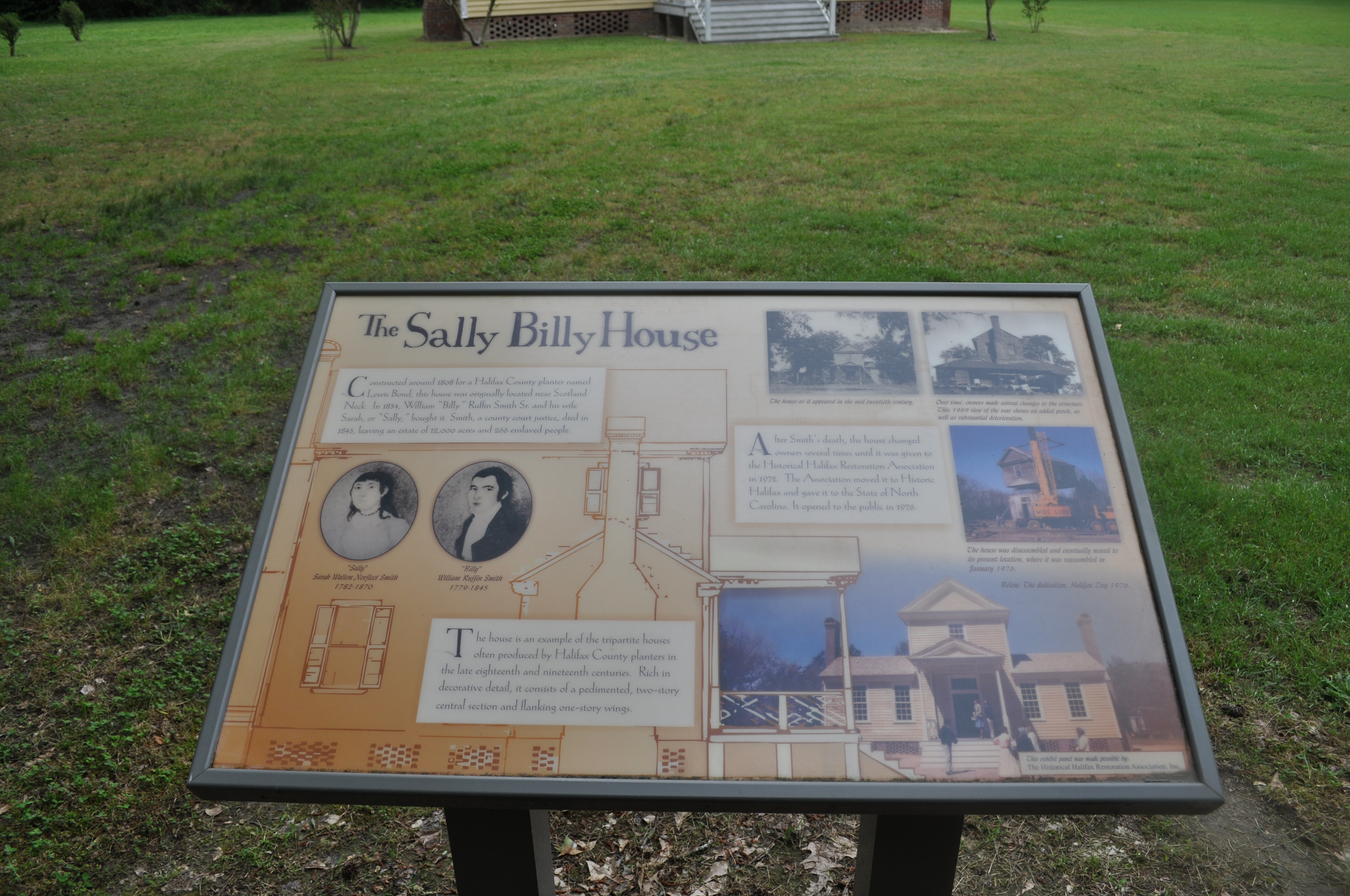
2249 The Sally Billy Plantation House c 1808 Img_16843

2208 Montfort Archaeology Museum Img_16802

2226 The Art and Science Img_16820

Backside View Halifax County Courthouse

Side View Halifax County Courthouse

2225 Map Img_16819

Roanoke River Weldon NC

Old Roanoke Rail Bridge

"THE RICH ARE DIFFERENT FROM YOU AND ME..."

Barns and Fields in Enfield

Halifax County Courthouse

Sunrise in Roanoke Rapids

Yard_March_2012 007

Fall2012 019
Topographic Map of South King Street, S King St, Halifax, NC, USA
Find elevation by address:

Places near South King Street, S King St, Halifax, NC, USA:
Halifax
Halifax
NC-, Halifax, NC, USA
Halifax County
Delmar Rd, Enfield, NC, USA
Aurelian Springs Rd, Halifax, NC, USA
Weldon
South Weldon
136 Elwyn Dr
Justice Branch Rd, Halifax, NC, USA
Enfield
44 St James Rd
Faucett
1 Pastoral Park Dr, Roanoke Rapids, NC, USA
2787 Caledonia Dr
640 Carolina St
Roanoke Rapids
Charles Street
Piney Grove Church Rd, Littleton, NC, USA
512 Franklin St
Recent Searches:
- Elevation of Corso Fratelli Cairoli, 35, Macerata MC, Italy
- Elevation of Tallevast Rd, Sarasota, FL, USA
- Elevation of 4th St E, Sonoma, CA, USA
- Elevation of Black Hollow Rd, Pennsdale, PA, USA
- Elevation of Oakland Ave, Williamsport, PA, USA
- Elevation of Pedrógão Grande, Portugal
- Elevation of Klee Dr, Martinsburg, WV, USA
- Elevation of Via Roma, Pieranica CR, Italy
- Elevation of Tavkvetili Mountain, Georgia
- Elevation of Hartfords Bluff Cir, Mt Pleasant, SC, USA