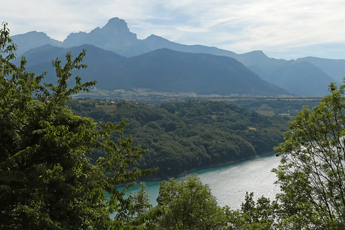
Elevation of Sommet des Rouchoux, Valjouffrey, France
Location: France > Isere > Valjouffrey >
Longitude: 6.006959
Latitude: 44.855606
Elevation: 2075m / 6808feet
Barometric Pressure: 79KPa
Related Photos:
Topographic Map of Sommet des Rouchoux, Valjouffrey, France
Find elevation by address:

Places near Sommet des Rouchoux, Valjouffrey, France:
Croix De Rougny
La Salette-fallavaux
Sanctuaire De Notre-dame La Salette
Sanctuaire De La Salette
Le Laton
Valjouffrey
Pic De Valsenestre
Pey De Saint Maurice
Signal Du Lauvitel
Tête Du Clotonnet
Aiguille Des Marmes
Pic Du Clapier Du Peyron
Pointe Swan
Pointe De Malhaubert
Roche De La Muzelle
Pic Des Souffles - Sommet Ouest
Chantelouve
Aiguille De Venosc
Cime Du Montagnon
Tête De Lauranoure - Sommet Central
Recent Searches:
- Elevation of Corso Fratelli Cairoli, 35, Macerata MC, Italy
- Elevation of Tallevast Rd, Sarasota, FL, USA
- Elevation of 4th St E, Sonoma, CA, USA
- Elevation of Black Hollow Rd, Pennsdale, PA, USA
- Elevation of Oakland Ave, Williamsport, PA, USA
- Elevation of Pedrógão Grande, Portugal
- Elevation of Klee Dr, Martinsburg, WV, USA
- Elevation of Via Roma, Pieranica CR, Italy
- Elevation of Tavkvetili Mountain, Georgia
- Elevation of Hartfords Bluff Cir, Mt Pleasant, SC, USA


