Elevation of SE Sweetbriar Ln, Troutdale, OR, USA

Location: United States > Oregon > Multnomah County > Troutdale >

Longitude: -122.38087

Latitude: 45.506774

Elevation: 104m / 341feet

Barometric Pressure: 100KPa

Elevation Map:

elevation map of SE Sweetbriar Ln, Troutdale, OR, USA

Satellite Map:

Satellite map of SE Sweetbriar Ln, Troutdale, OR, USA

Related Photos:

vistahouse columbiarivergorge eric ericgail canon 6d sky architechture oregon portland
The Vista House
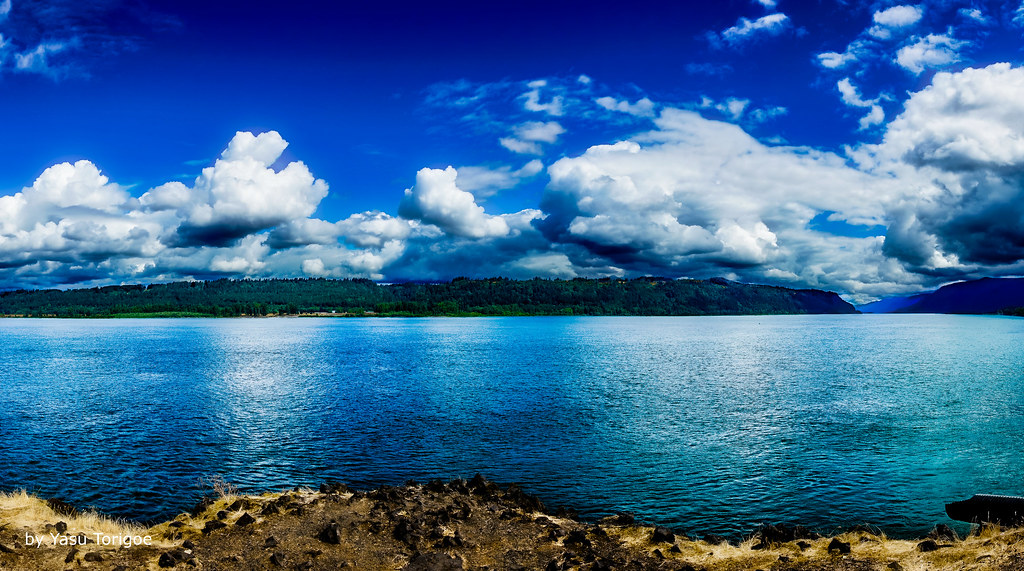
View of Columbia River Near Portland OR USA-5a
view gorge columbia columbiarivergorge womens womansforum vista vistahouse rainbow water river trees tree green light sunlight clouds weather rain tripod oregon statepark canon cats
Rainbow in the Columbia River Gorge
columbiagorge latourellbridge oregon autumn fall bridge pacificnorthwest garyquay latourellfalls hcrh historiccolumbiariverhighway
Latourell Falls Bridge, Columbia Gorge, Oregon
Rainy Day Looking Towards Latourell Fall Near Portland OR USA-6a (in Explore)
columbiariver sandisland roosterrock statepark or oregon water river
Columbia River and Sand Island
crownpoint columbiagorge oregon washington pacificnorthwest nature landscape columbiariver winter clouds cloudporn light storm sunset nikon garyquay bw
The Columbia Gorge from Crown Point, Dec 2019
powellvalley oregon sandyriver mthood mounthood infrared trees valley clouds nikon garylquay garyquay blackandwhite heat river summer
Mt. Hood over the Powell Valley, Oregon
statepark usa building station architecture oregon vintage point photo site highway view or scenic columbia historic hwy observatory vista historical crown register pioneers comfort crownpoint multnomah attraction oregonstate corbett vistahouse scenicdrive nrhp memoral onasill gorgeld multnomahcount
Vista House ~Oregon State ~ Columbia Gorge ~ My Old Photo
columbiariver columbiarivergorge oregon latourell latourellfalls pacificnorthwest northwest landscape waterscape waterfall waterfalls creek stream river scenic breathtaking viewpoint hiking hike mountains
Latourell Falls I
columbiarivergorge vistahouse columbiariver architecture women’sforumpark sunset oregon goldenhour oregonexplored gorge vista outlookpoint viewpoint summer roadtrip icon panorama chanticleerpoint portlandwomensforumstatescenicviewpoint
Maybe this world is another planet's hell…
jonsurdpoint mthood cascaderange cascademountains portland oregon roadtrip summer spring pacificnorthwest green forests meadows volcano
When ambition ends, happiness begins…
statepark usa mountain building field station stone architecture oregon vintage point landscape photo site highway view outdoor or hill scenic columbia historic hwy ridge observatory vista historical crown block register mountainside pioneers comfort crownpoint grassland multnomah attraction oregonstate corbett foothill vistahouse scenicdrive multnomahcounty nrhp memoral onasill gorgeld
Vista House ~Oregon State ~ Columbia Gorge ~ My Old Photo
columbiariver columbiarivergorge oregon latourell latourellfalls pacificnorthwest northwest landscape waterscape waterfall waterfalls creek stream river scenic breathtaking viewpoint hiking hike mountains explore explored inexplore
Latourell Falls II [Explore 7/6/20]
telegraphtuesday
Power Poles with a View
longexposure sunset water rock clouds oregon canon river landscape or sigma columbia pacificnorthwest northamerica portlandoregon cpl columbiarivergorge desaturate circularpolarizerfilter neutraldensityfilter circularpolarizingfilter canoneos70d
Columbia River Sunset
gorge columbiariver corbett oregon unitedstatesofamerica
Columbia River Gorge
angelsrest aroundcrownpoint aroundvistahouse autumn blueskieswithclouds capturenx2edited carsdriving cascaderange colorefexpro colors columbiariver columbiarivergorge columbiarivergorgenationalscenicarea columbiariverhwy creek crownpointvistahouse day8 highway hillside hillsideoftrees historiccolumbiariverhighway historiccolumbiariverhighwayscenicbyway interstate84 lookingeast meadow mounthoodarea multiplecolors multitudeofplantleafcolors nationalscenicarea nature nikond800e onbalconydeckatvistahouse oregoncascades pacificranges pixelmator portfolio project365 river sandisland trees triptomountrainierandcolumbiarivergorge usroute30 vistahouse youngcreek or unitedstates
From Near to Far While Taking in the Gorge
nikond800e day8 capturenx2edited colorefexpro triptomountrainierandcolumbiarivergorge columbiarivergorge columbiarivergorgenationalscenicarea columbiariverhwy usroute30 historiccolumbiariverhighway historiccolumbiariverhighwayscenicbyway project365 nature portfolio canvas nationalscenicarea hillside hillsideoftrees trees blueskieswithclouds angelsrest mounthoodarea oregoncascades cascaderange pacificranges chanticleerpoint overlook columbiariver river lookingtovistahouse vistahouseoffindistance lookingtocrownpoint crownpointoffindistance portlandwomensforumstate sandisland lookingeast or unitedstates
Views of the Columbia River at Chanticleer Point
trees summer tree wall oregon us unitedstates foggy july lamppost overlook columbiarivergorge us30 corbett fav10 nationalscenicarea columbiagorgehistorichighway uscopyrightregistered2013
A foggy view from Crown Point
portland oregon unitedstates us
Lazuli Bunting
fall cascada trees leave branch green river rocks nature landscape cold rock naturaleza arbol water agua
Multnomah Falls
columbiariver columbia columbiagorge washingtonstate i84
Columbia river gorge
water mountains usa flickr oregon columbiarivergorge river nature
Columbia River Gorge
wood travel tree green fall nature water oregon canon river landscape us waterfall unitedstates columbia npc gorge corbett 6d sigma50mmf14dghsm
Latourell Falls
Rainy Day over the Columbia River Near Portland OR USA-7a
camera autumn nature 30 oregon canon lens landscape ian photography eos waterfall highway long exposure images historic r usm wilderness columbiarivergorge sane latourellfalls f4l ef1740mm 5ds athinline latourell
A Thin Line
trees washougal unitedstates stateofwashington tree untedstatesofamerica usa washington northamerica plants plant
Washougal, Washington
cloud clouds columbiariver landscape landscapes northamerica river rivers stateofwashington stream streams usa unitedstates untedstatesofamerica village washington washougal
Washougal, Washington
trees washougal clouds unitedstates stateofwashington tree cloud untedstatesofamerica usa village northamerica washington
Washougal, Washington
instagramapp square squareformat iphoneography uploaded:by=instagram
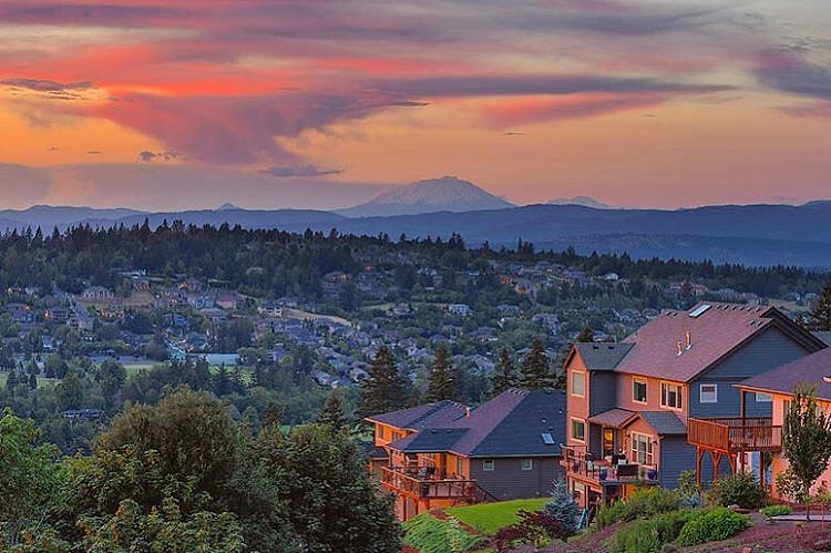
The happy colors of sunset in Happy Valley. Must be a happy place to live. But happy just to be there, even for a moment. . . . . . #photooftheday #happyvalley #sunset_ig #jj_oregon #jj_westcoast #pnw #traveloregon #exploreoregon #happyvalleyoregon #sunse
trees washougal unitedstates stateofwashington tree untedstatesofamerica usa village northamerica washington
Washougal, Washington
autumn fall columbiagorge columbiarivergorge mirrorlake swans cliff oregon pacificnorthwest garyquay garylquay nikon ortoneffect foliage fallfoliage autumnleaves water lake reflection reflectiononwater color landscape
Under Crown Point, Columbia Gorge, November 2020
building architecture sunrise canon river landscape interesting atmosphere dome t4i 1riverat matthewreichel
Beacon Rock and Vista House
fall color landscape hood sandy river water stream fog clouds sunrise tripod canon oregon mountain
Hood and the fog at Jonsrud
lewisandclark lewisandclarkpark statepark oregon oregonstatepark fallautumn tree foliage fallfoliage garyquay garylquay columbiagorge landscape november autumnleaves 2020 troutdale usa
Fall Foliage, Lewis and Clark Park, Oregon
mounthood washougal clouds unitedstates stateofwashington cloud untedstatesofamerica usa washington northamerica mountain mountains landscape landscapes mountainside
Washougal, Washington