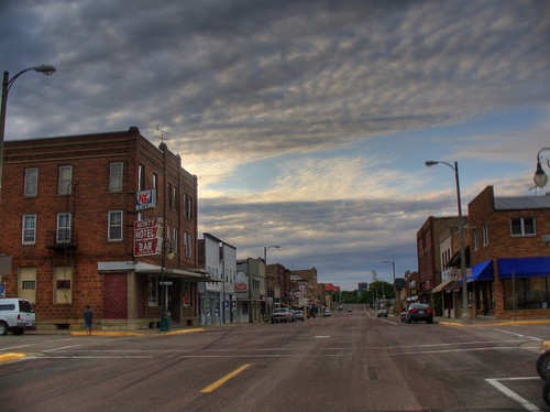
Elevation of S Waterville Ave, Le Center, MN, USA
Location: United States > Minnesota > Le Sueur County > Le Center >
Longitude: -93.730225
Latitude: 44.3853696
Elevation: 325m / 1066feet
Barometric Pressure: 97KPa
Related Photos:
Topographic Map of S Waterville Ave, Le Center, MN, USA
Find elevation by address:

Places near S Waterville Ave, Le Center, MN, USA:
Le Center
Lexington Township
Lexington Rd, Le Center, MN, USA
Cordova Township
Cannon River Rd, Le Center, MN, USA
47282 Beaver Dam Rd
Sharon Township
26881 320th St
47742 241st Ave
Tyrone Township
Caribou Gun Club
Montgomery
1st St N, Montgomery, MN, USA
Klondike Hill
Kilkenny Rd, Waterville, MN, USA
6376 W 270th St
Elysian
20 NE 2nd St, Elysian, MN, USA
Le Sueur County
Chestnut Ave, Madison Lake, MN, USA
Recent Searches:
- Elevation of Corso Fratelli Cairoli, 35, Macerata MC, Italy
- Elevation of Tallevast Rd, Sarasota, FL, USA
- Elevation of 4th St E, Sonoma, CA, USA
- Elevation of Black Hollow Rd, Pennsdale, PA, USA
- Elevation of Oakland Ave, Williamsport, PA, USA
- Elevation of Pedrógão Grande, Portugal
- Elevation of Klee Dr, Martinsburg, WV, USA
- Elevation of Via Roma, Pieranica CR, Italy
- Elevation of Tavkvetili Mountain, Georgia
- Elevation of Hartfords Bluff Cir, Mt Pleasant, SC, USA
