Elevation of S Garden Sage Loop, Vail, AZ, USA

Location: United States > Arizona > Pima County > Vail >

Longitude: -110.79510

Latitude: 31.9367624

Elevation: 1033m / 3389feet

Barometric Pressure: 90KPa

Elevation Map:

elevation map of S Garden Sage Loop, Vail, AZ, USA

Satellite Map:

Satellite map of S Garden Sage Loop, Vail, AZ, USA

Related Photos:

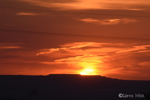
©diannewhite nikond7200 sahuarita arizona sonorandesert sunset
Sonoran Sunset
old travel arizona southwest color colour detail art history halloween monument cemetery grave graveyard grass animal animals angel clouds rural america photoshop garden dark landscape dead outdoors death countryside ancient memorial peace cross desert image symbol antique sony rip headstone cemetary country hill religion tomb tombstone decoration ground az scene eerie romance funeral burial rest gloom decor mourn gravesite oldwest cs4 abigfave dslra350 dslr350 sonydslra350 lgeof
Last Respects
arizona horse white animal tucson doubletake equestrian
horse sun details [IMG_0594]
arizona greenvalleysahuarita moon pinkmoon supermoon
2020 Super Pink Moon (4 of 4)
sunset arizona horse white animal tucson explore doubletake equestrian
white horse sunset [IMG_0592]
sunset arizona horse white animal clouds landscape tucson doubletake equestrian
sun burning through the clouds [IMG_0606]
arizona usa az helvetia greenvalley canonef24105mmf4lisusm gunsightpass canoneos1dmkiii goldstaraward
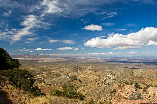
View from Gunsight Pass
arizona az developer vail theft useless fraud hoa bankrupt crooks subdivision extortion kickback racketeering dues vacantland homeownersassociation unconscionable sycamorevista againstpublicpolicy hoadoesntdoanything
What is this line & the dumpsters doing here?
arizona vail hoa unit2 coronadetucson sycamorevista johnmichaelpoore
Sycamore Vista Unit 2 Lot 131 Cleanup
arizona coppermine subdivision rinconmountain santaritamountains homeownersassociation pimacounty newtucson sycamorevista rosemontmine mountwrightston savethesenicsantaritas augustaresources
Sycamore Vista Subdivision // Santa Rita Mountains
arizona coppermine subdivision unit2 rinconmountain santaritamountains homeownersassociation pimacounty newtucson sycamorevista rosemontmine mountwrightston savethesenicsantaritas augustaresources
Sycamore Vista Subdivision Unit 2
Lot 189 panorama from rear of lot
Lot 189 (Right) & 188
Lot 131
Panorama from Lot 189
arizona blackandwhite hasselblad 35mmfilm xpan southernarizona epsonperfectionv700
S. Sonoita Mountain View Highway
©diannewhite nikond7200 sahuarita arizona sonorandesert sunset
117/3 Bold color - Sonoran Sunset
arizona mountain mountains southwest nature landscape geotagged desert tripod az vista 1855mm americanwest naturallandscape desertsouthwest randomnature highway83 canonefs1855mmf3556ii whetstonemountains arizonahighways route83 az07 sonoitaaz geo:tool=gmif sonoitaarizona geo:lat=31830557 geo:lon=110712903 random6
Whetstone Mountains, Arizona
arizona az helvetia santaritamountains gunsightpass arizonapassages
Gunsight Pass from Helvetia
arizona ruins az adobe ghosttown helvetia santaritamountains arizonapassages
Helvetia Adobe
arizona horse animal clouds tucson doubletake equestrian
in circles [IMG_0573]
up union pacific vail tucson arizona usa güterzug containerzug intermodal train ge ac4400cw
UP 6790 Vail, Arizona
amtrak sunsetlimited amtraksunsetlimited amtrak199 ge generalelectric desert blooming ocotillocactus ocotillo cactus vail arizona vailarizona up unionpacific gep42 p42 amt199
Sunset through the Ocotillos
totalwreckroad
Total Wreck Road 5-Ac Panorama
hoa subdivision santaritamountains sycamorevista savethescenicsantaritas santaritagolfcourse santaritagolfclub thechallengeatsantaritagolfcourse newtucsonunit4
Golf Course Lot / (Looking SW)
arizona desert
20140908 20 Arizona Desert
UP 8966 leads a Stacktrain east through Vail
americansouthwest arizona arizonatrail bureauoflandmanagement desertmountains desertsouthwest lascienegas lascienegasnationalconservationarea mesquitetrees pricklypearcactus rinconmountains rinconpeak skyisland sonorandesert southernarizona yucca
Rincon Peak Above Sonoran Desert
americansouthwest arizona arizonatrail bureauoflandmanagement desertmountains desertsouthwest hikingtrail lascienegas lascienegasnationalconservationarea mesquitetrees micamountain ocotillo pricklypearcactus rinconmountains rinconpeak sonorandesert southernarizona yucca vail unitedstates
Hiking Trail in southern Arizona
americansouthwest arizona arizonatrail coronadonationalforest desertgrasslands desertsouthwest highdesert highdesertgrasslands hikingtrail mesquitetrees pricklypearcactus rinconmountains rinconpeak santaritamountainfoothills santaritamountains sonorandesert sonorandesertgrasslands southernarizona
Hiking Trail Below Rincon Mountains
arizona mine open pit aerial pima copper
Aerial View of Arizona
americansouthwest arizona arizonatrail coronadonationalforest desertgrasslands desertsouthwest highdesert highdesertgrasslands hikingtrail mesquitetrees pricklypearcactus rinconmountains rinconpeak santaritamountainfoothills santaritamountains sonorandesert sonorandesertgrasslands southernarizona vail unitedstates
Rincon Mountains Above the Arizona Trail
americansouthwest arizona arizonatrail bureauoflandmanagement chollacactus dawn dawnlight desertmountains desertsouthwest desertsunrise earthsshadow lascienegas lascienegasnationalconservationarea mesquitetree pricklypearcactus sonorandesert southernarizona sunrise vail unitedstates
Earth's Shadow over Sonoran Desert