Elevation of Ouray, UT, USA
Location: United States > Utah > Uintah County >
Longitude: -109.86632
Latitude: 40.3262949
Elevation: 1557m / 5108feet
Barometric Pressure: 84KPa
Elevation Map:
Satellite Map:
Related Photos:

Tridell Utah Panorama, 2001

Tridell, Utah, 1974

Abandonded House in Tridell, Utah

Sometimes things just happen on a drive. But real magic is when you pull over. Minus 7 degrees at the top of Cameron Pass with first light hitting fresh snow on the Nokhu Crags and the Never Summers. #Colorado
U.S. 40 Between Roosevelt and Vernal, Utah

Roosevelt, Utah 191

US-40 West at UT-88 South

Perfect colors in Roosevelt today!

Scenic highway 121 from Vernal to Lapoint

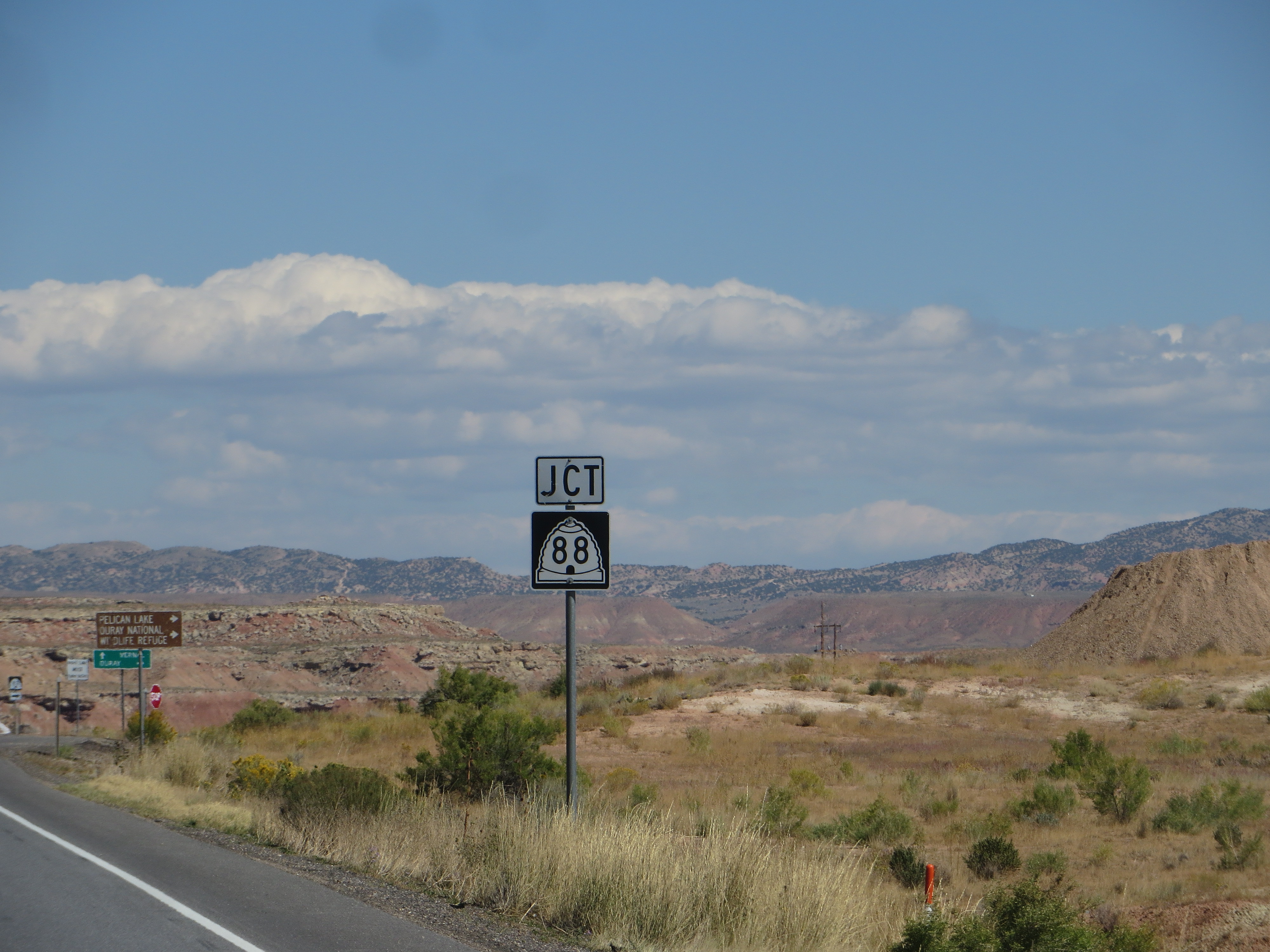
Junction with Utah State Route 88, U.S. Highway 40 Between Roosevelt and Vernal, Utah

Road to Ouray National Wildlife Refuge, U.S. Highway 40 Between Roosevelt and Vernal, Utah
Topographic Map of Ouray, UT, USA
Find elevation by address:

Places near Ouray, UT, USA:
2854 1000 N
E N, Whiterocks, UT, USA
Ballard
Lapoint Elementary School
Lapoint
E S, Roosevelt, UT, USA
Roosevelt
Whiterocks
2243 W 280 S
Neola
3000 East
E Main St, Myton, UT, USA
Myton
1500 South
8498 Deep Creek Rd
Bluebell
Duchesne County
Kings Peak
9 Mile Canyon Road
Nine Mile Ranch
Recent Searches:
- Elevation of Corso Fratelli Cairoli, 35, Macerata MC, Italy
- Elevation of Tallevast Rd, Sarasota, FL, USA
- Elevation of 4th St E, Sonoma, CA, USA
- Elevation of Black Hollow Rd, Pennsdale, PA, USA
- Elevation of Oakland Ave, Williamsport, PA, USA
- Elevation of Pedrógão Grande, Portugal
- Elevation of Klee Dr, Martinsburg, WV, USA
- Elevation of Via Roma, Pieranica CR, Italy
- Elevation of Tavkvetili Mountain, Georgia
- Elevation of Hartfords Bluff Cir, Mt Pleasant, SC, USA