Elevation of Milton Township, MI, USA
Location: United States > Michigan > Cass County >
Longitude: -86.1650024
Latitude: 41.7863175
Elevation: 249m / 817feet
Barometric Pressure: 0KPa
Related Photos:

Stormy River

The view downriver

Wilson Shirt Factory Revisited

The view from my bike while doing an eight mile ride before work. Glad to be working out and getting healthy again!

Friday Autumn River View

Street View

Backyard view

sun sets on a win

Wilson Bros. Shirt Co.

The Chapin House, Niles, MI

Wilson Shirt Factory
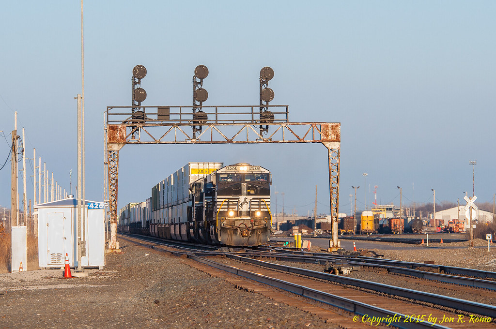
NS 205 headed west past the signals at CP 426

Artomyces pyxidatus

Hesburgh Library's mural

Taking the long view (explored)

Wilson Shirt Factory

Your Personal "Flying Carpet"

Calpyogeja sp.
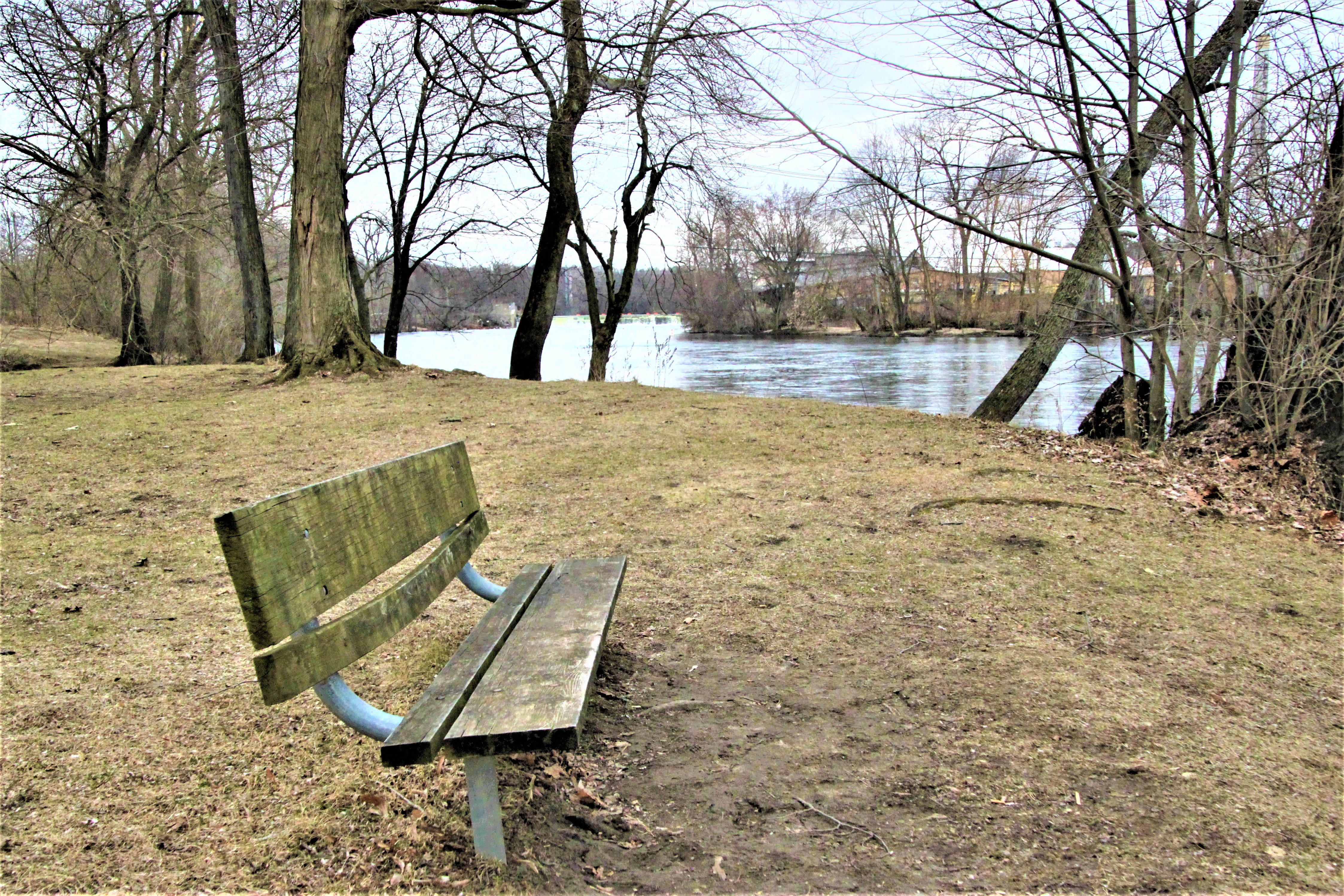
Riverside Bench

Wilson Shirt Factory Mapped

My First Sunflower

South Bend in lights

Sunset over the river
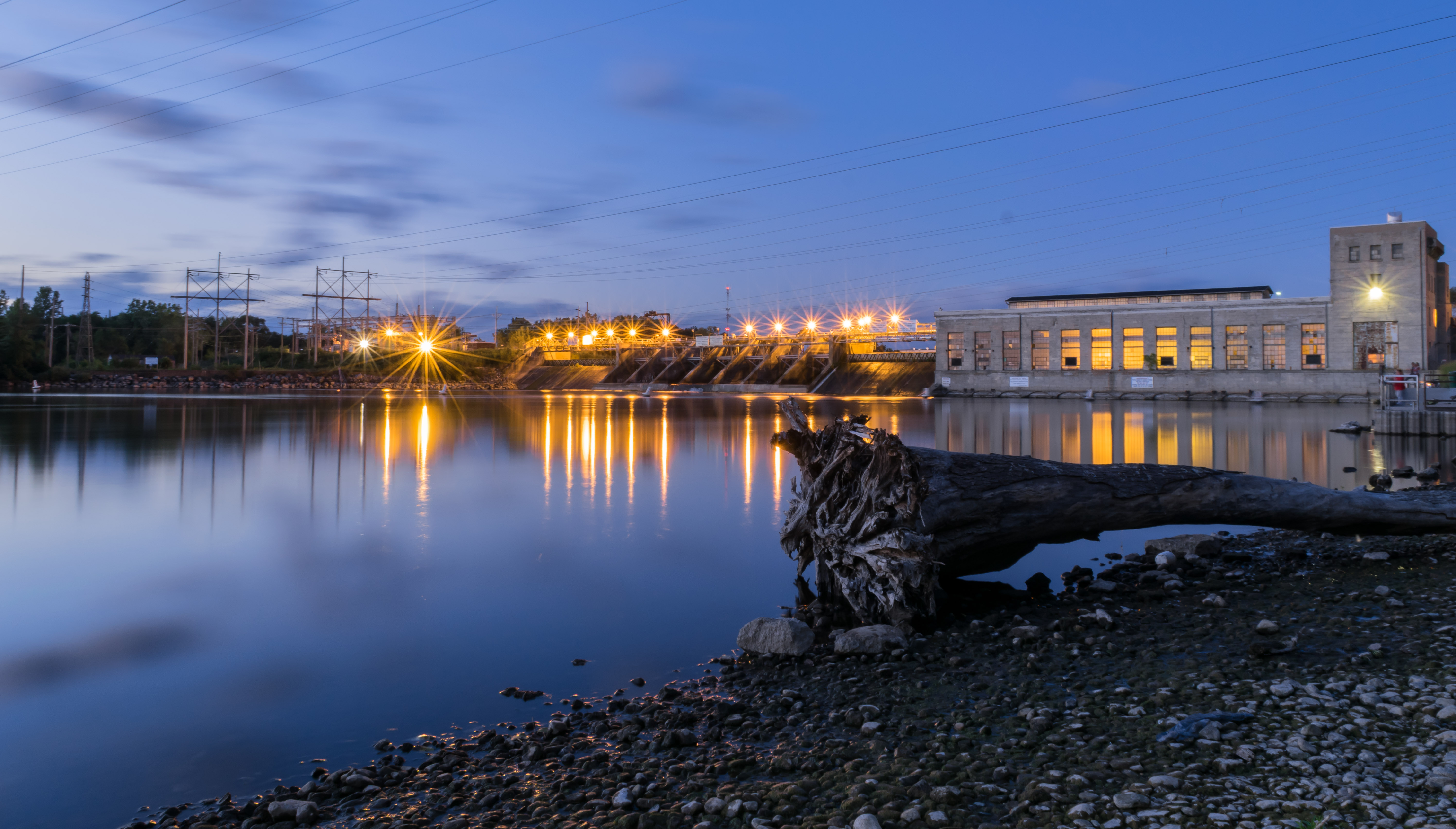
30 seconds of dam reflections

Sunset @ Boot Lake Nature Preserve

Rushing past the ice

God Quad, Notre Dame, South Bend, Indiana

Sunset at Boot Lake Nature Preserve

Winter is Back

Dowagiac River

ND Fall Colors

Alone in Japanase garden

Interesting Architecture

First Real Snow

Spooky Tree

Evening Skies

Boot Lake Nature Preserve

Railroad Bridge, Niles, MI, December, 2012

Fall Colors @ Boot Lake Nature Preserve

Lonely Swan

Sunset @ Boot Lake Nature Preserve
Topographic Map of Milton Township, MI, USA
Find elevation by address:

Places near Milton Township, MI, USA:
15657 Spring Meadow Ln
14215 Worthington Dr
Summit Hill Court
51105 Lexingham Dr
13733 Bridlewood Ct
Niles, MI, USA
70938 Jones Dr
Swanson Highlands
1111 Edwards St
52691 Helvie Dr
1600 Silverbrook Ave
1215 E Bertrand Rd
Clay Township
1358 Broadway
530 Tanglewood Ln
2415 S 3rd St
Safelite Autoglass
Hannapel Home Center
Niles
South Bend, IN, USA
Recent Searches:
- Elevation of Pasing, Munich, Bavaria, 81241, Germany
- Elevation of 24, Auburn Bay Crescent SE, Auburn Bay, Calgary, Alberta, T3M 0A6, Canada
- Elevation of Denver, 2314, Arapahoe Street, Five Points, Denver, Colorado, 80205, USA
- Elevation of Community of the Beatitudes, 2924, West 43rd Avenue, Sunnyside, Denver, Colorado, 80211, USA
- Elevation map of Litang County, Sichuan, China
- Elevation map of Madoi County, Qinghai, China
- Elevation of 3314, Ohio State Route 114, Payne, Paulding County, Ohio, 45880, USA
- Elevation of Sarahills Drive, Saratoga, Santa Clara County, California, 95070, USA
- Elevation of Town of Bombay, Franklin County, New York, USA
- Elevation of 9, Convent Lane, Center Moriches, Suffolk County, New York, 11934, USA
- Elevation of Saint Angelas Convent, 9, Convent Lane, Center Moriches, Suffolk County, New York, 11934, USA
- Elevation of 131st Street Southwest, Mukilteo, Snohomish County, Washington, 98275, USA
- Elevation of 304, Harrison Road, Naples, Cumberland County, Maine, 04055, USA
- Elevation of 2362, Timber Ridge Road, Harrisburg, Cabarrus County, North Carolina, 28075, USA
- Elevation of Ridge Road, Marshalltown, Marshall County, Iowa, 50158, USA
- Elevation of 2459, Misty Shadows Drive, Pigeon Forge, Sevier County, Tennessee, 37862, USA
- Elevation of 8043, Brightwater Way, Spring Hill, Williamson County, Tennessee, 37179, USA
- Elevation of Starkweather Road, San Luis, Costilla County, Colorado, 81152, USA
- Elevation of 5277, Woodside Drive, Baton Rouge, East Baton Rouge Parish, Louisiana, 70808, USA
- Elevation of 1139, Curtin Street, Shepherd Park Plaza, Houston, Harris County, Texas, 77018, USA