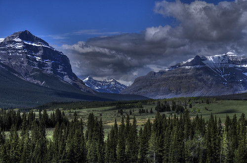
Elevation of Maze Peak, Clearwater County, AB T0M, Canada
Location: Canada > Alberta > Division No. 9 >
Longitude: -115.43333
Latitude: 51.715
Elevation: 2272m / 7454feet
Barometric Pressure: 77KPa
Related Photos:
Topographic Map of Maze Peak, Clearwater County, AB T0M, Canada
Find elevation by address:

Places near Maze Peak, Clearwater County, AB T0M, Canada:
Labyrinth Mountain
Mount Minos
Ya Ha Tinda Ranch
Dormer Mountain
Barrier Mountain
Otuskwan Peak
Zombie Peak
Limestone Mountain
Scalp Se5
Scalp Se2
Scalp Peak
Mount Oliver
Panther Mountain
Puma Peak
Psychic Peak
Mount Davidson
Wapiti Mountain
Bare Range
Haunted Peak
Melanin Peak
Recent Searches:
- Elevation of Corso Fratelli Cairoli, 35, Macerata MC, Italy
- Elevation of Tallevast Rd, Sarasota, FL, USA
- Elevation of 4th St E, Sonoma, CA, USA
- Elevation of Black Hollow Rd, Pennsdale, PA, USA
- Elevation of Oakland Ave, Williamsport, PA, USA
- Elevation of Pedrógão Grande, Portugal
- Elevation of Klee Dr, Martinsburg, WV, USA
- Elevation of Via Roma, Pieranica CR, Italy
- Elevation of Tavkvetili Mountain, Georgia
- Elevation of Hartfords Bluff Cir, Mt Pleasant, SC, USA
