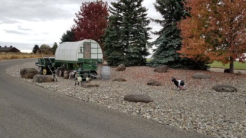
Elevation of Maestas Rd, Richfield, ID, USA
Location: United States > Idaho > Lincoln County > Richfield >
Longitude: -114.16435
Latitude: 43.0982718
Elevation: 1395m / 4577feet
Barometric Pressure: 86KPa
Related Photos:
Topographic Map of Maestas Rd, Richfield, ID, USA
Find elevation by address:

Places near Maestas Rd, Richfield, ID, USA:
Lincoln County
Richfield
Dietrich
222 E 520 N
2nd St, Bellevue, ID, USA
Picabo
Shoshone
Magic Resort
Carey
N Main St, Carey, ID, USA
Little Wood Reservoir Road
Little Wood Reservoir Road
820 Riverside Dr
510 Chestnut Loop
S Main St, Bellevue, ID, USA
Bellevue
Bellevue
Bellevue
Bellevue
Bellevue
Recent Searches:
- Elevation of Corso Fratelli Cairoli, 35, Macerata MC, Italy
- Elevation of Tallevast Rd, Sarasota, FL, USA
- Elevation of 4th St E, Sonoma, CA, USA
- Elevation of Black Hollow Rd, Pennsdale, PA, USA
- Elevation of Oakland Ave, Williamsport, PA, USA
- Elevation of Pedrógão Grande, Portugal
- Elevation of Klee Dr, Martinsburg, WV, USA
- Elevation of Via Roma, Pieranica CR, Italy
- Elevation of Tavkvetili Mountain, Georgia
- Elevation of Hartfords Bluff Cir, Mt Pleasant, SC, USA


