Latitude: 39.1372764
Longitude: -76.250571
Elevation: 2 meters / 7 feet
Barometric Pressure 1013KPa

Related Photos

Candid by dK.i photography, A candid of my buddy Reggie at Down's Park.  This was shot literally from the hip, so it is not perf
Candid by dK.i photography
a little sun flare by dK.i photography, Finally, it's official.  Announced on COM, the grand prize winner.  <a href="http://www.capturemaryl
a little sun flare by dK.i photography
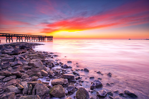
bathe in the winter sun by alexandratsuruta, the winter sun rises from the Chesapeake in a desparate attempt to bathe the land in its warm glow.
bathe in the winter sun by alexandratsuruta
sunrise at low tide by dK.i photography, The sky wasn't as spectacular as last week, but still was a decent sunrise.  The tide was low, so I
sunrise at low tide by dK.i photography
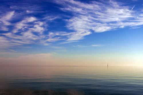
Minimalist Chesapeake by dK.i photography, Cloudscape at dawn over the Chesapeake, a minimalist interpretation

Water, without a long exposure,
Minimalist Chesapeake by dK.i photography
run to the sun by dK.i photography, step into the light

A last minute run out the door for today's sunrise.  Completely unplanned, but
run to the sun by dK.i photography
the beach by dK.i photography, Down's Park, Pasadena, Maryland on a January morning.  Subtle colors to start the day off.

Capture
the beach by dK.i photography
Im Feeling a Bit Small by chardeenly, This had me running back and forth from my camera to the trees before the self-timer went off. Lucki
Im Feeling a Bit Small by chardeenly
frozen dawn by dK.i photography, A winter sunrise on the Chesapeake.  There is a certain clarity, though frigid, in the winter air th
frozen dawn by dK.i photography
mini henge by dK.i photography, random wood formations on the beach, perhaps built by ancient faeries to mark the end of days.....
o
mini henge by dK.i photography
all along the bay by dK.i photography, That first house you see on the left...well, Reggie and I were told, forcefully, to take ourselves o
all along the bay by dK.i photography
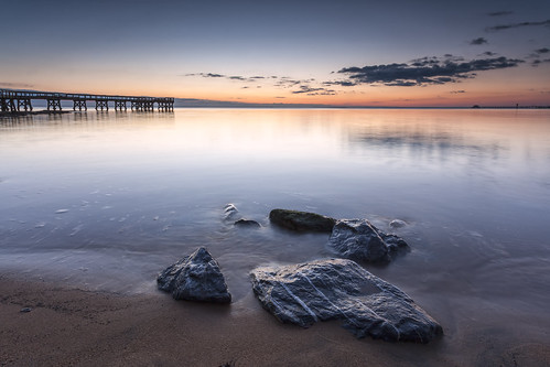
the B game by dK.i photography, Sunday dawn patrol with Reggie and my new friend Andrew at Down's Park. 
Perhaps I spent my A game a
the B game by dK.i photography
RED FOX by nflravens, The preferred habitat of red foxes is a mixed landscape—comprising patches of forests, grasslands, a
RED FOX by nflravens
Corsica River living shoreline in Queen Anne's County, Maryland by chesbayprogram, A living shoreline built to withstand sea level rise due to climate change is seen on July 20, 2017,
Corsica River living shoreline in Queen Anne's County, Maryland by chesbayprogram
Sunday on the bay by dK.i photography, Clouds make the sunrise, in most cases.  This is an exception, however.  Yes, clouds would have elev
Sunday on the bay by dK.i photography
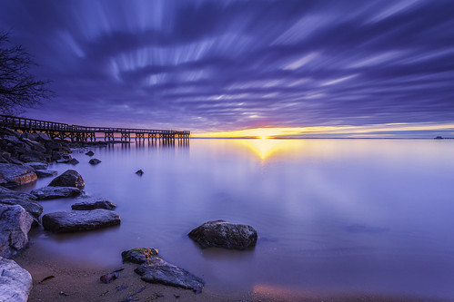
A new dawn by dK.i photography, A new dawn, a new year.  First light of 2017

HSS

downspark pasadena maryland chesapeakebay sunrise
A new dawn by dK.i photography
shoulda coulda woulda by dK.i photography, I finally get my mojo and rise early.  The sun, however did not.  A blah rise, but since I was there
shoulda coulda woulda by dK.i photography
Eastern Neck National Wildlife Refuge by U. S. Fish and Wildlife Service - Northeast Region, Credit: USFWSneck landscape md wildlife maryland national eastern usfws refuge nationalwildliferefug
Eastern Neck National Wildlife Refuge by U. S. Fish and Wildlife Service - Northeast Region
grains of light by dK.i photography, A bonus feature, for the first time in 2 years of coming here, that I have seen.  I believe that it
grains of light by dK.i photography
breaking the line by dK.i photography, Rockhopping along the shores of Down's Park in Pasadena.  Just a simple composition.  A pier, the wa
breaking the line by dK.i photography
2 mins of salmon by dK.i photography, Fleeting, yet it was present, if only for a moment, the colors of dawn.  My 2 minutes of salmon, on
2 mins of salmon by dK.i photography
Eastern Neck National Wildlife Refuge controlled burn by U. S. Fish and Wildlife Service - Northeast Region, March, 2011, Eastern Neck National Wildlife Refuge, Maryland:  A controlled burn helps keep invasive
Eastern Neck National Wildlife Refuge controlled burn by U. S. Fish and Wildlife Service - Northeast Region
Between Zero and the Sun by dK.i photography, The pier at Down's Park provides filtering for the rising sun.

Multi-layer, single exposure image.
Between Zero and the Sun by dK.i photography
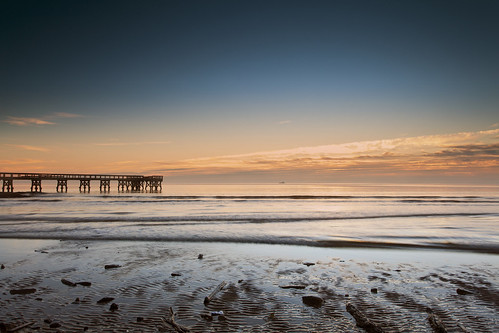
wait for it by dK.i photography, Waves generated by a passing ship moving towards the shore.  Until now, the bay was like a pond, so
wait for it by dK.i photography
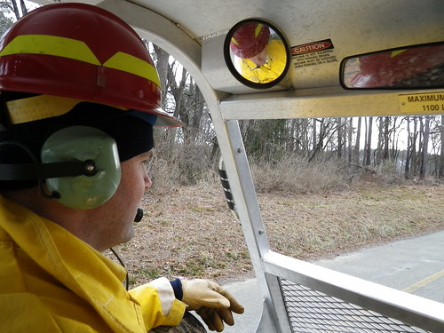
View from inside Marshmaster by U. S. Fish and Wildlife Service - Northeast Region, March, 2011, Eastern Neck National Wildlife Refuge, Maryland.  A firefighter drives a tracked, amphi
View from inside Marshmaster by U. S. Fish and Wildlife Service - Northeast Region
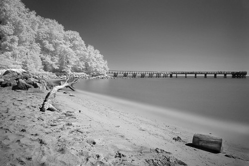
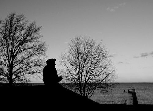
Downs Park Infrared by Joe_R, Another attempt at IR photographybeach bw infrared landscape maryland pasadena unitedstates us canon
Downs Park Infrared by Joe_R
Bird banding by U. S. Fish and Wildlife Service - Northeast Region, Refuge employees banding a duck at Eastern Neck National Wildlife Refuge. Credit: USFWSbird neck lan
Bird banding by U. S. Fish and Wildlife Service - Northeast Region
Eastern Neck National Wildlife Refuge in Kent County, Md. by chesbayprogram, Phragmites and other shoreline wetland plants grow near a restoration project that uses a living sho
Eastern Neck National Wildlife Refuge in Kent County, Md. by chesbayprogram
Corsica River living shoreline in Queen Anne's County, Maryland by chesbayprogram, A living shoreline built to withstand sea level rise due to climate change is seen on July 20, 2017,
Corsica River living shoreline in Queen Anne's County, Maryland by chesbayprogram
Corsica River living shoreline in Queen Anne's County, Maryland by chesbayprogram, A living shoreline built to withstand sea level rise due to climate change is seen on July 20, 2017,
Corsica River living shoreline in Queen Anne's County, Maryland by chesbayprogram
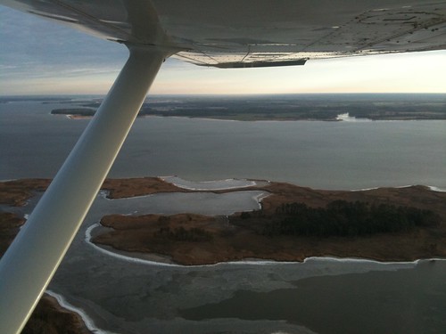
Aerial view of Hale Cove by U. S. Fish and Wildlife Service - Northeast Region, Eastern Neck National Wildlife Refuge. Credit: USFWSneck landscape md wildlife maryland aerial natio
Aerial view of Hale Cove by U. S. Fish and Wildlife Service - Northeast Region
Corsica River living shoreline in Queen Anne's County, Maryland by chesbayprogram, A living shoreline built to withstand sea level rise due to climate change is seen on July 20, 2017,
Corsica River living shoreline in Queen Anne's County, Maryland by chesbayprogram
Chesapeake Bay watershed from the air by chesbayprogram, Fanels Branch, a tributary of the Chester River, is bordered by a mature riparian forest buffer sepa
Chesapeake Bay watershed from the air by chesbayprogram
Corsica River living shoreline in Queen Anne's County, Maryland by chesbayprogram, A living shoreline built to withstand sea level rise due to climate change is seen on July 20, 2017,
Corsica River living shoreline in Queen Anne's County, Maryland by chesbayprogram
Corsica River living shoreline in Queen Anne's County, Maryland by chesbayprogram, A living shoreline built to withstand sea level rise due to climate change is seen on July 20, 2017,
Corsica River living shoreline in Queen Anne's County, Maryland by chesbayprogram
a tangled mess by dK.i photography, must have been waiting for a BIG fish!
This 'rod' was placed here by some mysterious species and the
a tangled mess by dK.i photography
Frozen Chesapeake by agladshtein, Sunset over the Chesapeake Bay in January. Taken at Rock Hall, Maryland.winter snow ice maryland eas
Frozen Chesapeake by agladshtein
Corsica River living shoreline in Queen Anne's County, Maryland by chesbayprogram, A living shoreline built to withstand sea level rise due to climate change is seen on July 20, 2017,
Corsica River living shoreline in Queen Anne's County, Maryland by chesbayprogram
Corsica River living shoreline in Queen Anne's County, Maryland by chesbayprogram, A living shoreline built to withstand sea level rise due to climate change is seen on July 20, 2017,
Corsica River living shoreline in Queen Anne's County, Maryland by chesbayprogram
every sunrise is a blessing by dK.i photography, The less photogenic side of the "Pier"  Hey, at least it a different perspective....lol

I
every sunrise is a blessing by dK.i photography
Corsica River living shoreline in Queen Anne's County, Maryland by chesbayprogram, A living shoreline built to withstand sea level rise due to climate change is seen on July 20, 2017,
Corsica River living shoreline in Queen Anne's County, Maryland by chesbayprogram
Corsica River living shoreline in Queen Anne's County, Maryland by chesbayprogram, A living shoreline built to withstand sea level rise due to climate change is seen on July 20, 2017,
Corsica River living shoreline in Queen Anne's County, Maryland by chesbayprogram
Conquest Beach Living Shoreline in Queen Anne's County, Maryland by chesbayprogram, A living shoreline built to withstand sea level rise due to climate change is seen on July 20, 2017,
Conquest Beach Living Shoreline in Queen Anne's County, Maryland by chesbayprogram
Agriculture in Queen Anne's County, Md. by chesbayprogram, Farmland near the Chester River is seen in Queen Anne's County, Md., on June 27, 2016. (Photo by Wil
Agriculture in Queen Anne's County, Md. by chesbayprogram
Corsica River living shoreline in Queen Anne's County, Maryland by chesbayprogram, A living shoreline built to withstand sea level rise due to climate change is seen on July 20, 2017,
Corsica River living shoreline in Queen Anne's County, Maryland by chesbayprogram
Eastern Neck National Wildlife Refuge in Kent County, Maryland by chesbayprogram, The Chester River wraps around Eastern Neck National Wildlife Refuge in Kent County, Md., on March 2
Eastern Neck National Wildlife Refuge in Kent County, Maryland by chesbayprogram
St. Paul's Episcopal Church, Kent County, Maryland by Big Mike 42, Home since 1713 of a Church of England parish established in 1692, one among thirty decreed for Mary
St. Paul's Episcopal Church, Kent County, Maryland by Big Mike 42
Corsica River living shoreline in Queen Anne's County, Maryland by chesbayprogram, A living shoreline built to withstand sea level rise due to climate change is seen on July 20, 2017,
Corsica River living shoreline in Queen Anne's County, Maryland by chesbayprogram
pine by thucydides5, a viewmaryland easternshore
pine by thucydides5
Queen Anne's County, Md. by chesbayprogram, Kent Island is seen in Queen Anne's County, Md., on March 20, 2017. (Photo by Will Parson/Chesapeake
Queen Anne's County, Md. by chesbayprogram
A Story Untold by lindquist6, Edited with Distressed FX, Snapseed, Photowizarduploaded:by=flickrmobile flickriosapp:filter=nofilte
A Story Untold by lindquist6
Eastern Neck National Wildlife Refuge by chesbayprogram, The Chester River wraps around Eastern Neck National Wildlife Refuge in Kent County, Md., on March 2
Eastern Neck National Wildlife Refuge by chesbayprogram
Chesapeake Bay Pier by matthewbeziat, This picture was taken at Downs Park in Pasadena, Maryland.pasadena chesapeakebay downspark annearun
Chesapeake Bay Pier by matthewbeziat
Where I Chill by chardeenly, Ok well this is where I would chill if I lived at this house,
But I dont
But I do chill there whenev
Where I Chill by chardeenly
Vestry House, 1766 by Big Mike 42, St. Paul's Episcopal Church, Kent County, Maryland.  Beautiful example of Flemish bond brickwork  <a
Vestry House, 1766 by Big Mike 42
Gray Kingbird in Maryland by cullerfuls, Gray Kingbirds breed in Florida then winter in the Antilles and South America. This one migrated the
Gray Kingbird in Maryland by cullerfuls
AMERICAN BALD EAGLE by nflravens, The Eagle obtain much of their food as carrion or via a practice known as kleptoparasitism, by which
AMERICAN BALD EAGLE by nflravens
Bald Faced-Hornet by matthewbeziat, This is a picture of Dolichovespula maculata at Downs Park in Pasadena, Maryland.
Gibson Island Quad
Bald Faced-Hornet by matthewbeziat
IMGP3424 by Rondalo, view from the Moonlight Bay Inn, Rock Hall, Marylandsunset bay pier
IMGP3424 by Rondalo
BALD EAGLE by nflravens, One of the most recognizable birds in North America is the Bald Eagle. 

Because they fly at higher
BALD EAGLE by nflravens