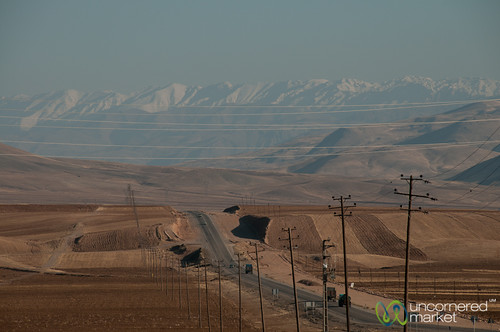
Elevation of Kangavar, Kermanshah Province, Iran
Location: Iran > Kermanshah Province >
Longitude: 47.9564594
Latitude: 34.5070927
Elevation: 1503m / 4931feet
Barometric Pressure: 85KPa
Related Photos:
Topographic Map of Kangavar, Kermanshah Province, Iran
Find elevation by address:

Places near Kangavar, Kermanshah Province, Iran:
Asadabad
Tuyserkan
Hamadan Province
Alvand Peak
Nahavand
Ostadan
Bahar
Hamedan
Famast
Aleshtar
Anuch
Malayer
مجتمع نگین اندیشه
Borujerd
بروجرد
Do Dange
Famenin
Khondab
Recent Searches:
- Elevation of Corso Fratelli Cairoli, 35, Macerata MC, Italy
- Elevation of Tallevast Rd, Sarasota, FL, USA
- Elevation of 4th St E, Sonoma, CA, USA
- Elevation of Black Hollow Rd, Pennsdale, PA, USA
- Elevation of Oakland Ave, Williamsport, PA, USA
- Elevation of Pedrógão Grande, Portugal
- Elevation of Klee Dr, Martinsburg, WV, USA
- Elevation of Via Roma, Pieranica CR, Italy
- Elevation of Tavkvetili Mountain, Georgia
- Elevation of Hartfords Bluff Cir, Mt Pleasant, SC, USA


