Elevation of Alvand Peak, Iran

Location: Iran > Hamadan Province >

Longitude: 48.4024398

Latitude: 34.763498

Elevation: 3314m / 10873feet

Barometric Pressure: 67KPa

Elevation Map:

elevation map of Alvand Peak, Iran

Satellite Map:

Satellite map of Alvand Peak, Iran

Related Photos:

iran middleeast middleeastculture traditional tourism travel adobe aerial asia hamedan islamicrepublic village westasia rural hesareqarahbaghi
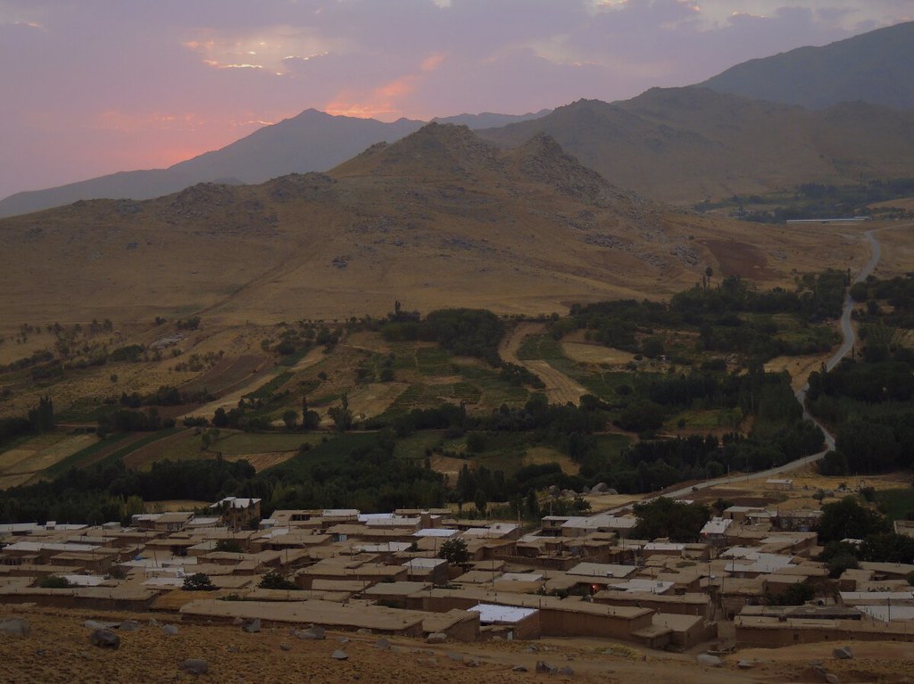
Rooftops of a rural village in Iran
adobe aerial asia hamedan iran islamicrepublic middleeast village westasia gettyimagesmiddleeast hesareqarahbaghi
Iranian adobe village
architecture outside asia arch iran perspective middleeast mausoleum hamedan islamicrepublic westasia babatahir earthasia gettyimagesmiddleeast
Mausoleum tentacles
asia iran hamedan baba taher tahir mausoleum architecture fall season poet mystic islam muslim autumn monument column outdoor islamicrepublic middleeast stairs babataher westasia landmark travel traveldestinations traveltourism tourism touristattractions
Autumn colors at Iran mystic and poet Baba Taher mausoleum - Hamedan
iran hamadan babataher fisneye babatahertomb dna2iran
Baba Taher Tomb - Hamadan, Iran
door iran tomb fisheye esther hamadan queenesther dna2iran tombofesther
Tomb of Esther, Fisheye View - Hamadan, Iran
iran barbershop barber hamadan figheye dna2iran iranianbarber
Iranian Barber Shop - Hamadan, Iran
laidback foothill mountainside ruralroad path road hesareqarahbaghi valley agriculturalvillage agriculture asia westasia middleeast iran islamicrepublicofiran islamicrepublic muslimworld middleeasternculture travel tourism traveldestinations touristattractions hamedanprovince hamedan ruralscene rurallandscape mountain village town ruraliran agriculturaljihad
Rural road to traditional mountain village in Iran
square squareformat iphoneography instagramapp uploaded:by=instagram
The Alisadr cave #Hamedan #Iran #mustseeiran #tourism #hamgardi #discoveriran by #Note4
offthebeatentrack offthebeatenpath beautyinnature background garden ruraliran rural serene peaceful naturallandscape asia westasia middleeast iran islamicrepublicofiran islamicrepublic muslimworld middleeasternculture travel tourism traveldestinations touristattractions hamedanprovince hesareqarahbaghi forest trees green nature hamedan
Forest in rural Iran
aerial agriculture asia field harvest iran islamicrepublic land middleeast village westasia gettyimagesmiddleeast rural travel tourism hesareqarahbaghi
Fertile Iranian lands and countryside
iran hamedan 2014 hamadan hamadanprovince hamedaniran hamadaniran hamedanprovince march2014 march132014 iran2014 hamadānprovince hamadān hamedān hamadāniran hamedāniran hamedānprovince
Remains of Ecbatanah (Hegmataneh, هگمتانه), the Median/Achaemenid City
iran hamedan 2014 hamadan hamadanprovince hamedaniran hamadaniran hamedanprovince march2014 march132014 iran2014 hamadānprovince hamadān hamedān hamadāniran hamedāniran hamedānprovince
Remains of Ecbatanah (Hegmataneh, هگمتانه), the Median/Achaemenid City
aerial asia hamedan iran islamicrepublic middleeast path road rural tree wallnut way westasia jahadi gettyimagesmiddleeast rurallandscape silkroad muslimculture middleeastculture travel traveldestinations traveltourism tourism touristattraction landmark holidaydestination windingroad ruralroad oudoors outdoor countryside walnut walnuttree shade hesareqarahbaghi
Rural road by the walnut tree - Hamedan, Iran
hamedan iranhamedan
iran-hamedan
Marty memorial at Mishan (base camp for Alvand)
square squareformat iphoneography instagramapp uploaded:by=instagram foursquare:venue=4fe47ac7e4b0ab54ea99b5b5
رشته پلویی Made in Hamdan
asia westasia middleeast iran hamedan village rural road arrival approach agriculture offthebeatentrack offthebeatenpath travel tourism outdoors landscape outdoor hesareqarahbaghi
Rural road to Hesar-e Qarah Baghi agricultural village in Hamedan, Iran
instagramapp square squareformat iphoneography uploaded:by=instagram
The #Ali_Sadr #Cave (Persian: غار علی صدر) is the world's largest #water cave which attracts thousands of visitors every year. It is located in Ali Sadr #Kabudarahang County about 100 kilometers north of #Hamadan, western #Iran (more accurately at 48°18'
aerial asia dawn hamedan iran islamicrepublic jahadi middleeast morning valley village westasia gettyimagesmiddleeast hesareqarahbaghi
Dawn in remote folds of the world
asia dense flora forest hamedan iran islamicrepublic jahadi middleeast nature westasia gettyimagesmiddleeast hesareqarahbaghi
Hesar-e Qarah Baghi forest in Iran
asia hamedan iran islamicrepublic middleeast mountain road rural valley village westasia jahadi gettyimagesmiddleeast landscape hill mountainside foothill outdoor travel tourism hesareqarahbaghi
Hesar-e Qarah Baghi traditional village in Iran
abandoned ruins asia mud iran middleeast adobe hamedan islamicrepublic westasia sangesefid gettyimagesmiddleeast jahadi
Washed away mud village
asia hamedan hill iran islamicrepublic middleeast mountain road rural traditional village westasia gettyimagesmiddleeast hesareqarahbaghi
Road to Iranian village
iran xerxes ganjnameh hamadan achaemenidempire dna2iran ganjnamehcarvings
Ganjnameh Engravings - Hamadan, Iran
iran2014hamedan
Hamedan - Ganjnameh
iran2014hamedan
Hamedan - Ganjnameh
square squareformat iphoneography instagramapp uploaded:by=instagram
بچه‌های کوه آلپ! دشت میشان، کوه #الوند #همدان