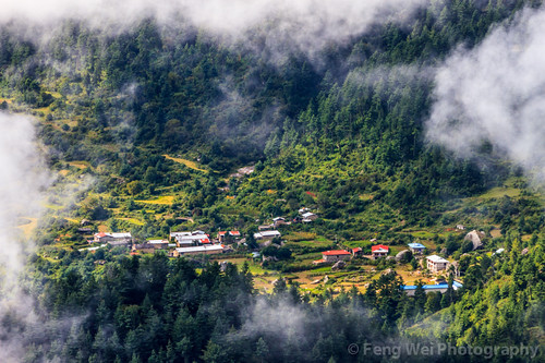
Elevation of Jilongzhen, Gyirong, Xigaze, Tibet, China
Location: China > Tibet > Xigaze > Gyirong >
Longitude: 85.329248
Latitude: 28.393293
Elevation: 2793m / 9163feet
Barometric Pressure: 72KPa
Related Photos:
Topographic Map of Jilongzhen, Gyirong, Xigaze, Tibet, China
Find elevation by address:

Places near Jilongzhen, Gyirong, Xigaze, Tibet, China:
Rasuwa Ghadhi
Gatlang
Yangra
Rasuwa
Langtang National Park
Langtang Lirung
Thangsyap
Langtang View Guest House
Goljung
Gang Benchhen
Nile
Ganesh Himal
Mu Gompa
Chhokangparo
Kyanjing Gompa And Monastery Lodge
Kyangjin Kharka
Baden-powell Peak
Tsergo Ri
Sertung
Kerauja
Recent Searches:
- Elevation of Corso Fratelli Cairoli, 35, Macerata MC, Italy
- Elevation of Tallevast Rd, Sarasota, FL, USA
- Elevation of 4th St E, Sonoma, CA, USA
- Elevation of Black Hollow Rd, Pennsdale, PA, USA
- Elevation of Oakland Ave, Williamsport, PA, USA
- Elevation of Pedrógão Grande, Portugal
- Elevation of Klee Dr, Martinsburg, WV, USA
- Elevation of Via Roma, Pieranica CR, Italy
- Elevation of Tavkvetili Mountain, Georgia
- Elevation of Hartfords Bluff Cir, Mt Pleasant, SC, USA


