Elevation of Grice Rd, Columbia, MS, USA
Location: United States > Mississippi > Marion County > Columbia >
Longitude: -89.815248
Latitude: 31.407749
Elevation: 108m / 354feet
Barometric Pressure: 100KPa
Elevation Map:
Satellite Map:
Related Photos:
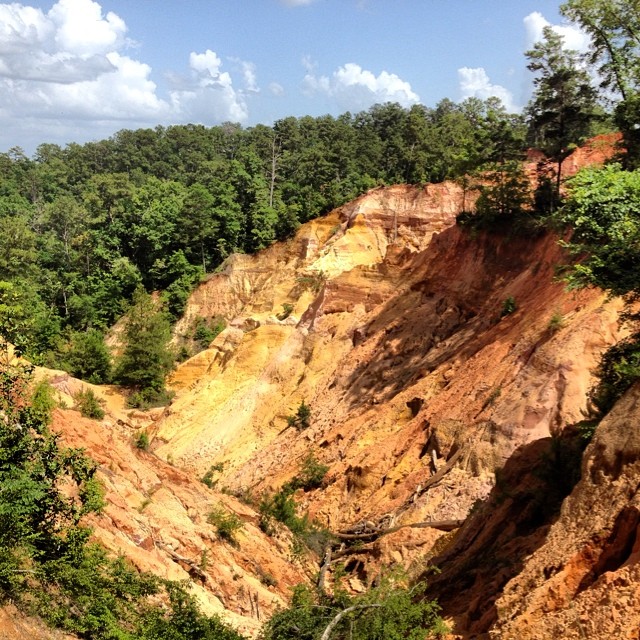
We went to a cool place for Father's Day! #redbluff #redbluffms #mississippisgrandcanyon

Red Bluff 4

Soils at Red Bluff

Red Bluff

Robin Sled

Robin and Rachel sled!

a sedimentation IMG_1327

a sedimentation pearl river IMG_1326

at the bottom
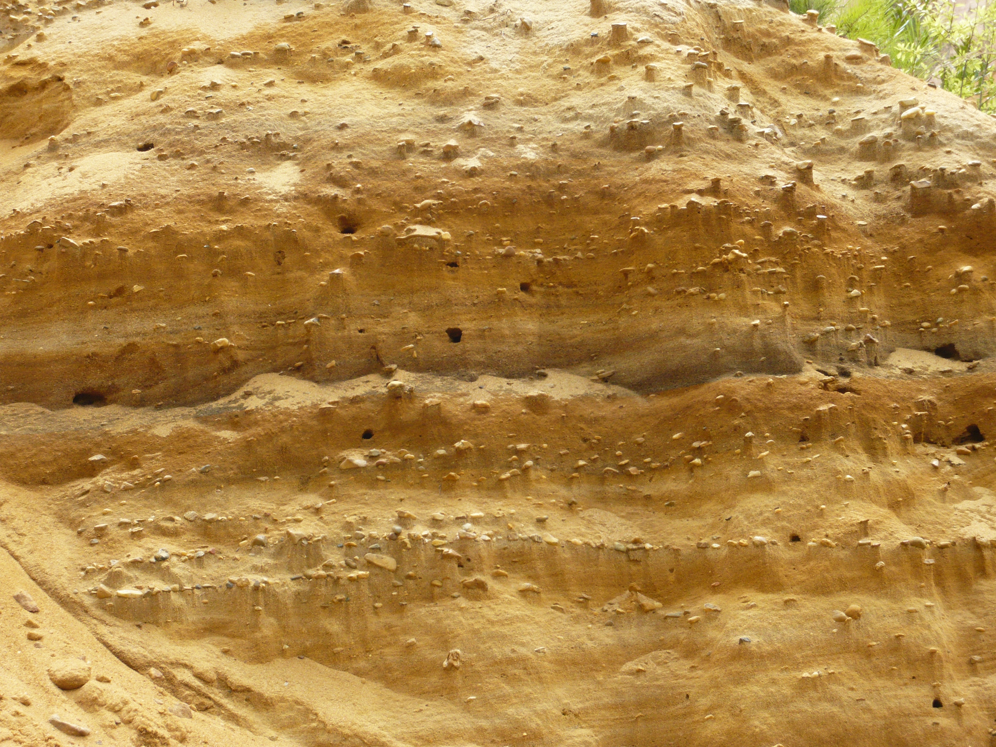
Little houses made of gravel

Red Bluff is 30 meters deep

Mississippi's Little Grand Canyon

better shot with robins camera
Topographic Map of Grice Rd, Columbia, MS, USA
Find elevation by address:

Places near Grice Rd, Columbia, MS, USA:
631 W Reservoir Rd
19 C Williamson Rd
32 Wilson Ave
MS-42, Carson, MS, USA
218 E Rankin St
3880 Ms-35
Columbia
2nd St, Columbia, MS, USA
Jefferson Davis County
102 Old Morgantown Rd
Foxworth
1216 Scott Ave
Prentiss
Columbia Ave, Prentiss, MS, USA
73 Buddy Price Rd
236 Munn Rd
Marion County
91 Hartzog Magee Rd
1818 Columbia Purvis Rd
1818 Columbia Purvis Rd
Recent Searches:
- Elevation of Corso Fratelli Cairoli, 35, Macerata MC, Italy
- Elevation of Tallevast Rd, Sarasota, FL, USA
- Elevation of 4th St E, Sonoma, CA, USA
- Elevation of Black Hollow Rd, Pennsdale, PA, USA
- Elevation of Oakland Ave, Williamsport, PA, USA
- Elevation of Pedrógão Grande, Portugal
- Elevation of Klee Dr, Martinsburg, WV, USA
- Elevation of Via Roma, Pieranica CR, Italy
- Elevation of Tavkvetili Mountain, Georgia
- Elevation of Hartfords Bluff Cir, Mt Pleasant, SC, USA