Elevation of Elm Grove Rd, Colerain, NC, USA
Location: United States > North Carolina > Bertie County > Colerain > Colerain >
Longitude: -76.906212
Latitude: 36.143133
Elevation: 17m / 56feet
Barometric Pressure: 101KPa
Elevation Map:
Satellite Map:
Related Photos:

2329 China Press circa 1785-1800 Img_16923

NB076CashieRSR1257_topUPS_20130604

CIMG1625

NB076CashieRSR1257_adjacentRSF_20130604

NB076CashieRSR1257_topDNS_20130604
NB076CashieRSR1257_bottomDNS_20130604

NB076CashieRSR1257_bottomUPS_20130604

Colerain, NC
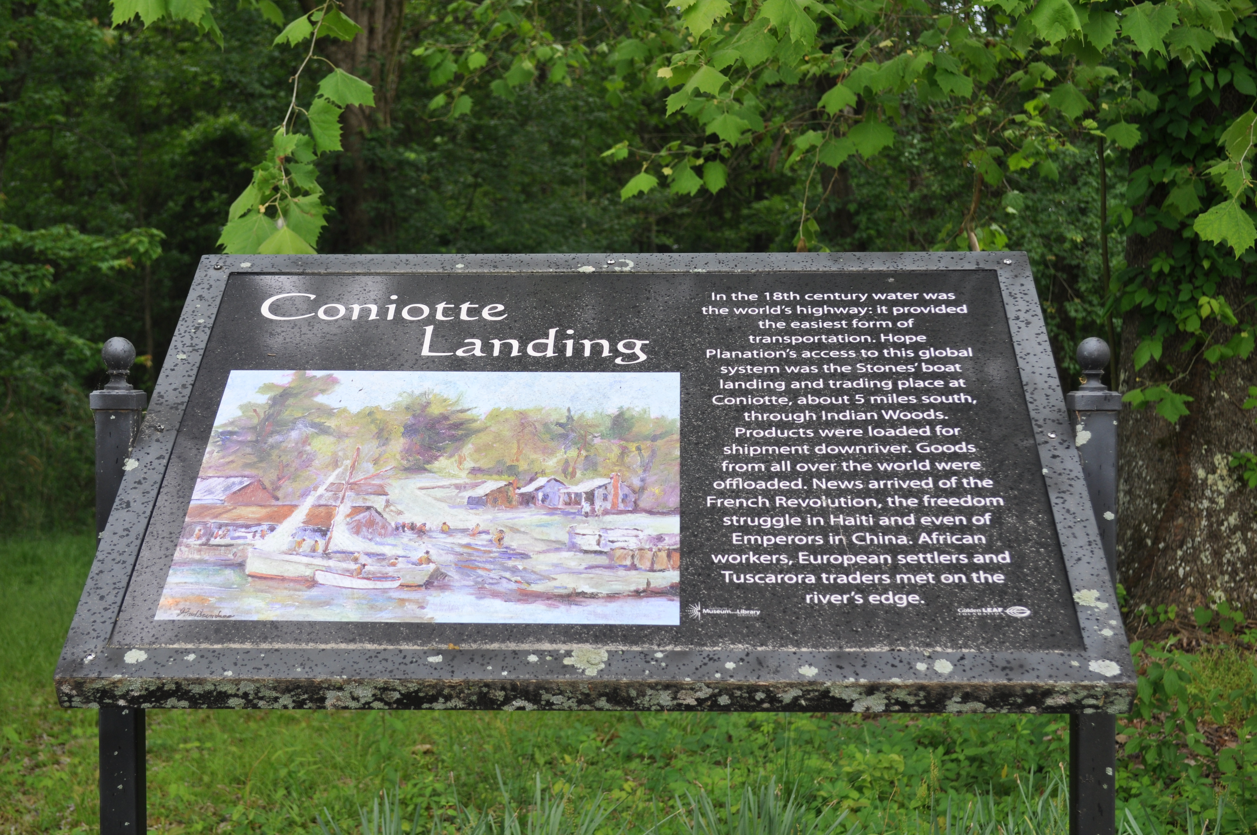
2402 Coniotte Landing Img_16996

2403 Freedom or Exile Img_16997

2404 Building Img_16998

2405 Building A Img_16999

2406 Building A Img_17000

2407 Building B Img_17001
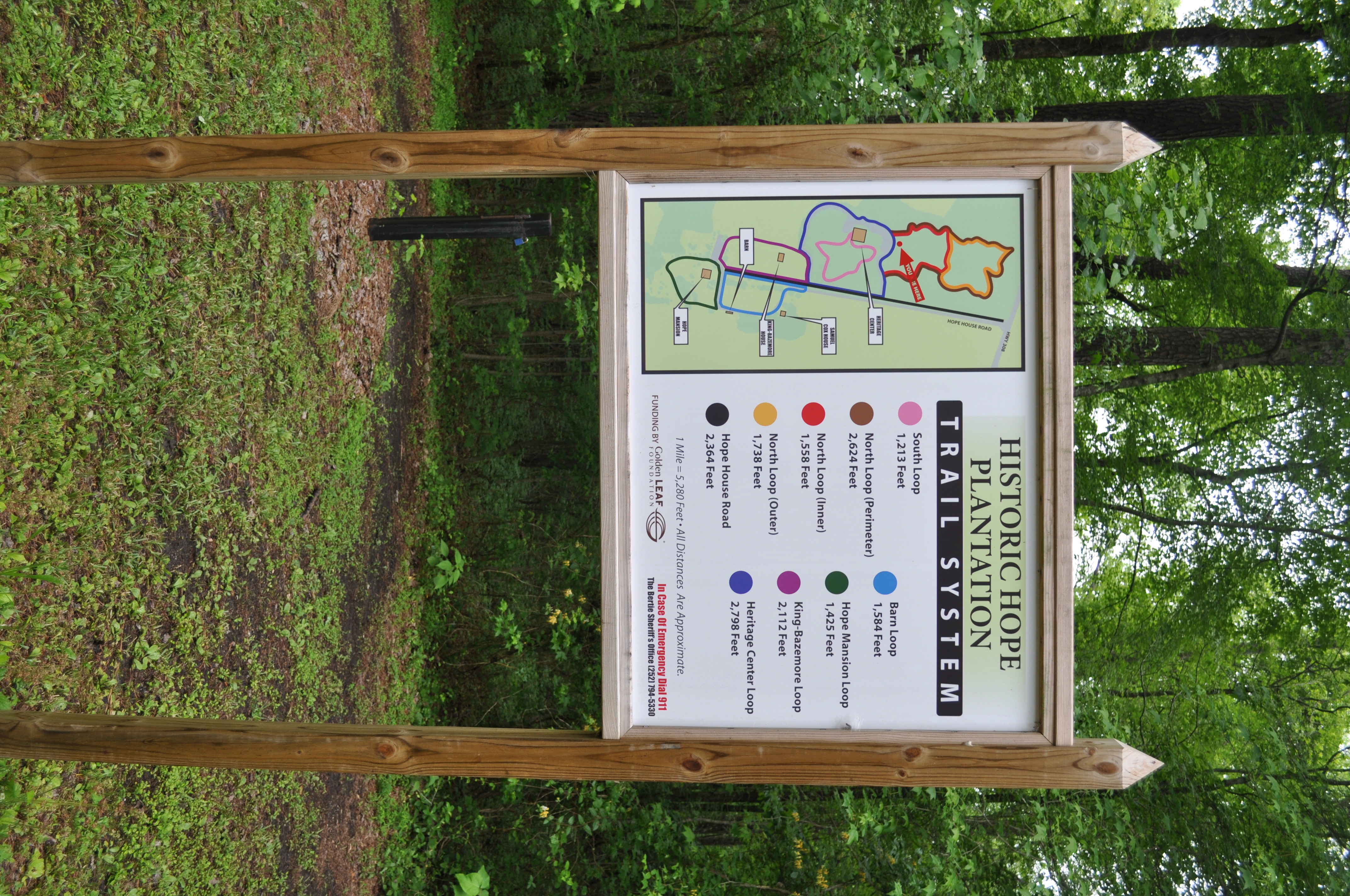
2408 Plantation trail system Img_17002

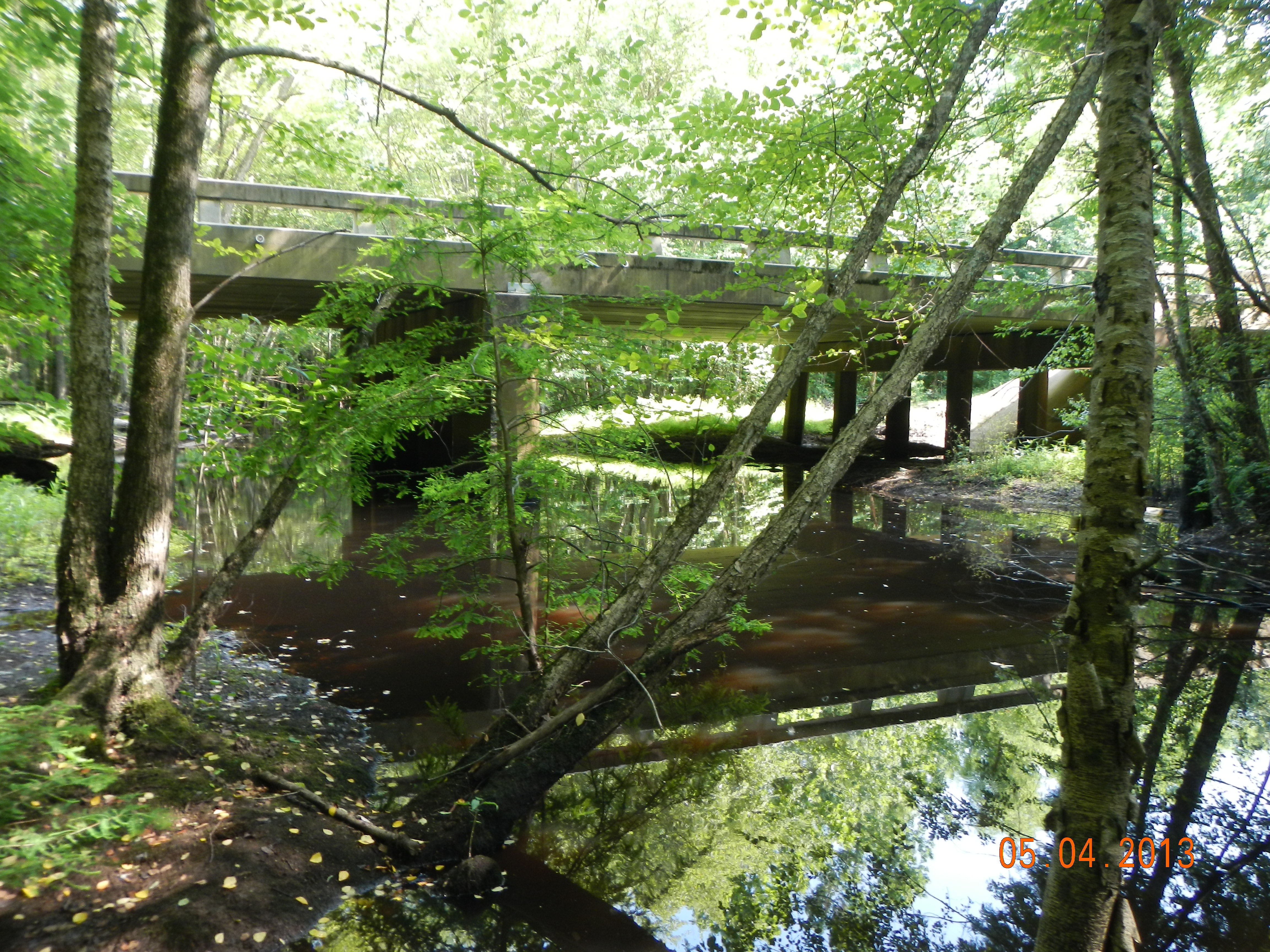
2401 The Roanoke River Img_16995

2322 Plantation bread bowl Img_16916

2323 Family bread bowl Img_16917

2324 Judges Chair Img_16918

2325 Judges Chair Img_16919
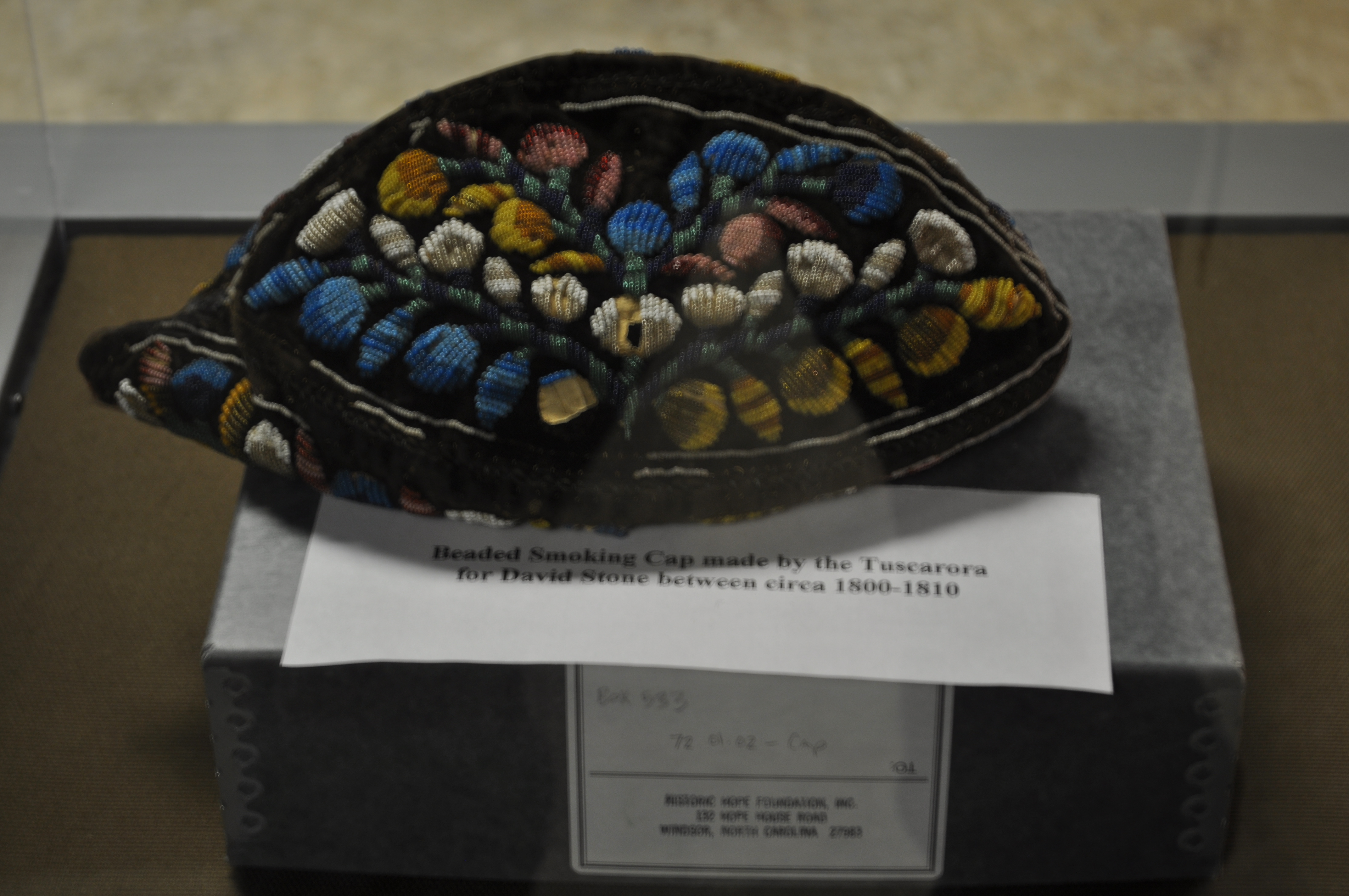
2326 Headed Smoking Cap Img_16920
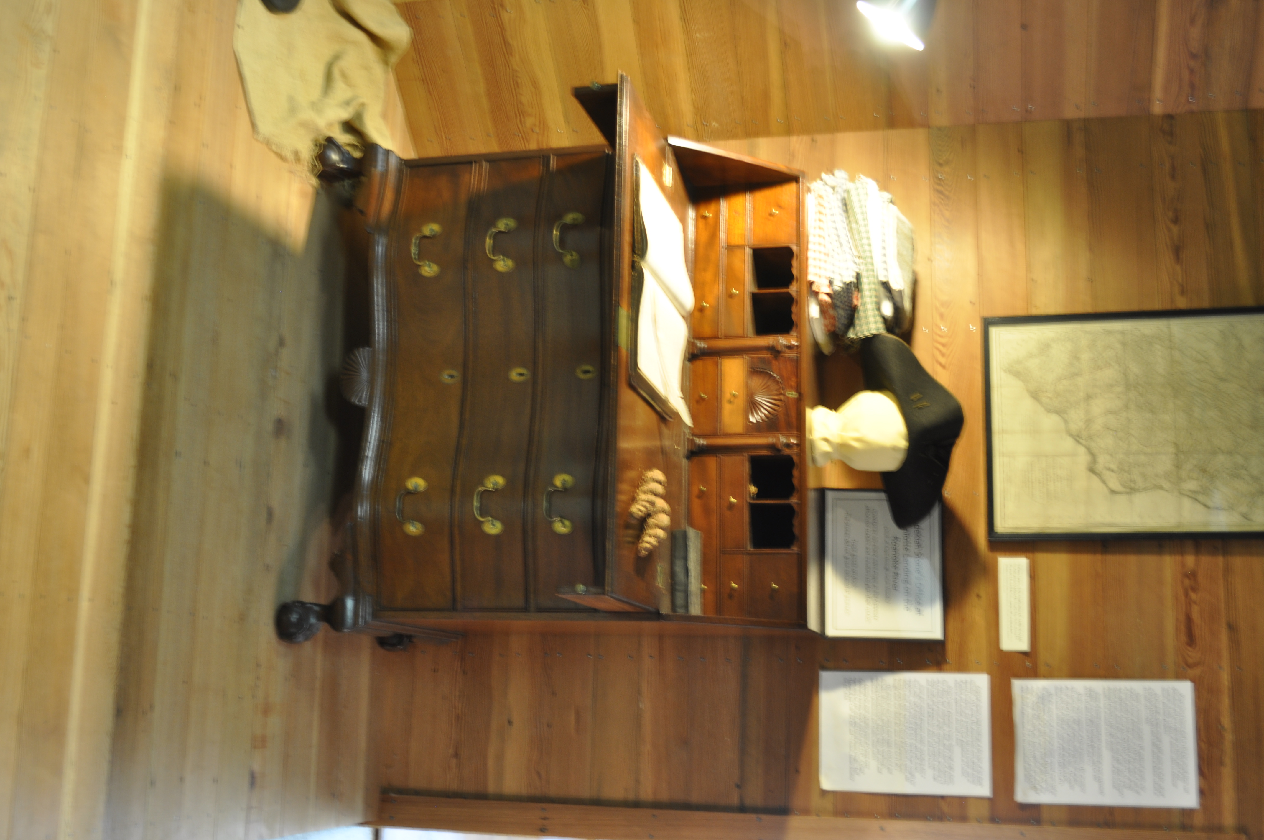
2327 Zedekiah Stones Office Img_16921

2328 Zedekiah Stones Office Img_16922

2330 China Press circa 1785-1800 Img_16924
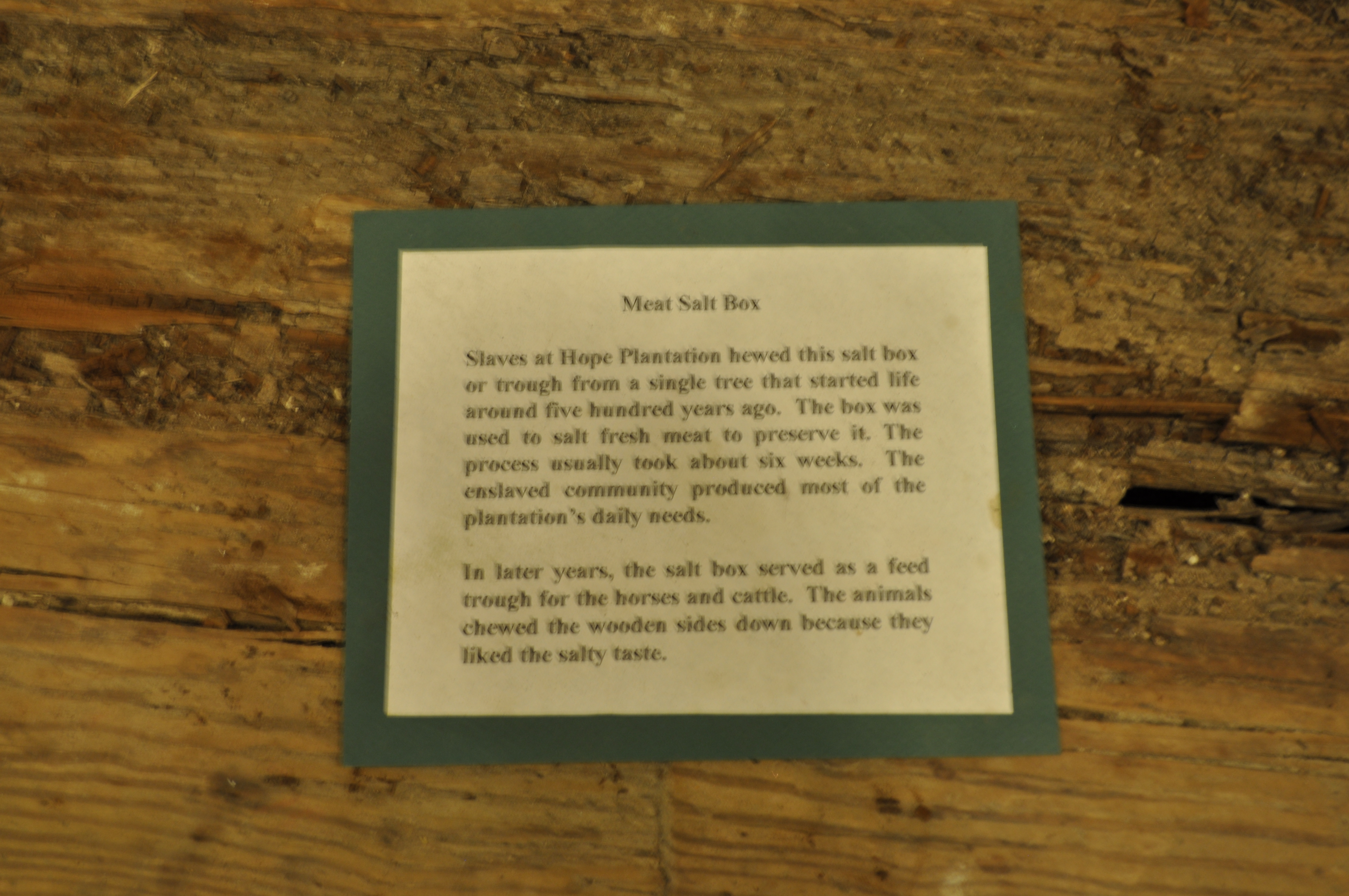
2331 Meat Salt Box Img_16925

2332 Meat Salt Box Img_16926
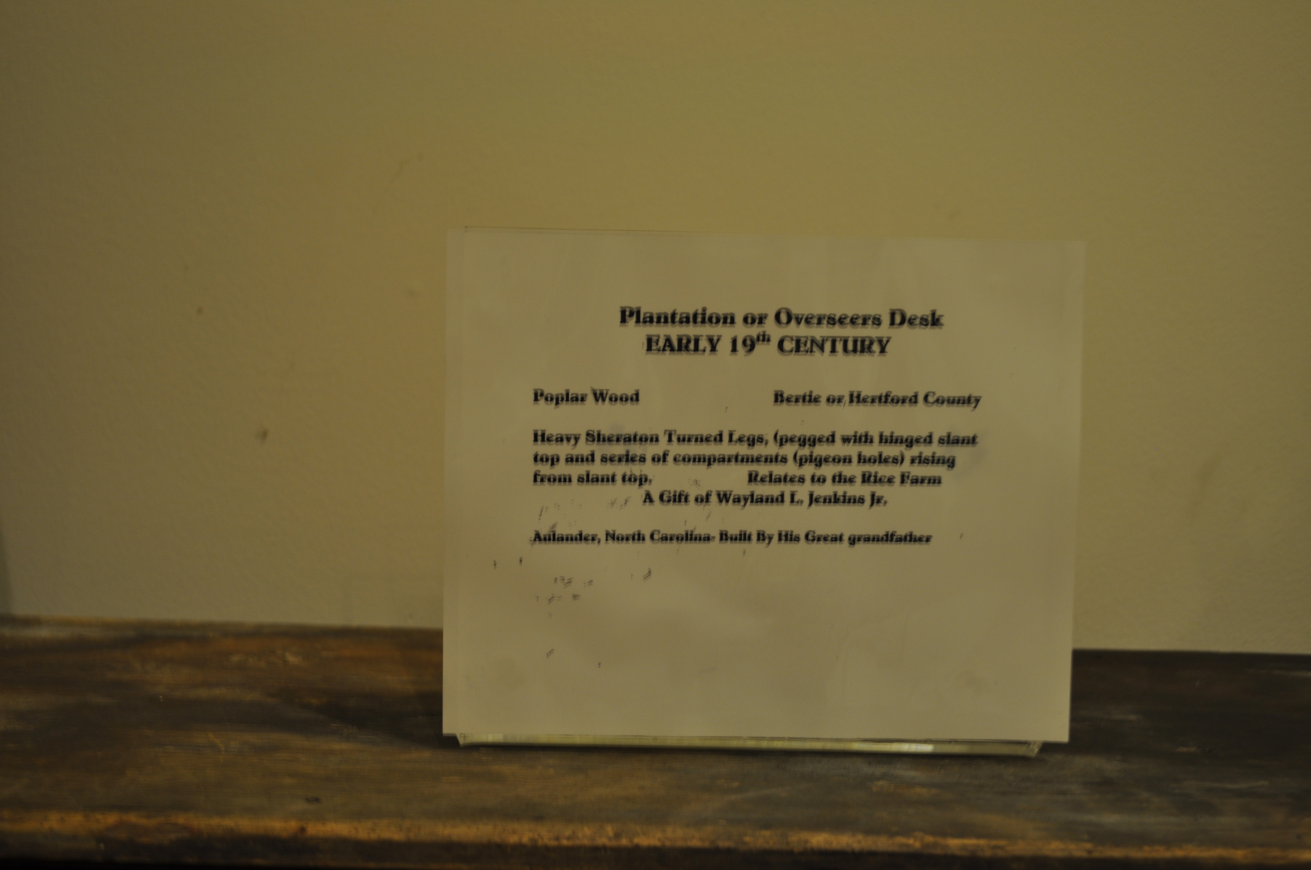
2334 Plantation or Overseers Desk Img_16928
Topographic Map of Elm Grove Rd, Colerain, NC, USA
Find elevation by address:

Places near Elm Grove Rd, Colerain, NC, USA:
Wakelon Rd, Colerain, NC, USA
Cremo Rd, Colerain, NC, USA
W Askewville Rd, Askewville, NC, USA
Morris Ford Rd, Colerain, NC, USA
108 Cherry Farm Ln
Early Station Rd, Windsor, NC, USA
Colerain
739 Us-13
Whites
205b W Academy St
Colerain
619 Jeff White Rd
239 Mt Gould River Rd
Lazy Hill Dr, Colerain, NC, USA
320 Jeff White Rd
Blackrock Rd, Merry Hill, NC, USA
729 River Cottage Rd
Rockyhock
Edenhouse
Macedonia Rd, Edenton, NC, USA
Recent Searches:
- Elevation of Corso Fratelli Cairoli, 35, Macerata MC, Italy
- Elevation of Tallevast Rd, Sarasota, FL, USA
- Elevation of 4th St E, Sonoma, CA, USA
- Elevation of Black Hollow Rd, Pennsdale, PA, USA
- Elevation of Oakland Ave, Williamsport, PA, USA
- Elevation of Pedrógão Grande, Portugal
- Elevation of Klee Dr, Martinsburg, WV, USA
- Elevation of Via Roma, Pieranica CR, Italy
- Elevation of Tavkvetili Mountain, Georgia
- Elevation of Hartfords Bluff Cir, Mt Pleasant, SC, USA