Elevation of Dominion Ranch Dr, Port Arthur, TX, USA

Location: United States > Texas > Jefferson County > Port Arthur >

Longitude: -94.007363

Latitude: 29.9497931

Elevation: 3m / 10feet

Barometric Pressure: 101KPa

Elevation Map:

elevation map of Dominion Ranch Dr, Port Arthur, TX, USA

Satellite Map:

Satellite map of Dominion Ranch Dr, Port Arthur, TX, USA

Related Photos:

boat business capture dji digital drone image impression landscape logistics mjscanlon mjscanlonphotography mavik2 mavik2zoom merchandise mojo outdoor outdoors perspective photo photograph photographer photography picture portarthur quadcopter sabinenechescanal scanlon sunrise super texas tug tugboat view waterway wow ©mjscanlon ©mjscanlonphotography
Sabine-Neches Canal | Port Arthur, Texas
morning shadow wild vacation portrait brown green texture beach gulfofmexico face animal closeup landscape outdoors concentration big eyes focus day arms legs skin zoom body reptile stripes wildlife tail tan highcontrast limbs paws fangs sunlit powerful chin cheaks cameraraw texastx unitedstatesofamericausa nikonnikkor adobephotoshoplightroom naturenatureza mouthlips nosenostrils camouflagecamoflagecamo oldolderagedmatureoninyears formywifetheloveofmylife beautifullovelycutealluringprettygoodlookingattractivegorgeous colorcolorfulcolour femalewomangirlgalsheher cameraframeimagecaptureshotphotophotographdigitalpicturepainting teethchoppersenamel bracestaystructuresupportreinforcebearingbolsterpropguytruss adorablesweetcutedelightfulmostinterestingspecialinspiring
Sunning and Waiting for Lunch
Wednesday 2-2-11 1
bridge river ship texas postcard ships bridges historic vintagepostcard rainbowbridge bridging portarthur bridgecity bridgepixing bridgepix bridgeblog bridgephoto bridgepicture nechesriver texasbridges texasescapes portarthurbridge portarthurorangebridge
Vintage Postcard, Rainbow Bridge, Port Arthur, Texas
sunset sky beach water texas iphone
Beauty and The Beasts
grass rusty shack
room with a view
canon garden ir texas unitedstates outdoor infrared botanicalgarden beaumont tyrrellpark lifepixel
Japanese Garden — Infrared — Explored
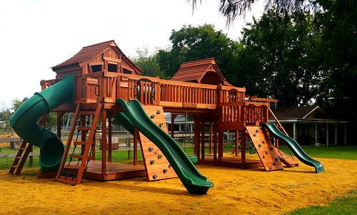
backyardfunfactory swingsets swings outdoor backyard playground kids fortswithbridges bridgedforts forkids monkeybars slides rockwalls twisterslides playset picnictables trapeze firemanspole parkbench ramp adventureramp airpogo lemonadestand overheadclimber climbers woodenplaysets family landscape summer me park art tree selfie design people home happy morning new usa fun smile sunny digital market child sunshine baby swingset woodenswingset woodswingset backyardplayset backyardswingset swingsetaccessories playsetaccessories backyardfort woodenfort woodfort
Bridged Maverick playsets
backyardfunfactory swingsets swings outdoor backyard playground kids fortswithbridges bridgedforts forkids monkeybars slides rockwalls twisterslides playset picnictables trapeze firemanspole parkbench ramp adventureramp airpogo lemonadestand overheadclimber climbers woodenplaysets family landscape summer me park art tree selfie design people home happy morning new usa fun smile sunny digital market child sunshine baby swingset woodenswingset woodswingset backyardplayset backyardswingset swingsetaccessories playsetaccessories backyardfort woodenfort woodfort
Bridged Fort Stockton to Mustang with Spiral Slide
square squareformat iphoneography instagramapp uploaded:by=instagram
Sea Rim Beach #searimstatepark #gulfcoast
square squareformat iphoneography instagramapp xproii uploaded:by=instagram foursquare:venue=4c01a4a1f8492d7f3e375ffa
Playful lights on the landscape.
sunset over neches 3
seawall uploaded:by=flickrmobile colorvibefilter flickriosapp:filter=colorvibe
Sabine lake
uploaded:by=flickrmobile flickriosapp:filter=nofilter
Swampland near Pleasure Island
Sunrise over Neches
square squareformat mayfair iphoneography instagramapp uploaded:by=instagram
Beautiful day at the beach #searimstatepark #gulfcoast
square squareformat hudson iphoneography instagramapp uploaded:by=instagram foursquare:venue=4e87b060cc21e9e8593336f6
Instagrammed Sabine Lake
uploaded:by=flickrmobile flickriosapp:filter=nofilter
Bird on rock, Pleasure Island, TX
square squareformat iphoneography instagramapp uploaded:by=instagram
Cool day on the gulf coast #searimstatepark #gulfcoast
beaumont texas unitedstates us
DJI_0017-Pano
gulfofmexico water greenpeace aerial pollution oil bp foia usfws oilspill waterpollution usfishandwildlifeservice freedomofinformationact gulfoilspill 26june2010camera1card2
26 June 2010 Camera 1 Card 2 129
a detour through port arthur, tx
portarthur
a IMG_6592 port arthur contraflow
epicroadie2011
Refineries all up and down the inlets
a tcp IMG_5884 stormwater pumping