Elevation map of Degehabur, Ethiopia

Location: Ethiopia > Somali >

Longitude: 44.0960311

Latitude: 8.4644124

Elevation: 1112m / 3648feet

Barometric Pressure: 89KPa

Elevation Map:

elevation map of Degehabur, Ethiopia

Satellite Map:

Satellite map of Degehabur, Ethiopia

Related Photos:

africa distortion color apple water yellow outdoors photo exterior application container camel photograph drought afrika somali somalia tanks chromatic somaliland afrique iphone hornofafrica aberration 3002 jerrycan greenhousing somalie achromatism britishsomaliland somalië aqalsoomali σομαλία сомали szomália الصومال dhagaxbuur ソマリア hipstamatic soomaaliland صوماللاند‎ degehabur vegetalhabitat somalihut
Coming back from the well in Degehabur thru Iphone Hipstamatic - Somaliland
africa africanethnicity agriculture camel climate climatechange degehabur developingcountry domesticanimals donkeys dromedary drought eastafrica emergenciesanddisasters environment extremeweather herbivorous herder horizontal hornofafrica mammal man men naturaldisaster nomad nomadic oneadultonly onemanonly oneperson outdoors ruralscene socialissues soma5288 somali somalia somaliland transportation unrecognisablepeople weather dhagaxbuurregion
Young somali boy with his camels and donkeys in the desert, Dhagaxbuur region, Degehabur, Somaliland
africa color apple yellow outdoors exterior african bluesky container transportation somali somalia chromatic somaliland iphone hornofafrica jerrycan greenhousing achromatism photographphoto hipstamatic degehabur aberrationdistortion vegetalhabitat degehaburdhagaxbuur aqalsoomaalisomalihut
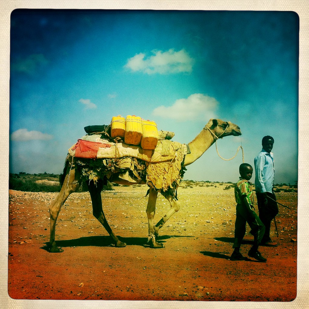
A Man And A Child Using A Camel To Transport Water, Degehabur Area, Somaliland
africa color apple outdoors exterior bluesky transportation somalia chromatic somaliland iphone hornofafrica onepersononly africanethnicity achromatism photographphoto hipstamatic blackethnicity degehabur aberrationdistortion degehaburdhagaxbuur
Camels Are Conveyed Through The Desert, Degehabur Area, Somaliland
africa agriculture climate climatechange copyspace degehabur developingcountry domesticanimals domesticated drought eastafrica emergenciesanddisasters environment extremeweather herbivorous herd herder herding horizontal hornofafrica mammal man men naturaldisaster nomad nomadic oneadultonly onemanonly oneperson outdoors ruralscene socialissues soma5262 somalia somaliland weather dhagaxbuurregion
Somali herder with his sheeps in an arid area, Dhagaxbuur region, Degehabur, Somaliland
acacia africa africanethnicity agriculture camels climatechange copyspace degehabur developingcountry domesticanimals dromedary drought eastafrica emergenciesanddisasters environment extremeweather herbivorous herder hornofafrica man men muslim naturaldisaster nomad nomadic oneadultonly onemanonly oneperson outdoors ruralscene socialissues soma5291 somali somalia somaliland transportation unrecognisablepeople vertical weather dhagaxbuurregion
Young somali boy with his camels in the desert, Dhagaxbuur region, Degehabur, Somaliland
africa woman man color horizontal outdoors exterior greysky somalia somaliland hornofafrica photographphoto sheeplivestock degehabur degehaburdhagaxbuur animalmammalherbivorous
Two People With A Flock Of Sheep In A Flat Landscape In The Desert, Degehabur Area, Somaliland
africa color apple landscape outdoors flora exterior bluesky vegetation somalia chromatic somaliland iphone hornofafrica achromatism photographphoto hipstamatic degehabur aberrationdistortion degehaburdhagaxbuur
A Predatory Bird Is Flying Over The Bushes, Degehabur Area, Somaliland
africa arid climatechange copyspace day degehabur desert developingcountry drought eastafrica emergenciesanddisasters environment ethnic exterior extremeweather fence habitation heat horizontal hornofafrica house housing hut nature nopeople nomad nomadic nomadicpeople nomadism outdoors poverty socialissues soma5215 somalia somaliland tradition traditional tribal weather dhagaxbuurregion
A somali hut called aqal in the desert, Dhagaxbuur region, Degehabur, Somaliland