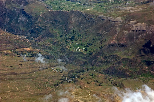
Elevation of Colca, Peru
Location: Peru > Apurimac >
Longitude: -72.276617
Latitude: -13.742978
Elevation: -10000m / -32808feet
Barometric Pressure: 295KPa
Related Photos:
Topographic Map of Colca, Peru
Find elevation by address:

Places near Colca, Peru:
Anta Province
3S 16, Peru
Mollepata
Plaza De Armas Cusco
Independencia
San Pedro Market
Centro Histórico
Urb Bancopata
Sta Teresa 344
Xima Cusco Hotel
Plaza De Armas
Mountain Palcoyo
Salkantay Trail Peru
Cusco
Cusco
Cusco
Rainbow Mountain Peru Travel Agency
Avenida Perú
Qorikancha
Machupicchu Tours Peru - Tour In Peru
Recent Searches:
- Elevation of Corso Fratelli Cairoli, 35, Macerata MC, Italy
- Elevation of Tallevast Rd, Sarasota, FL, USA
- Elevation of 4th St E, Sonoma, CA, USA
- Elevation of Black Hollow Rd, Pennsdale, PA, USA
- Elevation of Oakland Ave, Williamsport, PA, USA
- Elevation of Pedrógão Grande, Portugal
- Elevation of Klee Dr, Martinsburg, WV, USA
- Elevation of Via Roma, Pieranica CR, Italy
- Elevation of Tavkvetili Mountain, Georgia
- Elevation of Hartfords Bluff Cir, Mt Pleasant, SC, USA


